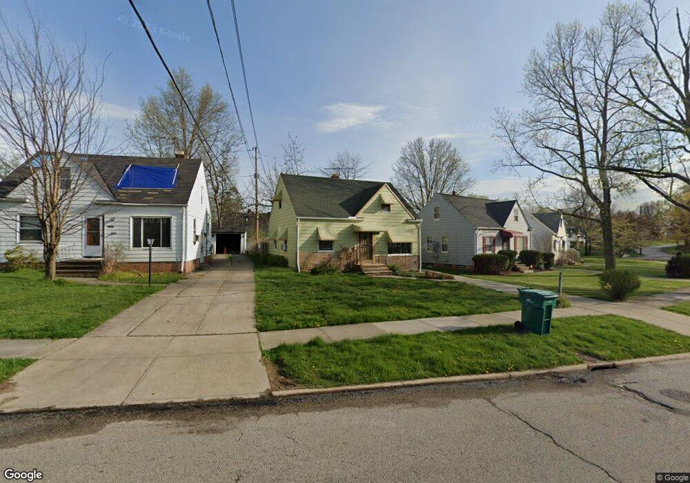
19711 Raymond St Maple Heights, OH 44137
Estimated Value: $102,317 - $152,000
3
Beds
1
Bath
969
Sq Ft
$122/Sq Ft
Est. Value
About This Home
This home is located at 19711 Raymond St, Maple Heights, OH 44137 and is currently estimated at $117,829, approximately $121 per square foot. 19711 Raymond St is a home located in Cuyahoga County with nearby schools including Abraham Lincoln Elementary School, Rockside/ J.F. Kennedy School, and Italy High School.
Ownership History
Date
Name
Owned For
Owner Type
Purchase Details
Closed on
Dec 10, 1998
Sold by
Leanza Rich and Valenti Jeannine
Bought by
Clemons Cheryl L
Current Estimated Value
Home Financials for this Owner
Home Financials are based on the most recent Mortgage that was taken out on this home.
Original Mortgage
$69,018
Outstanding Balance
$16,003
Interest Rate
7.02%
Estimated Equity
$101,826
Purchase Details
Closed on
Jul 30, 1998
Sold by
Popovich Donna
Bought by
Leanza Rich and Valenti Jeannine
Purchase Details
Closed on
Jan 1, 1975
Bought by
Viola M Jakub
Create a Home Valuation Report for This Property
The Home Valuation Report is an in-depth analysis detailing your home's value as well as a comparison with similar homes in the area
Home Values in the Area
Average Home Value in this Area
Purchase History
| Date | Buyer | Sale Price | Title Company |
|---|---|---|---|
| Clemons Cheryl L | $75,000 | Cuyahoga Valley Title Agency | |
| Leanza Rich | -- | Cuyahoga Valley Title Agency | |
| Leanza Rich | $42,500 | Cuyahoga Valley Title Agency | |
| Viola M Jakub | -- | -- |
Source: Public Records
Mortgage History
| Date | Status | Borrower | Loan Amount |
|---|---|---|---|
| Open | Clemons Cheryl L | $69,018 |
Source: Public Records
Tax History Compared to Growth
Tax History
| Year | Tax Paid | Tax Assessment Tax Assessment Total Assessment is a certain percentage of the fair market value that is determined by local assessors to be the total taxable value of land and additions on the property. | Land | Improvement |
|---|---|---|---|---|
| 2024 | $2,133 | $32,830 | $6,860 | $25,970 |
| 2023 | $1,013 | $17,220 | $3,990 | $13,230 |
| 2022 | $1,047 | $17,220 | $3,990 | $13,230 |
| 2021 | $1,107 | $17,220 | $3,990 | $13,230 |
| 2020 | $739 | $13,020 | $3,010 | $10,010 |
| 2019 | $726 | $37,200 | $8,600 | $28,600 |
| 2018 | $3,462 | $13,020 | $3,010 | $10,010 |
| 2017 | $604 | $11,870 | $2,770 | $9,100 |
| 2016 | $578 | $11,870 | $2,770 | $9,100 |
| 2015 | $641 | $11,870 | $2,770 | $9,100 |
| 2014 | $641 | $13,060 | $3,050 | $10,010 |
Source: Public Records
Map
Nearby Homes
- 20120 Mccracken Rd
- 19309 Nitra Ave
- 19807 Gardenview Dr
- 5165 Camden Rd
- 19520 Maple Heights Blvd
- 19806 Mountville Dr
- 20715 Watson Rd
- 20107 Libby Rd
- 20814 Watson Rd
- 20907 Watson Rd
- 20510 Mountville Dr
- 19812 Stockton Ave
- 5265 Bellview St
- 19289 Stafford Ave
- 20701 Kenyon Dr
- 21102 Raymond St
- 19221 Stafford Ave
- 20814 Kenyon Dr
- 21207 Franklin Rd
- 18909 Maple Heights Blvd
- 19707 Raymond St
- 19815 Maple Heights Blvd
- 19703 Raymond St
- 19819 Maple Heights Blvd
- 19620 Longview Ave
- 19617 Raymond St
- 19616 Longview Ave
- 19608 Longview Ave
- 19823 Maple Heights Blvd
- 19740 Raymond St
- 19613 Raymond St
- 19604 Longview Ave
- 19700 Raymond St
- 19698 Raymond St
- 19651 Raymond St
- 19810 Maple Heights Blvd
- 19600 Longview Ave
- 19652 Raymond St
- 19830 Raymond St
- 19605 Raymond St