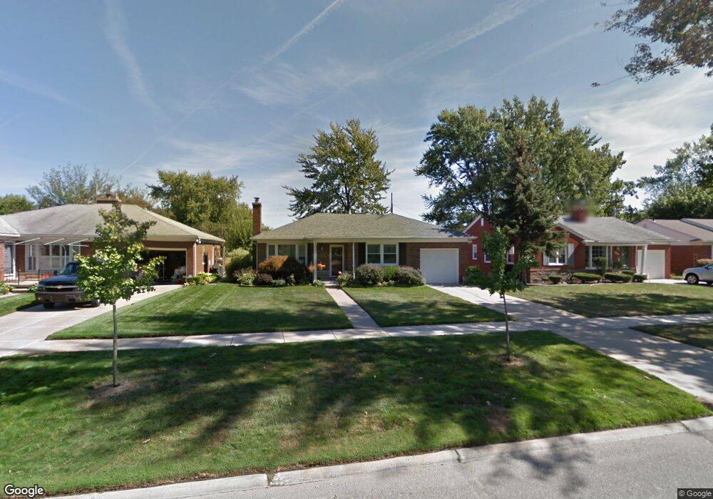
19718 E Kings Ct Grosse Pointe Farms, MI 48236
Estimated Value: $303,000 - $466,000
3
Beds
2
Baths
1,312
Sq Ft
$273/Sq Ft
Est. Value
About This Home
This home is located at 19718 E Kings Ct, Grosse Pointe Farms, MI 48236 and is currently estimated at $358,024, approximately $272 per square foot. 19718 E Kings Ct is a home located in Wayne County with nearby schools including John Monteith Elementary School, Brownell Middle School, and Grosse Pointe North High School.
Ownership History
Date
Name
Owned For
Owner Type
Purchase Details
Closed on
Oct 3, 2001
Sold by
Fordon Eric
Bought by
Kimbrough Valorie C
Current Estimated Value
Purchase Details
Closed on
Jun 30, 1995
Sold by
Grinders Clearing House
Bought by
Dennis Andrus J and Andrus Anne F
Create a Home Valuation Report for This Property
The Home Valuation Report is an in-depth analysis detailing your home's value as well as a comparison with similar homes in the area
Home Values in the Area
Average Home Value in this Area
Purchase History
| Date | Buyer | Sale Price | Title Company |
|---|---|---|---|
| Kimbrough Valorie C | $215,000 | -- | |
| Dennis Andrus J | $121,000 | -- |
Source: Public Records
Tax History Compared to Growth
Tax History
| Year | Tax Paid | Tax Assessment Tax Assessment Total Assessment is a certain percentage of the fair market value that is determined by local assessors to be the total taxable value of land and additions on the property. | Land | Improvement |
|---|---|---|---|---|
| 2025 | $2,967 | $150,200 | $0 | $0 |
| 2024 | $2,967 | $138,200 | $0 | $0 |
| 2023 | $2,853 | $130,100 | $0 | $0 |
| 2022 | $4,469 | $119,400 | $0 | $0 |
| 2021 | $4,260 | $110,500 | $0 | $0 |
| 2020 | $4,387 | $106,300 | $0 | $0 |
| 2019 | $2,597 | $100,900 | $0 | $0 |
| 2018 | $2,553 | $96,200 | $0 | $0 |
| 2017 | $2,966 | $90,900 | $0 | $0 |
| 2016 | $4,044 | $82,100 | $0 | $0 |
| 2015 | $7,009 | $71,900 | $0 | $0 |
| 2013 | $6,980 | $71,200 | $0 | $0 |
| 2012 | -- | $75,600 | $20,000 | $55,600 |
Source: Public Records
Map
Nearby Homes
- 463 Colonial Ct
- 19980 W Clairview Ct
- 486 Bournemouth Rd
- 1597 Newcastle Rd
- 1764 Prestwick Rd
- 410 Roland Ct
- 809 Fairford Rd
- 19299 Raymond St
- 450 Roland Rd
- 19242 Eastborne St
- 19226 Eastborne St
- 21602 Newcastle Rd
- 419 Maison Rd
- 22200 Moross Rd
- 1818 Norwood Dr
- 1922 Oxford Rd
- 5228 Hillcrest St
- 21315 Prestwick Ave
- 21237 Severn Rd
- 21138 Huntington Ave
- 19734 E Kings Ct
- 19734 E Kings Ct
- 19702 E Kings Ct
- 19694 E Kings Ct
- 19750 E Kings Ct
- 19750 E Kings Ct
- 19686 E Kings Ct
- 19719 E Kings Ct
- 19735 E Kings Ct
- 19703 E Kings Ct
- 19751 E Kings Ct
- 19687 E Kings Ct
- 19678 E Kings Ct
- 19768 Holiday Rd
- 19759 Ida Ln W
- 19759 Holiday Rd
- 19716 W Kings Ct
- 19716 W Kings Ct
- 19677 E Kings Ct
- 19571 E Kings Ct