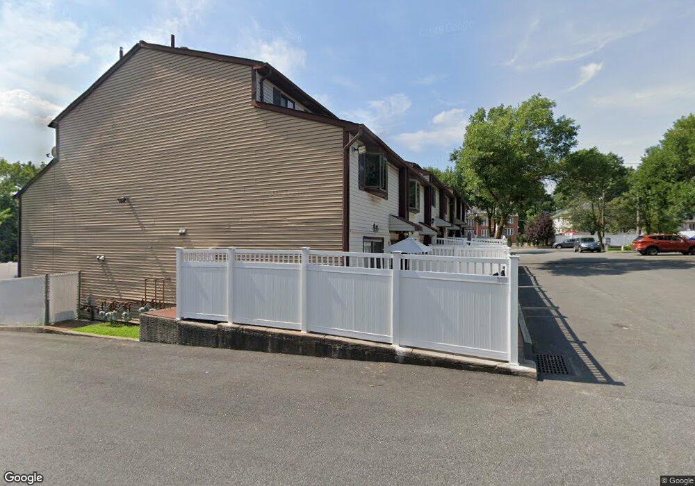
1972 Arthur Kill Rd Staten Island, NY 10312
Huguenot NeighborhoodEstimated Value: $450,000 - $495,000
2
Beds
2
Baths
980
Sq Ft
$483/Sq Ft
Est. Value
About This Home
This home is located at 1972 Arthur Kill Rd, Staten Island, NY 10312 and is currently estimated at $472,883, approximately $482 per square foot. 1972 Arthur Kill Rd is a home located in Richmond County with nearby schools including P.S. 4 - Maurice Wollin, I.S. 075 Frank D. Paulo, and Tottenville High School.
Ownership History
Date
Name
Owned For
Owner Type
Purchase Details
Closed on
Jan 31, 2006
Sold by
Selimaj Balija and Djukanovic Ermin
Bought by
Djukanovic Ermin
Current Estimated Value
Home Financials for this Owner
Home Financials are based on the most recent Mortgage that was taken out on this home.
Original Mortgage
$228,750
Outstanding Balance
$135,977
Interest Rate
7.16%
Mortgage Type
New Conventional
Estimated Equity
$336,906
Purchase Details
Closed on
Jun 11, 2003
Sold by
Fernandez Vicente and Fernandez Liliana
Bought by
Djukanovic Ermin and Selimaj Balija
Home Financials for this Owner
Home Financials are based on the most recent Mortgage that was taken out on this home.
Original Mortgage
$176,400
Interest Rate
6.05%
Mortgage Type
Purchase Money Mortgage
Create a Home Valuation Report for This Property
The Home Valuation Report is an in-depth analysis detailing your home's value as well as a comparison with similar homes in the area
Home Values in the Area
Average Home Value in this Area
Purchase History
| Date | Buyer | Sale Price | Title Company |
|---|---|---|---|
| Djukanovic Ermin | -- | The Judicial Title Insurance | |
| Djukanovic Ermin | $1,942 | Lawyers Title Insurance Corp |
Source: Public Records
Mortgage History
| Date | Status | Borrower | Loan Amount |
|---|---|---|---|
| Open | Djukanovic Ermin | $228,750 | |
| Previous Owner | Djukanovic Ermin | $176,400 |
Source: Public Records
Tax History Compared to Growth
Tax History
| Year | Tax Paid | Tax Assessment Tax Assessment Total Assessment is a certain percentage of the fair market value that is determined by local assessors to be the total taxable value of land and additions on the property. | Land | Improvement |
|---|---|---|---|---|
| 2025 | $3,598 | $24,120 | $2,577 | $21,543 |
| 2024 | $3,598 | $25,740 | $2,297 | $23,443 |
| 2023 | $3,534 | $17,400 | $2,289 | $15,111 |
| 2022 | $3,277 | $24,240 | $3,300 | $20,940 |
| 2021 | $3,303 | $22,800 | $3,300 | $19,500 |
| 2020 | $3,322 | $21,120 | $3,300 | $17,820 |
| 2019 | $3,123 | $20,580 | $3,300 | $17,280 |
| 2018 | $2,956 | $14,500 | $2,740 | $11,760 |
| 2017 | $2,789 | $13,680 | $3,300 | $10,380 |
| 2016 | $2,615 | $13,080 | $3,300 | $9,780 |
| 2015 | $2,388 | $13,186 | $2,369 | $10,817 |
| 2014 | $2,388 | $12,441 | $2,510 | $9,931 |
Source: Public Records
Map
Nearby Homes
- 10A Pratt Ct
- 20 Country Ln
- 17 Country Ln
- 40 Raily Ct
- 12 Alcott St Unit A
- 39 Poets Cir
- 26 Alcott St Unit A
- 28 Alcott St
- 30 Alcott St
- 15 Mimosa Ln
- 45 Daffodil Ct
- 12 Yucca Dr
- 164 Dover Green
- 6 Dogwood Dr
- 29 Chestnut Cir Unit 214
- 29 Chestnut Cir
- 30 Chestnut Cir
- 163 Hampton Green
- 214 Forest Green
- 141 Hampton Green
- 1970 Arthur Kill Rd
- 1968 Arthur Kill Rd
- 1966 Arthur Kill Rd
- 1984 Arthur Kill Rd
- 1986 Arthur Kill Rd
- 1982 Arthur Kill Rd
- 1964 Arthur Kill Rd
- 1980 Arthur Kill Rd
- 1978 Arthur Kill Rd
- 1962 Arthur Kill Rd
- 1976 Arthur Kill Rd
- 1960 Arthur Kill Rd
- 1974 Arthur Kill Rd
- 1974 Arthur Kill Rd Unit PH
- 1948 Arthur Kill Rd
- 1946 Arthur Kill Rd
- 1950 Arthur Kill Rd
- 1944 Arthur Kill Rd
- 1952 Arthur Kill Rd
- 1954 Arthur Kill Rd