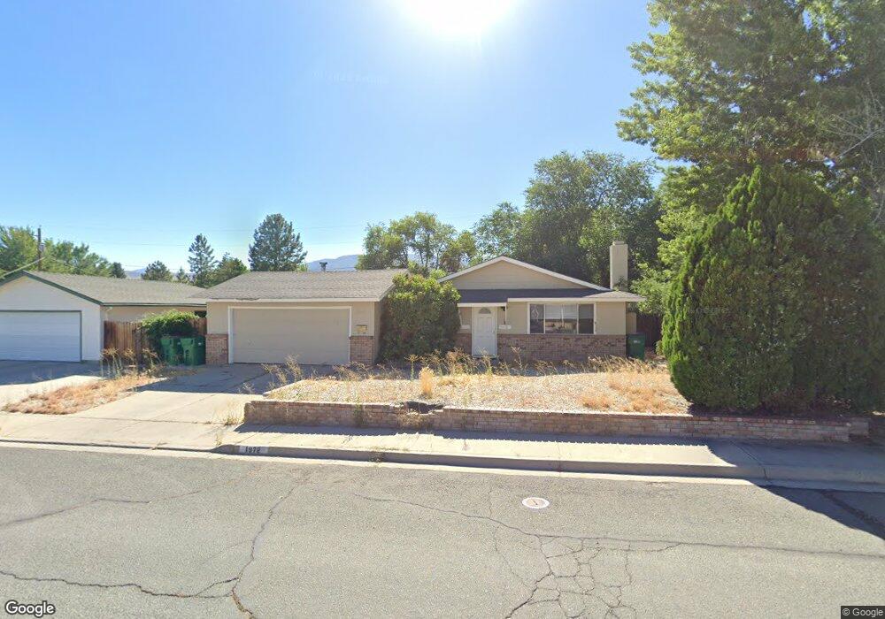
1972 Carriage Crest Dr Unit 12B Carson City, NV 89706
Northridge NeighborhoodEstimated Value: $375,918 - $419,000
3
Beds
2
Baths
1,320
Sq Ft
$307/Sq Ft
Est. Value
About This Home
This home is located at 1972 Carriage Crest Dr Unit 12B, Carson City, NV 89706 and is currently estimated at $404,980, approximately $306 per square foot. 1972 Carriage Crest Dr Unit 12B is a home located in Carson City with nearby schools including Mark Twain Elementary School, Carson Middle School, and Carson High School.
Ownership History
Date
Name
Owned For
Owner Type
Purchase Details
Closed on
Jul 31, 2025
Sold by
Harrison Peter
Bought by
Pch Living Trust and Harrison
Current Estimated Value
Purchase Details
Closed on
Aug 22, 2011
Sold by
Harrison Claire
Bought by
Harrison Peter
Purchase Details
Closed on
Jun 9, 2011
Sold by
Machado Caron P and Morrissey Michael W
Bought by
Cam Real Estate I Llc
Create a Home Valuation Report for This Property
The Home Valuation Report is an in-depth analysis detailing your home's value as well as a comparison with similar homes in the area
Home Values in the Area
Average Home Value in this Area
Purchase History
| Date | Buyer | Sale Price | Title Company |
|---|---|---|---|
| Pch Living Trust | -- | None Listed On Document | |
| Harrison Peter | -- | Northern Nevada Title Co | |
| Harrison Peter | $115,000 | Northern Nevada Title Co | |
| Cam Real Estate I Llc | $93,000 | Accommodation |
Source: Public Records
Tax History Compared to Growth
Tax History
| Year | Tax Paid | Tax Assessment Tax Assessment Total Assessment is a certain percentage of the fair market value that is determined by local assessors to be the total taxable value of land and additions on the property. | Land | Improvement |
|---|---|---|---|---|
| 2025 | $1,610 | $55,182 | $34,300 | $20,882 |
| 2024 | $1,503 | $55,064 | $34,300 | $20,764 |
| 2023 | $726 | $48,748 | $29,750 | $18,998 |
| 2022 | $1,290 | $41,636 | $23,800 | $17,836 |
| 2021 | $1,194 | $38,708 | $20,650 | $18,058 |
| 2020 | $1,194 | $35,142 | $16,800 | $18,342 |
| 2019 | $1,110 | $35,490 | $16,800 | $18,690 |
| 2018 | $1,059 | $32,490 | $14,000 | $18,490 |
| 2017 | $1,017 | $31,487 | $12,600 | $18,887 |
| 2016 | $992 | $30,209 | $10,500 | $19,709 |
| 2015 | $989 | $29,720 | $9,625 | $20,095 |
| 2014 | $958 | $27,184 | $7,700 | $19,484 |
Source: Public Records
Map
Nearby Homes
- 1970 Hamilton Ave
- 1381 Spooner Dr
- 1654 Spooner Dr
- 2542 Ravenshorn Dr
- 2616 Carriage Crest Dr
- 2613 Pinion Pine Dr
- 2756 Table Rock Dr
- 2048 Poole Way
- 1902 Peters St
- 1955 F St
- 493 Hot Springs Rd Unit 1
- 493 Hot Springs Rd Unit 24
- 0 Research Way
- 1772 Hogan Peak St
- 2408 Bunch Way
- 1321 Ashby Ct
- 5 Riley Cir
- Cross Creek, Plan 6 at Cross Creek
- Cross Creek, Plan 3 at Cross Creek
- Cross Creek, Plan 1 at Cross Creek
- 1966 Carriage Crest Dr
- 1978 Carriage Crest Dr
- 1960 Carriage Crest Dr
- 1965 Molly Dr
- 2010 Hamilton Ave
- 1618 Karin Dr
- 1969 Molly Dr
- 1963 Molly Dr
- 2016 Hamilton Ave
- 1619 Karin Dr
- 1954 Carriage Crest Dr
- 1978 Hamilton Ave
- 1951 Molly Dr Unit 9
- 1624 Karin Dr
- 1959 Carriage Crest Dr
- 1953 Carriage Crest Dr
- 1948 Carriage Crest Dr
- 1625 Karin Dr
- 1974 Hamilton Ave
- 1943 Molly Dr