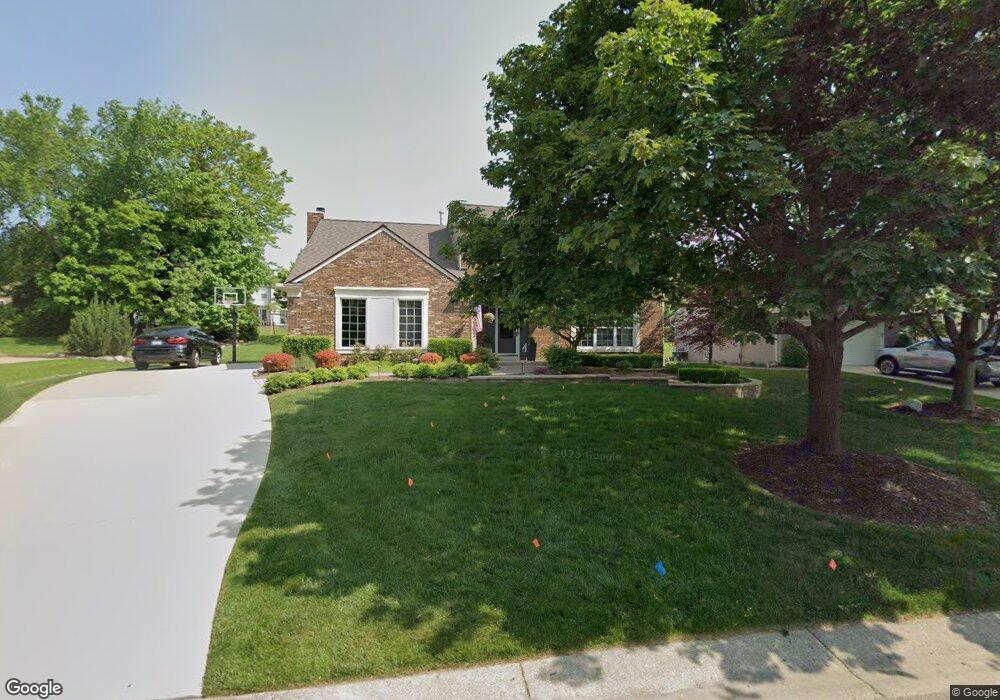
1972 Clear Point Ct Rochester Hills, MI 48306
Estimated Value: $470,410 - $529,000
4
Beds
3
Baths
2,074
Sq Ft
$245/Sq Ft
Est. Value
About This Home
This home is located at 1972 Clear Point Ct, Rochester Hills, MI 48306 and is currently estimated at $507,603, approximately $244 per square foot. 1972 Clear Point Ct is a home located in Oakland County with nearby schools including Brewster Elementary School, Van Hoosen Middle School, and Rochester Adams High School.
Ownership History
Date
Name
Owned For
Owner Type
Purchase Details
Closed on
Nov 30, 2009
Sold by
Relocation Advantage Llc
Bought by
Fabbri Jason and Sadowski Shannon
Current Estimated Value
Purchase Details
Closed on
Sep 1, 2009
Sold by
Szachta Michael J and Szachta Christine R
Bought by
Relocation Advantage Llc
Purchase Details
Closed on
Apr 26, 2001
Sold by
Branoff Paul P
Bought by
Szachta Michael J
Home Financials for this Owner
Home Financials are based on the most recent Mortgage that was taken out on this home.
Original Mortgage
$223,550
Interest Rate
7.02%
Create a Home Valuation Report for This Property
The Home Valuation Report is an in-depth analysis detailing your home's value as well as a comparison with similar homes in the area
Home Values in the Area
Average Home Value in this Area
Purchase History
| Date | Buyer | Sale Price | Title Company |
|---|---|---|---|
| Fabbri Jason | $183,000 | Metropolitan | |
| Relocation Advantage Llc | $171,000 | Metropolitan | |
| Szachta Michael J | $263,000 | -- |
Source: Public Records
Mortgage History
| Date | Status | Borrower | Loan Amount |
|---|---|---|---|
| Previous Owner | Szachta Michael J | $223,550 |
Source: Public Records
Tax History Compared to Growth
Tax History
| Year | Tax Paid | Tax Assessment Tax Assessment Total Assessment is a certain percentage of the fair market value that is determined by local assessors to be the total taxable value of land and additions on the property. | Land | Improvement |
|---|---|---|---|---|
| 2022 | $2,121 | $173,830 | $0 | $0 |
| 2018 | $3,469 | $140,890 | $0 | $0 |
| 2017 | $3,401 | $140,410 | $0 | $0 |
| 2015 | -- | $125,480 | $0 | $0 |
| 2014 | -- | $119,350 | $0 | $0 |
| 2011 | -- | $98,170 | $0 | $0 |
Source: Public Records
Map
Nearby Homes
- 1536 Royal Crescent St
- 1298 W Fairview Ln
- 1811 Blue Grass Dr
- 1515 Chevy Circuit
- 1402 E Fairview Ln
- 1865 Archers Pointe
- 1996 Tall Oaks Blvd
- 842 Timberline Dr
- 1083 N Livernois Rd
- 1437 Lantern Ln
- 1609 Kilburn Rd N
- 585 Timberline Dr
- 1377 Autumn Ln
- 5537 Orchard Ridge Dr
- 1484 Saddle Ln
- 448 Streamview Ct
- 73 Nevada Ave
- 5466 Orchard Ridge Dr
- 1340 Kings Cove Dr Unit 317
- 184 Shagbark Dr
- 1960 Clear Point Ct
- 1984 Clear Point Ct
- 1948 Clear Point Ct
- 1963 N Fairview Ln
- 1947 N Fairview Ln
- 1979 N Fairview Ln
- 1971 Clear Point Ct
- 1935 Clear Point Ct
- 1995 N Fairview Ln
- 1985 Clear Point Ct
- 1931 N Fairview Ln
- 1936 Clear Point Ct
- 1915 N Fairview Ln
- 1924 Clear Point Ct
- 1479 Grandview Dr
- 1907 Clear Point Ct
- 1485 Grandview Dr
- 2035 N Fairview Ln
- 1901 N Fairview Ln
- 1994 N Fairview Ln