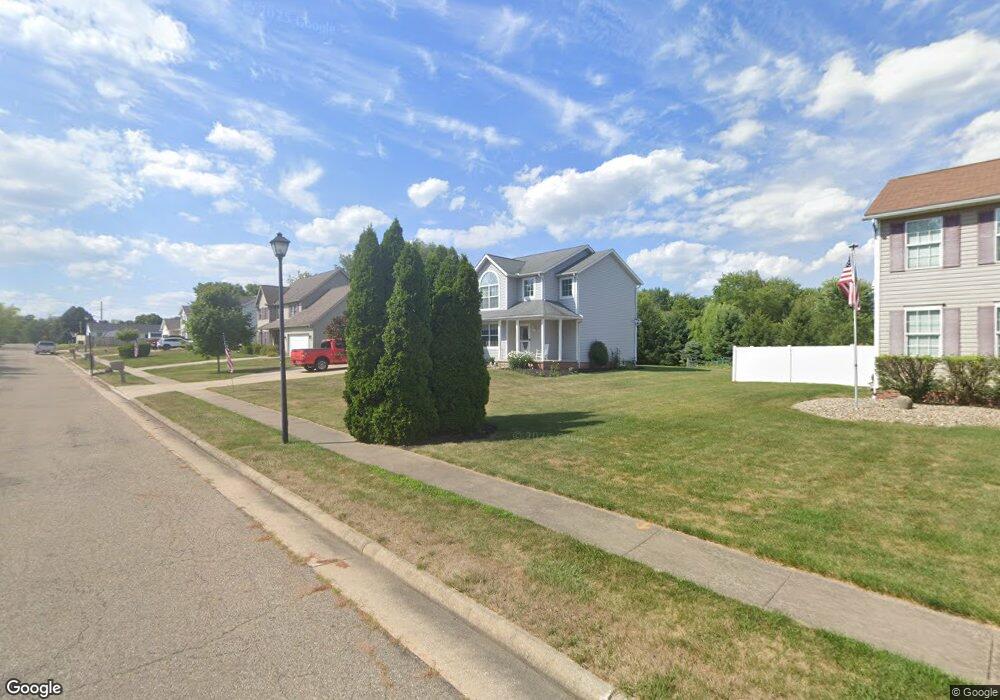
1972 Liberty Dr NE Louisville, OH 44641
Estimated Value: $334,000 - $368,000
3
Beds
3
Baths
1,802
Sq Ft
$191/Sq Ft
Est. Value
About This Home
This home is located at 1972 Liberty Dr NE, Louisville, OH 44641 and is currently estimated at $344,153, approximately $190 per square foot. 1972 Liberty Dr NE is a home located in Stark County with nearby schools including Louisville High School and St. Thomas Aquinas High School & Middle School.
Ownership History
Date
Name
Owned For
Owner Type
Purchase Details
Closed on
Nov 16, 2018
Sold by
Schroer Steven A and Schroer Joyce E
Bought by
Schroer Ryan M and Schroer Raquel
Current Estimated Value
Home Financials for this Owner
Home Financials are based on the most recent Mortgage that was taken out on this home.
Original Mortgage
$162,450
Outstanding Balance
$142,550
Interest Rate
4.7%
Mortgage Type
New Conventional
Estimated Equity
$201,603
Purchase Details
Closed on
Oct 2, 2013
Sold by
Schroer Steven A and Schroer Joyce E
Bought by
Schroer Steven A and Schroer Joyce E
Purchase Details
Closed on
Nov 17, 2010
Sold by
Alexander Michael S and Alexander Michele R
Bought by
Schroer Joyce E and Schroer Steven A
Home Financials for this Owner
Home Financials are based on the most recent Mortgage that was taken out on this home.
Original Mortgage
$167,741
Interest Rate
4.27%
Mortgage Type
FHA
Purchase Details
Closed on
Apr 23, 2008
Sold by
Alexander Michael S
Bought by
Alexander Michael R and Alexander Michele R
Purchase Details
Closed on
Jan 25, 2006
Sold by
21St Homes Inc
Bought by
Alexander Michael S
Home Financials for this Owner
Home Financials are based on the most recent Mortgage that was taken out on this home.
Original Mortgage
$139,200
Interest Rate
6.46%
Mortgage Type
Fannie Mae Freddie Mac
Purchase Details
Closed on
Sep 1, 2004
Sold by
Alpine Design & Development Corp
Bought by
21St Homes Inc
Home Financials for this Owner
Home Financials are based on the most recent Mortgage that was taken out on this home.
Original Mortgage
$144,800
Interest Rate
6.1%
Mortgage Type
Construction
Purchase Details
Closed on
Dec 12, 2003
Sold by
C & M Development Inc
Bought by
Alpine Design & Development Corp
Home Financials for this Owner
Home Financials are based on the most recent Mortgage that was taken out on this home.
Original Mortgage
$1,610,000
Interest Rate
6.01%
Mortgage Type
Purchase Money Mortgage
Create a Home Valuation Report for This Property
The Home Valuation Report is an in-depth analysis detailing your home's value as well as a comparison with similar homes in the area
Home Values in the Area
Average Home Value in this Area
Purchase History
| Date | Buyer | Sale Price | Title Company |
|---|---|---|---|
| Schroer Ryan M | $171,000 | American Title | |
| Schroer Steven A | -- | None Available | |
| Schroer Joyce E | $170,000 | None Available | |
| Alexander Michael R | -- | Attorney | |
| Alexander Michael S | $174,000 | None Available | |
| 21St Homes Inc | -- | -- | |
| Alpine Design & Development Corp | $1,610,000 | Land America/Lawyers Title |
Source: Public Records
Mortgage History
| Date | Status | Borrower | Loan Amount |
|---|---|---|---|
| Open | Schroer Ryan M | $162,450 | |
| Closed | Schroer Joyce E | $167,741 | |
| Previous Owner | Alexander Michael S | $139,200 | |
| Previous Owner | 21St Homes Inc | $144,800 | |
| Previous Owner | Alpine Design & Development Corp | $1,610,000 |
Source: Public Records
Tax History Compared to Growth
Tax History
| Year | Tax Paid | Tax Assessment Tax Assessment Total Assessment is a certain percentage of the fair market value that is determined by local assessors to be the total taxable value of land and additions on the property. | Land | Improvement |
|---|---|---|---|---|
| 2025 | -- | $115,150 | $18,340 | $96,810 |
| 2024 | -- | $115,150 | $18,340 | $96,810 |
| 2023 | $3,134 | $72,940 | $14,070 | $58,870 |
| 2022 | $3,140 | $72,940 | $14,070 | $58,870 |
| 2021 | $3,149 | $72,940 | $14,070 | $58,870 |
| 2020 | $2,638 | $66,360 | $12,670 | $53,690 |
| 2019 | $2,649 | $64,580 | $12,670 | $51,910 |
| 2018 | $2,568 | $64,580 | $12,670 | $51,910 |
| 2017 | $2,188 | $53,070 | $8,160 | $44,910 |
| 2016 | $2,232 | $53,070 | $8,160 | $44,910 |
| 2015 | $2,239 | $53,070 | $8,160 | $44,910 |
| 2014 | $556 | $56,360 | $8,650 | $47,710 |
| 2013 | $1,282 | $56,360 | $8,650 | $47,710 |
Source: Public Records
Map
Nearby Homes
- 1639 Horizon Dr
- 1702 View Pointe Ave
- 908 Sand Lot Cir
- 6969 Georgetown St NE
- 510 S Bauman Ct
- 204 E Broad St
- 107 E Broad St
- 728 E Broad St
- 520 S Silver St
- 2425 Miday Ave NE
- 4060 Hambleton Ave NE
- 201 Indiana Ave
- 641 S Nickelplate St
- 8225 Georgetown St
- 6416 15th St NE
- 248 Menegay Rd
- 308 Superior St
- 325 Lincoln Ave
- 1715 High St
- 1812 E Broad St
- 1962 Liberty Dr NE
- 1984 Liberty Dr NE
- 1952 Liberty Dr NE
- 1966 Pleasure Ct Unit 5
- 1865 Vantage Dr
- 1960 Pleasure Ct Unit 6
- 0 Pleasure Ct
- 1855 Vantage Dr
- 1942 Liberty Dr NE
- 1956 Pleasure Ct Unit 7
- 1950 Pleasure Ct Unit 8
- 2012 Liberty Dr NE
- 715 Overlook St
- 1975 Pleasure Ct Unit 15
- 1971 Pleasure Ct Unit 14
- 1944 Pleasure Ct Unit 9
- 1944 Pleasure Ct Unit 9
- 1985 Pleasure Ct Unit 17
- 1845 Vantage Dr
- 1981 Pleasure Ct Unit 16