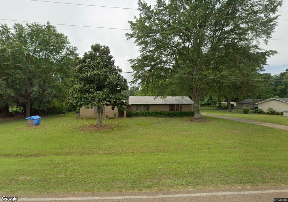
1972 Myrtle Springs Rd Texarkana, TX 75503
Estimated Value: $245,321 - $347,000
--
Bed
--
Bath
1,960
Sq Ft
$154/Sq Ft
Est. Value
About This Home
This home is located at 1972 Myrtle Springs Rd, Texarkana, TX 75503 and is currently estimated at $302,330, approximately $154 per square foot. 1972 Myrtle Springs Rd is a home located in Bowie County with nearby schools including Red Lick Elementary School, Red Lick Middle School, and Texarkana Sda School.
Ownership History
Date
Name
Owned For
Owner Type
Purchase Details
Closed on
Aug 25, 2006
Sold by
Russell James A and Russell Stephanie M
Bought by
Groce Judy C
Current Estimated Value
Home Financials for this Owner
Home Financials are based on the most recent Mortgage that was taken out on this home.
Original Mortgage
$126,700
Interest Rate
6.75%
Mortgage Type
Future Advance Clause Open End Mortgage
Create a Home Valuation Report for This Property
The Home Valuation Report is an in-depth analysis detailing your home's value as well as a comparison with similar homes in the area
Home Values in the Area
Average Home Value in this Area
Purchase History
| Date | Buyer | Sale Price | Title Company |
|---|---|---|---|
| Groce Judy C | -- | None Available |
Source: Public Records
Mortgage History
| Date | Status | Borrower | Loan Amount |
|---|---|---|---|
| Closed | Groce Judy C | $126,700 |
Source: Public Records
Tax History Compared to Growth
Tax History
| Year | Tax Paid | Tax Assessment Tax Assessment Total Assessment is a certain percentage of the fair market value that is determined by local assessors to be the total taxable value of land and additions on the property. | Land | Improvement |
|---|---|---|---|---|
| 2025 | $3,664 | $226,441 | $19,000 | $207,441 |
| 2024 | $3,664 | $220,914 | $19,000 | $201,914 |
| 2023 | $3,464 | $210,476 | $19,000 | $191,476 |
| 2022 | $3,136 | $186,515 | $19,000 | $167,515 |
| 2021 | $2,815 | $159,813 | $19,000 | $140,813 |
| 2020 | $2,798 | $157,164 | $19,000 | $138,164 |
| 2019 | $2,784 | $151,285 | $19,000 | $132,285 |
| 2018 | $2,701 | $146,750 | $19,000 | $127,750 |
| 2017 | $2,639 | $144,535 | $19,000 | $125,535 |
| 2016 | $2,572 | $140,900 | $18,500 | $122,400 |
| 2015 | $2,447 | $139,831 | $18,500 | $121,331 |
| 2014 | $2,447 | $138,783 | $18,500 | $120,283 |
Source: Public Records
Map
Nearby Homes
- 14 Stonewall Trace
- 1302 Arnold Ln
- 8204 Thames Cir
- 6803 Kincaid St
- 7207 N Richland Dr
- 6810 Kincaid St
- 7008 Cameron
- TBD Arnold Ln
- 7012 Cameron
- 6706 Cameron
- 6714 Lawson Cir
- 8109 Gadwall Trail
- 7104 N Richland Dr
- 5608 Hillcrest Dr
- 8227 N Kings Hwy
- 8112 Gadwall Trail
- 8102 Gadwall Trail
- 16 Irongate Dr
- 7 Coppercreek Cir
- 8203 Teal Rd
- 1942 Myrtle Springs Rd
- 2016 Myrtle Springs Rd
- 2016 Myrtle Springs Rd
- 6219 N Kings Hwy
- 1928 Myrtle Springs Rd
- 1967 Myrtle Springs Rd
- 1941 Myrtle Springs Rd
- 1910 Myrtle Springs Rd
- 6215 N Kings Hwy
- 1925 Myrtle Springs Rd
- 1925 Myrtle Springs Rd Unit 4.48 acres
- 1925 Myrtle Springs Rd Unit .672 acres
- 1925 Myrtle Springs Rd Unit 4.47 acres
- 1915 Myrtle Springs Rd
- 1901 Myrtle Springs Rd
- 6211 N Kings Hwy
- 6228 N Kings Hwy
- 1862 Myrtle Springs Rd
- 6212 N Kings Hwy
- 94 Collins Ln