Estimated Value: $230,000 - $366,400
--
Bed
--
Bath
1,470
Sq Ft
$202/Sq Ft
Est. Value
About This Home
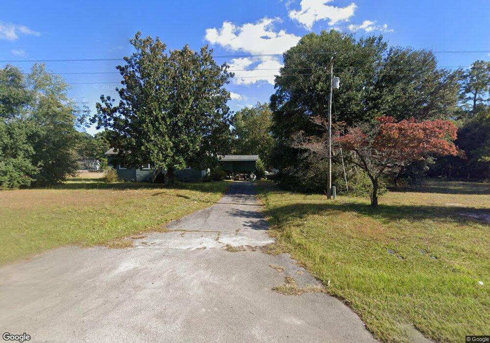
This home is located at 1972 Ranger Dr, Cross, SC 29436 and is currently estimated at $297,100, approximately $202 per square foot. 1972 Ranger Dr is a home located in Berkeley County with nearby schools including Cross Elementary School and Cross High School.
Ownership History
Date
Name
Owned For
Owner Type
Purchase Details
Closed on
Mar 4, 2013
Sold by
Ghan Agnes Annette
Bought by
Bilton Delbert
Current Estimated Value
Home Financials for this Owner
Home Financials are based on the most recent Mortgage that was taken out on this home.
Original Mortgage
$88,500
Interest Rate
3.56%
Mortgage Type
New Conventional
Purchase Details
Closed on
May 2, 2012
Sold by
Ghan Annette B
Bought by
Ghan Anges Annette and The Agnes Ghan Revocable Trust
Purchase Details
Closed on
Mar 29, 2006
Sold by
Lebby Davis E and Ghan Annette B
Bought by
Ghan Annette B
Create a Home Valuation Report for This Property
The Home Valuation Report is an in-depth analysis detailing your home's value as well as a comparison with similar homes in the area
Home Values in the Area
Average Home Value in this Area
Purchase History
| Date | Buyer | Sale Price | Title Company |
|---|---|---|---|
| Bilton Delbert | $141,000 | -- | |
| Ghan Anges Annette | -- | -- | |
| Ghan Annette B | -- | None Available |
Source: Public Records
Mortgage History
| Date | Status | Borrower | Loan Amount |
|---|---|---|---|
| Closed | Bilton Delbert | $88,500 |
Source: Public Records
Tax History Compared to Growth
Tax History
| Year | Tax Paid | Tax Assessment Tax Assessment Total Assessment is a certain percentage of the fair market value that is determined by local assessors to be the total taxable value of land and additions on the property. | Land | Improvement |
|---|---|---|---|---|
| 2025 | $823 | $166,900 | $74,832 | $92,068 |
| 2024 | $782 | $6,676 | $2,993 | $3,683 |
| 2023 | $782 | $6,676 | $2,993 | $3,683 |
| 2022 | $784 | $5,805 | $2,489 | $3,316 |
| 2021 | $802 | $5,800 | $2,454 | $3,351 |
| 2020 | $812 | $5,805 | $2,454 | $3,351 |
| 2019 | $797 | $5,805 | $2,454 | $3,351 |
| 2018 | $755 | $5,048 | $2,252 | $2,796 |
| 2017 | $715 | $5,048 | $2,252 | $2,796 |
| 2016 | $731 | $5,050 | $2,250 | $2,800 |
| 2015 | $679 | $5,050 | $2,250 | $2,800 |
| 2014 | $2,156 | $5,050 | $2,250 | $2,800 |
| 2013 | -- | $5,050 | $2,250 | $2,800 |
Source: Public Records
Map
Nearby Homes
- 184 Burbank Dr
- 280 Royalegates Ct
- 0 Bolt Dr
- 1726 Ranger Dr
- 00 Saint Julian Dr
- 108 Browns Family Place
- 0 Shortcut Rd
- 2363 Ranger Dr
- 1269 1271 1273 1265 Trojan Rd
- 113 Gospel Ln Unit A & B
- 00 Trojan 45
- 00 Spring Plains Rd
- 123 Spring Plains Rd
- 131 Lizzie Ave
- 1260 Spring Plains Rd
- 0 Ortho Ln
- 319 Hickory Nut Way
- 0 Richardson St Unit 21004538
- 0 Richardson St Unit 146658
- 611 Murphy Bay Dr
- 1968 Ranger Dr
- 1978 Ranger Dr
- 1988 Ranger Dr
- 1984 Ranger Dr
- 1973 Ranger Dr
- 1967 Ranger Dr
- 1977 Ranger Dr
- 1963 Ranger Dr
- 1959 Ranger Dr
- 1959 Ranger Dr Unit 1963
- 1949 Ranger Dr
- 5 Christina Ln
- 4 Christina Ln
- 215 Christina Ln
- 1939 Ranger Dr
- 919 Lakehouse Ln
- 936 Cedar Grove Dr
- 1929 Ranger Dr
- 942 Cedar Grove Dr
- 918 Mable Ln