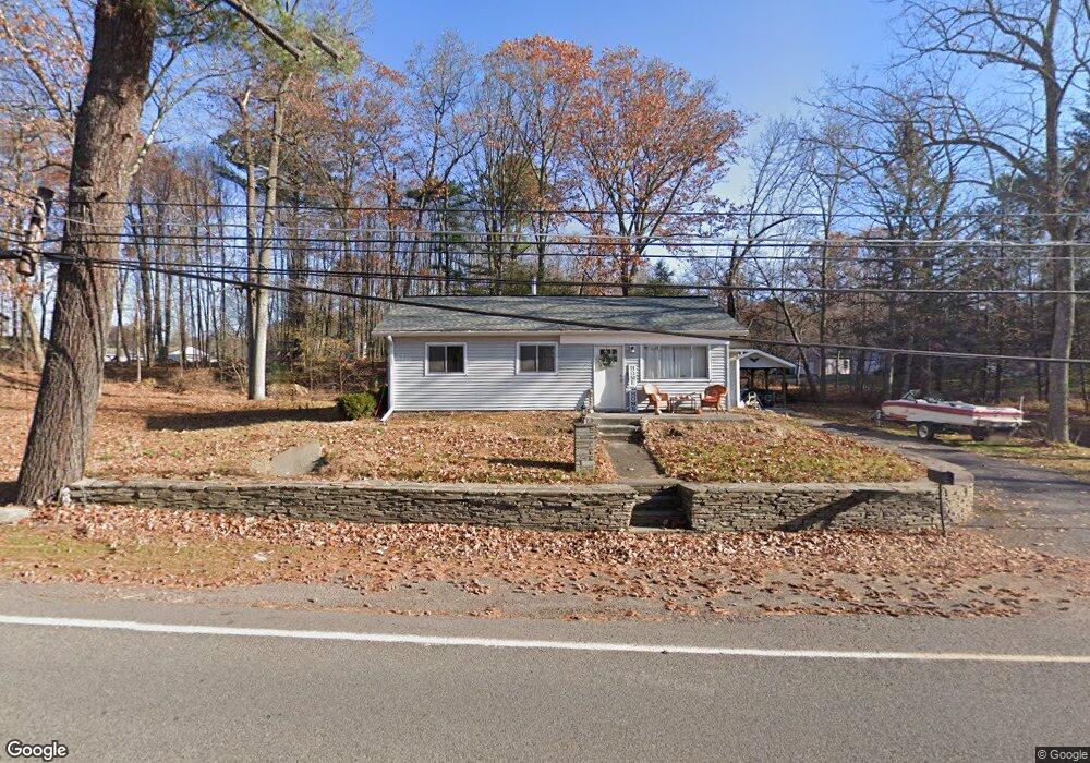
1972 State Route 29 Hwy Hunlock Creek, PA 18621
Estimated Value: $253,000 - $308,000
--
Bed
--
Bath
1,918
Sq Ft
$147/Sq Ft
Est. Value
About This Home
This home is located at 1972 State Route 29 Hwy, Hunlock Creek, PA 18621 and is currently estimated at $282,431, approximately $147 per square foot. 1972 State Route 29 Hwy is a home.
Ownership History
Date
Name
Owned For
Owner Type
Purchase Details
Closed on
Apr 16, 2024
Sold by
Morris Joseph P and Morris Shelia A
Bought by
Udzella Michele
Current Estimated Value
Home Financials for this Owner
Home Financials are based on the most recent Mortgage that was taken out on this home.
Original Mortgage
$205,000
Outstanding Balance
$201,937
Interest Rate
6.88%
Mortgage Type
New Conventional
Estimated Equity
$80,494
Purchase Details
Closed on
Jun 28, 2022
Sold by
Morris Joseph P and Morris Sheila A
Bought by
Morris Joseph P and Morris Sheila A
Purchase Details
Closed on
Dec 28, 2021
Sold by
Swartz Florence T
Bought by
Morris Joseph P and Morris Sheila A
Home Financials for this Owner
Home Financials are based on the most recent Mortgage that was taken out on this home.
Original Mortgage
$156,000
Interest Rate
2.39%
Mortgage Type
New Conventional
Purchase Details
Closed on
Jan 1, 1960
Bought by
Swartz Benjamin and Swartz Florence
Create a Home Valuation Report for This Property
The Home Valuation Report is an in-depth analysis detailing your home's value as well as a comparison with similar homes in the area
Home Values in the Area
Average Home Value in this Area
Purchase History
| Date | Buyer | Sale Price | Title Company |
|---|---|---|---|
| Udzella Michele | $275,000 | None Listed On Document | |
| Morris Joseph P | -- | None Listed On Document | |
| Morris Joseph P | -- | None Listed On Document | |
| Morris Joseph P | $195,000 | Terrana Law Pc | |
| Morris Joseph P | $195,000 | None Listed On Document | |
| Swartz Benjamin | -- | -- |
Source: Public Records
Mortgage History
| Date | Status | Borrower | Loan Amount |
|---|---|---|---|
| Open | Udzella Michele | $205,000 | |
| Previous Owner | Morris Joseph P | $156,000 |
Source: Public Records
Tax History Compared to Growth
Tax History
| Year | Tax Paid | Tax Assessment Tax Assessment Total Assessment is a certain percentage of the fair market value that is determined by local assessors to be the total taxable value of land and additions on the property. | Land | Improvement |
|---|---|---|---|---|
| 2025 | $3,765 | $170,400 | $40,700 | $129,700 |
| 2024 | $3,744 | $170,400 | $40,700 | $129,700 |
| 2023 | $3,726 | $170,400 | $40,700 | $129,700 |
| 2022 | $3,303 | $159,700 | $30,000 | $129,700 |
| 2021 | $3,169 | $159,700 | $30,000 | $129,700 |
| 2020 | $3,169 | $159,700 | $30,000 | $129,700 |
| 2019 | $3,052 | $159,700 | $30,000 | $129,700 |
| 2018 | $2,927 | $159,700 | $30,000 | $129,700 |
| 2017 | $2,876 | $159,700 | $30,000 | $129,700 |
| 2016 | -- | $159,700 | $30,000 | $129,700 |
| 2015 | -- | $159,700 | $30,000 | $129,700 |
| 2014 | -- | $159,700 | $30,000 | $129,700 |
Source: Public Records
Map
Nearby Homes
- 46 Country Crest Ln
- 15 Pearl St
- 32 Lake Ave
- 983 Swamp Rd
- 641 Sorbertown Hill Rd
- 0 Moon Lake Rd
- 127 White Oak Dr
- 107 White Oak Dr
- 73 Adams Dr
- 85 Sorbertown Hill Rd
- 0 Hunlock-Harveyville Rd
- 4B, C, & D Hayfield Rd
- 1B & C Hayfield Rd
- 0 Sweet Valley Rd
- 609 Main Rd
- Lot 54 Garden Dr
- 1842 Pennsylvania 118
- 205 Post Office Rd
- 198 Indian Cave Rd
- 1011 Mill St
- 1972 Pennsylvania 29
- 1997 Pennsylvania 29
- 1965 State Route 29 Hwy
- 7 Willow St
- 1961 Pennsylvania 29
- 141 Sayre Rd
- 41 Lakeside Dr
- 16 Carol St
- 1961 State Route 29 Hwy
- 29 Lakeside Dr
- 1955 Pennsylvania 29
- 1955 State Route 29 Hwy
- 19 Willow St
- 25 Lakeside Dr
- 25 Lakeside Dr
- 35 Lakeside Dr
- 8 Summit St
- 8 Cedar St
- 0 Carol St
- 31 Carol St