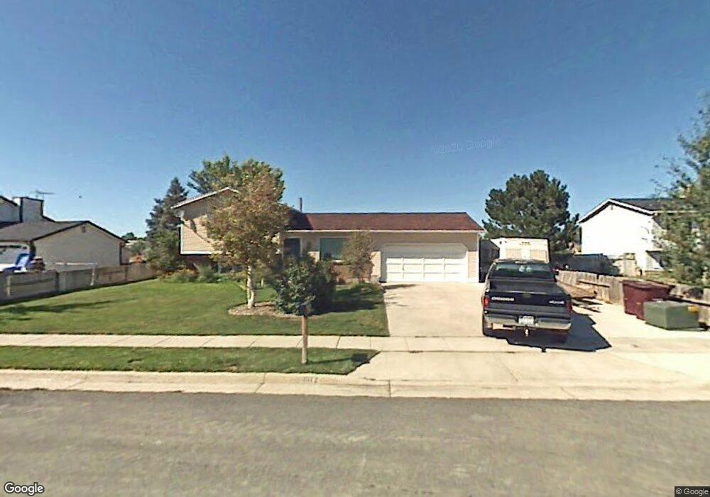
1972 W 11970 S Riverton, UT 84065
Estimated Value: $524,000 - $577,000
3
Beds
2
Baths
1,290
Sq Ft
$425/Sq Ft
Est. Value
About This Home
This home is located at 1972 W 11970 S, Riverton, UT 84065 and is currently estimated at $548,709, approximately $425 per square foot. 1972 W 11970 S is a home located in Salt Lake County with nearby schools including Rosamond Elementary School, Oquirrh Hills Middle School, and Riverton High School.
Ownership History
Date
Name
Owned For
Owner Type
Purchase Details
Closed on
Sep 23, 2025
Sold by
Brent Chad Davis and Brent Nicole Lynn
Bought by
Davis Brent Chad
Current Estimated Value
Purchase Details
Closed on
Dec 17, 2021
Sold by
Davis Brent C
Bought by
Brent Chad Davis And Nicole Lynne Bellah Fami and Ly Nicole
Purchase Details
Closed on
Mar 26, 2003
Sold by
Davis Brent C
Bought by
Davis Brent C
Home Financials for this Owner
Home Financials are based on the most recent Mortgage that was taken out on this home.
Original Mortgage
$129,620
Interest Rate
5.79%
Mortgage Type
FHA
Purchase Details
Closed on
Jan 19, 2001
Sold by
Grant Jeffrey C and Grant Jayme A
Bought by
Davis Brent C
Home Financials for this Owner
Home Financials are based on the most recent Mortgage that was taken out on this home.
Original Mortgage
$129,468
Interest Rate
7.41%
Mortgage Type
FHA
Create a Home Valuation Report for This Property
The Home Valuation Report is an in-depth analysis detailing your home's value as well as a comparison with similar homes in the area
Home Values in the Area
Average Home Value in this Area
Purchase History
| Date | Buyer | Sale Price | Title Company |
|---|---|---|---|
| Davis Brent Chad | -- | None Listed On Document | |
| Brent Chad Davis And Nicole Lynne Bellah Fami | -- | None Listed On Document | |
| Davis Brent C | -- | Metro National Title | |
| Davis Brent C | -- | Superior Title |
Source: Public Records
Mortgage History
| Date | Status | Borrower | Loan Amount |
|---|---|---|---|
| Previous Owner | Davis Brent C | $129,620 | |
| Previous Owner | Davis Brent C | $129,468 |
Source: Public Records
Tax History Compared to Growth
Tax History
| Year | Tax Paid | Tax Assessment Tax Assessment Total Assessment is a certain percentage of the fair market value that is determined by local assessors to be the total taxable value of land and additions on the property. | Land | Improvement |
|---|---|---|---|---|
| 2025 | $2,748 | $483,200 | $216,500 | $266,700 |
| 2024 | $2,748 | $475,600 | $212,600 | $263,000 |
| 2023 | $2,666 | $435,000 | $196,800 | $238,200 |
| 2022 | $2,799 | $448,000 | $193,000 | $255,000 |
| 2021 | $2,419 | $344,700 | $144,700 | $200,000 |
| 2020 | $2,173 | $288,700 | $129,700 | $159,000 |
| 2019 | $2,172 | $283,700 | $117,900 | $165,800 |
| 2018 | $2,042 | $0 | $0 | $0 |
| 2017 | $1,947 | $244,000 | $117,900 | $126,100 |
| 2016 | $1,829 | $220,000 | $106,200 | $113,800 |
| 2015 | $1,708 | $199,200 | $108,000 | $91,200 |
| 2014 | $1,637 | $187,100 | $103,000 | $84,100 |
Source: Public Records
Map
Nearby Homes
- 12034 S 1900 W
- 1721 W Hollow Cedar Ln Unit 1
- 2295 W Myers Ln
- 11666 S Gold Dust Dr
- 1767 W Lunford Ln
- 11788 S Myers Park Ln Unit 101
- 1611 W Laurel Chase Dr
- 11707 S Myers Park Ln Unit 111
- 1661 W Madison View Dr
- 12317 S Redwood Rd
- 12325 S Redwood Rd
- 12345 S Redwood Rd
- 2511 W 11730 S
- 1592 W Andover Rd
- 11694 Stone Crest Cir
- 11711 Stone Crest Cir
- 1410 W 12115 S
- 11784 Stone Ridge Ct
- 12294 S 1490 W
- 11423 S Polo Club Ct
- 1988 W 11970 S
- 1956 W 11970 S
- 1989 W Bamberger Dr Unit 20
- 1967 W Bamberger Dr
- 2004 W 11970 S
- 1971 W 11970 S
- 2007 W Bamberger Dr
- 1987 W 11970 S
- 1955 W 11970 S
- 2012 W 11970 S
- 2005 W 11970 S
- 1933 W Bamberger Dr
- 2029 W Bamberger Dr Unit 22
- 1970 W 12015 S
- 11912 S Verde View Cove
- 1986 W 12015 S
- 11917 S Verde View Cove
- 1952 W 12015 S
- 2028 W 11970 S
- 1998 W Bamberger Dr Unit 9