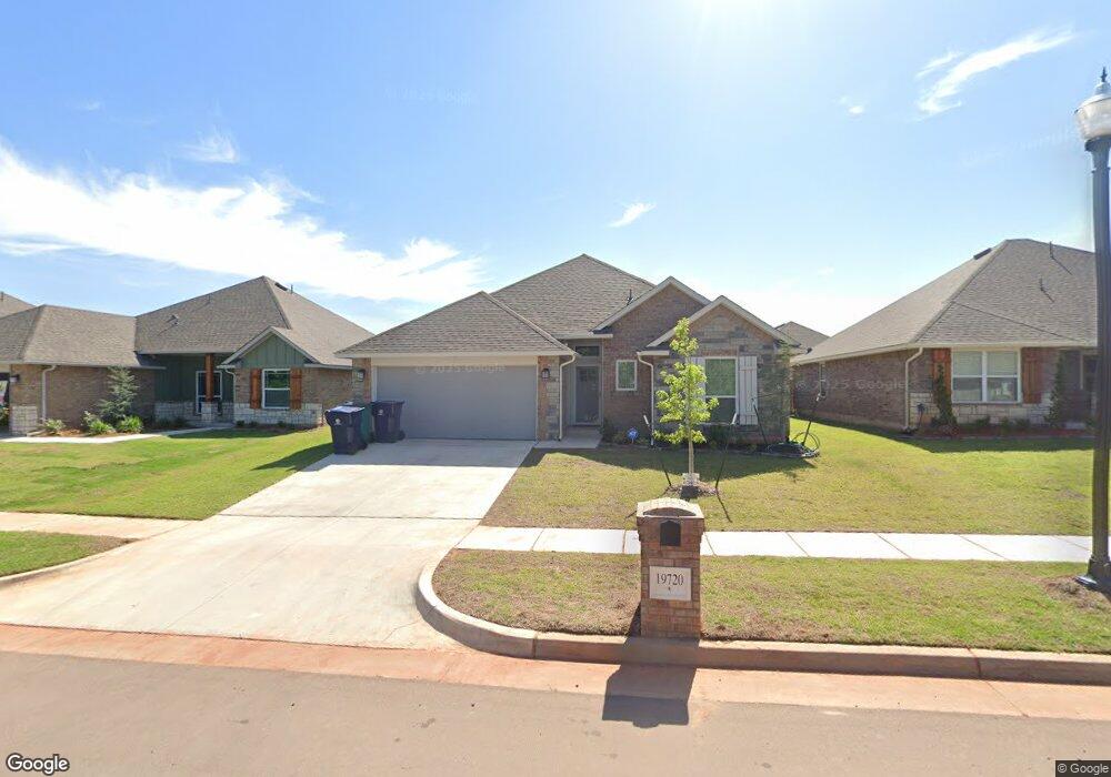
19720 Canning Rd Edmond, OK 73012
West Edmond NeighborhoodEstimated Value: $298,128 - $319,000
3
Beds
2
Baths
1,543
Sq Ft
$198/Sq Ft
Est. Value
About This Home
This home is located at 19720 Canning Rd, Edmond, OK 73012 and is currently estimated at $304,782, approximately $197 per square foot. 19720 Canning Rd is a home located in Oklahoma County with nearby schools including Grove Valley Elementary School, Deer Creek Middle School, and Deer Creek Intermediate School.
Ownership History
Date
Name
Owned For
Owner Type
Purchase Details
Closed on
Apr 17, 2025
Sold by
Ata Y Elauf Revocable Living Trust and Elauf Ata Y
Bought by
Pollock Braden and Pollock Alexus
Current Estimated Value
Home Financials for this Owner
Home Financials are based on the most recent Mortgage that was taken out on this home.
Original Mortgage
$289,750
Outstanding Balance
$287,396
Interest Rate
6.62%
Mortgage Type
New Conventional
Estimated Equity
$17,386
Purchase Details
Closed on
Nov 16, 2023
Sold by
Castleberry Properties Llc
Bought by
Elauf Ata Y
Create a Home Valuation Report for This Property
The Home Valuation Report is an in-depth analysis detailing your home's value as well as a comparison with similar homes in the area
Home Values in the Area
Average Home Value in this Area
Purchase History
| Date | Buyer | Sale Price | Title Company |
|---|---|---|---|
| Pollock Braden | $305,000 | American Eagle Title | |
| Pollock Braden | $305,000 | American Eagle Title | |
| Elauf Ata Y | $289,000 | Stewart Title Guaranty Company |
Source: Public Records
Mortgage History
| Date | Status | Borrower | Loan Amount |
|---|---|---|---|
| Open | Pollock Braden | $289,750 | |
| Closed | Pollock Braden | $289,750 |
Source: Public Records
Tax History
| Year | Tax Paid | Tax Assessment Tax Assessment Total Assessment is a certain percentage of the fair market value that is determined by local assessors to be the total taxable value of land and additions on the property. | Land | Improvement |
|---|---|---|---|---|
| 2025 | $4,132 | $33,055 | $5,024 | $28,031 |
| 2024 | $96 | $31,515 | $5,024 | $26,491 |
| 2023 | $96 | $727 | $727 | $0 |
| 2022 | $1 | $6 | $6 | $0 |
Source: Public Records
Map
Nearby Homes
- 19728 Canning Rd
- 19629 Canning Rd
- 19712 Brookville Dr
- 19621 Canning Rd
- 19616 Bolton Rd
- 19809 Stovall Dr
- 3016 NW 196th Place
- 3020 NW 196th Place
- 3021 NW 196th Place
- 2924 NW 196th Place
- 2928 NW 196th Place
- 2916 NW 196th Place
- 2920 NW 196th Place
- 3025 NW 196th Place
- 3028 NW 196th Place
- 3024 NW 196th Place
- 2917 NW 196th Place
- 19813 Stovall Dr
- 3032 NW 196th Place
- 2912 NW 196th Place
- 19724 Canning Rd
- 19716 Canning Rd
- 19712 Canning Rd
- 19729 Whitley Rd
- 19709 Canning Rd
- 19705 Whitley Rd
- 19705 Canning Rd
- 19720 Whitley Rd
- 19716 Whitley Rd
- 19701 Canning Rd
- 19704 Whitley Rd
- 19721 Brookville Dr
- 19721 Brookville Dr
- 19717 Brookville Dr
- 19713 Brookville Dr
- 19725 Brookville Dr
- 19709 Brookville Dr
- 2829 NW 197th St
- 2817 NW 197th St
- 19805 Canning Ct