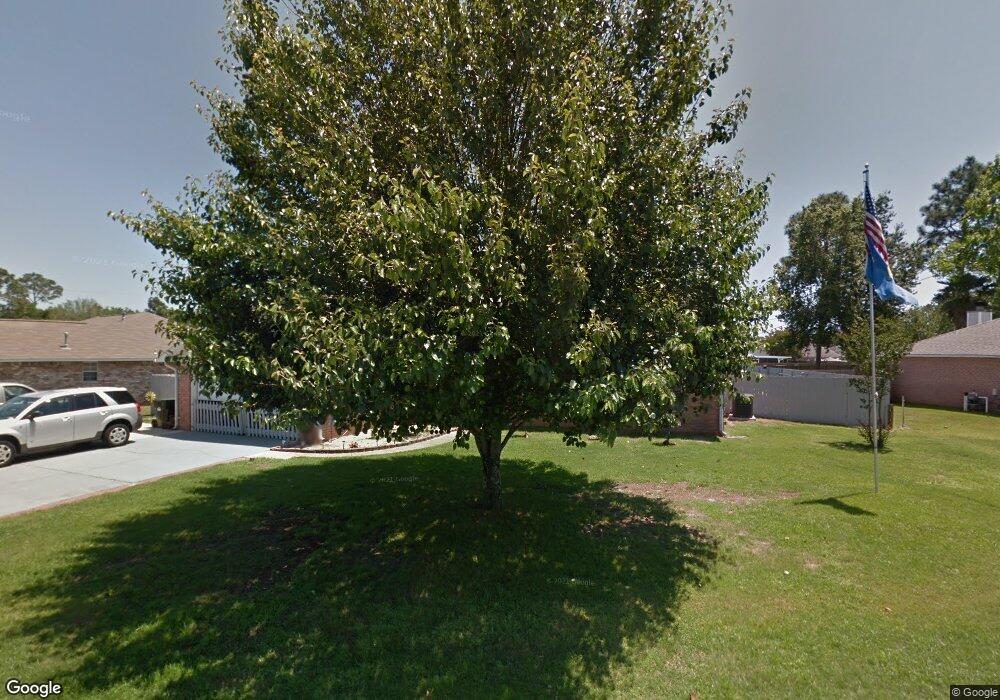
1973 Coral Reef Rd Pensacola, FL 32506
Southwest Pensacola NeighborhoodEstimated Value: $315,000 - $355,000
--
Bed
3
Baths
2,136
Sq Ft
$155/Sq Ft
Est. Value
About This Home
This home is located at 1973 Coral Reef Rd, Pensacola, FL 32506 and is currently estimated at $332,138, approximately $155 per square foot. 1973 Coral Reef Rd is a home located in Escambia County with nearby schools including Pleasant Grove Elementary School, Jim C. Bailey Middle School, and Escambia High School.
Ownership History
Date
Name
Owned For
Owner Type
Purchase Details
Closed on
Jan 5, 2008
Sold by
Mickler Vicki J
Bought by
Mickler Vicki J and Cayle Sandra K
Current Estimated Value
Purchase Details
Closed on
Jan 26, 1996
Sold by
Henry Co Homes Inc
Bought by
Mickler Vicki J
Home Financials for this Owner
Home Financials are based on the most recent Mortgage that was taken out on this home.
Original Mortgage
$107,477
Outstanding Balance
$3,583
Interest Rate
7.2%
Mortgage Type
VA
Estimated Equity
$328,555
Create a Home Valuation Report for This Property
The Home Valuation Report is an in-depth analysis detailing your home's value as well as a comparison with similar homes in the area
Home Values in the Area
Average Home Value in this Area
Purchase History
| Date | Buyer | Sale Price | Title Company |
|---|---|---|---|
| Mickler Vicki J | -- | None Available | |
| Mickler Vicki J | $105,400 | -- |
Source: Public Records
Mortgage History
| Date | Status | Borrower | Loan Amount |
|---|---|---|---|
| Open | Mickler Vicki J | $107,477 |
Source: Public Records
Tax History Compared to Growth
Tax History
| Year | Tax Paid | Tax Assessment Tax Assessment Total Assessment is a certain percentage of the fair market value that is determined by local assessors to be the total taxable value of land and additions on the property. | Land | Improvement |
|---|---|---|---|---|
| 2024 | $1,567 | $155,528 | -- | -- |
| 2023 | $1,567 | $150,999 | $0 | $0 |
| 2022 | $1,525 | $146,601 | $0 | $0 |
| 2021 | $1,513 | $142,332 | $0 | $0 |
| 2020 | $1,473 | $140,367 | $0 | $0 |
| 2019 | $1,443 | $137,212 | $0 | $0 |
| 2018 | $1,435 | $134,654 | $0 | $0 |
| 2017 | $1,428 | $131,885 | $0 | $0 |
| 2016 | $1,410 | $129,173 | $0 | $0 |
| 2015 | $1,395 | $128,276 | $0 | $0 |
| 2014 | $1,385 | $127,258 | $0 | $0 |
Source: Public Records
Map
Nearby Homes
- 1958 Coral Island Rd
- 911 Vonna Jo Cir
- 1978 Coral Reef Rd
- 940 Vonna Jo Cir
- 1101 Antigua Cir
- 1060 Antigua Cir
- The Alabaster Plan at Martin Preserve
- The Camilla Plan at Martin Preserve
- The Delilah Plan at Martin Preserve
- 9907 Starling Dr
- 9787 Cobblebrook Dr
- 9903 Starling Dr
- 9865 Starling Dr
- 9854 Starling Dr
- 2041 Marquesas Ln
- 9839 Starling Dr
- 9827 Starling Dr
- 9835 Starling Dr
- 1914 Coral Island Rd
- 9869 Starling Dr
- 1979 Coral Reef Rd
- 1965 Coral Reef Rd
- 1959 Coral Island Rd
- 0 Coral Reef Rd
- 1981 Coral Reef Rd
- 1957 Coral Island Rd
- 1980 Coral Reef Rd
- 1976 Coral Reef Rd
- 1954 Coral Island Rd
- 1982 Coral Reef Rd Unit 2
- 1974 Coral Reef Rd
- 1952 Coral Island Rd Unit 2
- 1955 Coral Island Rd
- 1972 Coral Island Rd
- 1985 Coral Reef Rd
- 1950 Coral Island Rd
- 2136 Coral Creek Dr Unit 2
- 1984 Coral Reef Rd
- 1015 Antigua Cir
- 1017 Antigua Cir
