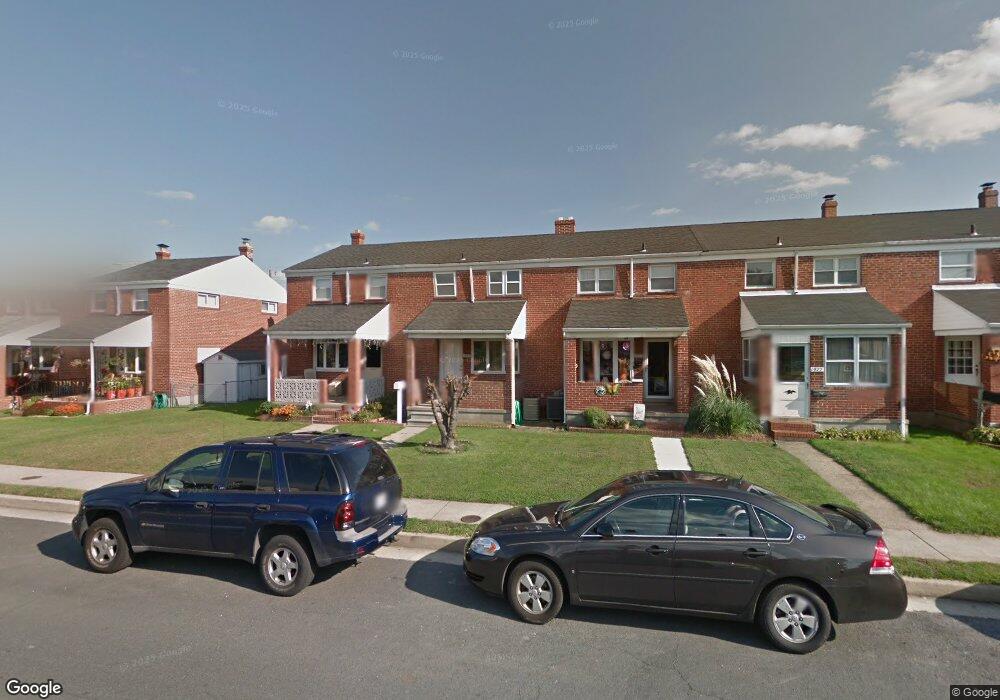
1973 Denbury Dr Dundalk, MD 21222
Estimated Value: $181,858 - $242,000
--
Bed
1
Bath
1,248
Sq Ft
$177/Sq Ft
Est. Value
About This Home
This home is located at 1973 Denbury Dr, Dundalk, MD 21222 and is currently estimated at $221,465, approximately $177 per square foot. 1973 Denbury Dr is a home located in Baltimore County with nearby schools including Grange Elementary School, General John Stricker Middle School, and Patapsco High & Center for Arts.
Ownership History
Date
Name
Owned For
Owner Type
Purchase Details
Closed on
Dec 21, 2022
Sold by
Case George W
Bought by
Welker Deborah D
Current Estimated Value
Home Financials for this Owner
Home Financials are based on the most recent Mortgage that was taken out on this home.
Original Mortgage
$77,000
Interest Rate
6.09%
Mortgage Type
New Conventional
Purchase Details
Closed on
Mar 12, 2013
Sold by
Wheeler Anthony Dean and Wheeler Rena Larue
Bought by
Case George W and Case Dianna M
Home Financials for this Owner
Home Financials are based on the most recent Mortgage that was taken out on this home.
Original Mortgage
$112,000
Interest Rate
3.56%
Mortgage Type
New Conventional
Create a Home Valuation Report for This Property
The Home Valuation Report is an in-depth analysis detailing your home's value as well as a comparison with similar homes in the area
Home Values in the Area
Average Home Value in this Area
Purchase History
| Date | Buyer | Sale Price | Title Company |
|---|---|---|---|
| Welker Deborah D | -- | -- | |
| Case George W | $140,000 | None Available |
Source: Public Records
Mortgage History
| Date | Status | Borrower | Loan Amount |
|---|---|---|---|
| Previous Owner | Welker Deborah D | $77,000 | |
| Previous Owner | Case George W | $112,000 |
Source: Public Records
Tax History Compared to Growth
Tax History
| Year | Tax Paid | Tax Assessment Tax Assessment Total Assessment is a certain percentage of the fair market value that is determined by local assessors to be the total taxable value of land and additions on the property. | Land | Improvement |
|---|---|---|---|---|
| 2025 | $2,580 | $168,833 | -- | -- |
| 2024 | $2,580 | $156,667 | $0 | $0 |
| 2023 | $1,206 | $144,500 | $36,000 | $108,500 |
| 2022 | $2,365 | $142,500 | $0 | $0 |
| 2021 | $2,539 | $140,500 | $0 | $0 |
| 2020 | $2,539 | $138,500 | $36,000 | $102,500 |
| 2019 | $2,382 | $134,900 | $0 | $0 |
| 2018 | $2,194 | $131,300 | $0 | $0 |
| 2017 | $2,188 | $127,700 | $0 | $0 |
| 2016 | $1,960 | $127,700 | $0 | $0 |
| 2015 | $1,960 | $127,700 | $0 | $0 |
| 2014 | $1,960 | $141,200 | $0 | $0 |
Source: Public Records
Map
Nearby Homes
- 2743 Kirkleigh Rd
- 1940 Wareham Rd
- 1935 Stanhope Rd
- 2746 Moorgate Rd
- 2738 Moorgate Rd
- 9 Vista Mobile Dr
- 7807 Rockbourne Rd
- 7252 Meadow Ln
- 1894 Church Rd
- 1907 Wills Rd
- 1940H Robinwood Rd
- 7839 Harold Rd
- 1914 Armco Way
- 2007 Dineen Dr
- 2953 Yorkway
- 3135 Sollers Point Rd
- 2970 Yorkway
- 1943 Dineen Dr
- 1614 Lynch Rd
- 8427 Stansbury Lake Dr
- 1975 Denbury Dr
- 1971 Denbury Dr
- 1977 Denbury Dr
- 1969 Denbury Dr
- 1967 Denbury Dr
- 1965 Denbury Dr
- 1963 Denbury Dr
- 1961 Denbury Dr
- 2814 Kirkleigh Rd
- 1959 Denbury Dr
- 2001 Denbury Dr
- 2812 Kirkleigh Rd
- 1962 Denbury Dr
- 1957 Denbury Dr
- 1960 Denbury Dr
- 2810 Kirkleigh Rd
- 1958 Denbury Dr
- 2003 Denbury Dr
- 1956 Denbury Dr
- 1955 Denbury Dr