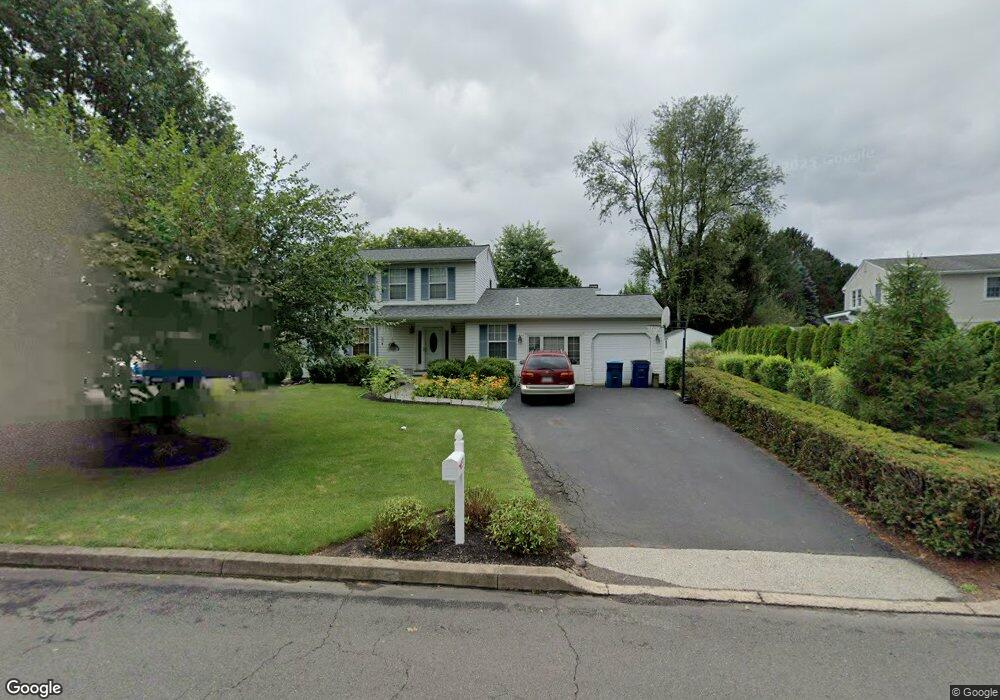
1973 Sunrise Way Jamison, PA 18929
Estimated Value: $593,000 - $641,431
4
Beds
3
Baths
1,766
Sq Ft
$352/Sq Ft
Est. Value
About This Home
This home is located at 1973 Sunrise Way, Jamison, PA 18929 and is currently estimated at $622,108, approximately $352 per square foot. 1973 Sunrise Way is a home located in Bucks County with nearby schools including Jamison Elementary School, Tamanend Middle School, and Central Bucks High School - South.
Ownership History
Date
Name
Owned For
Owner Type
Purchase Details
Closed on
Jun 27, 2024
Sold by
Barstow Donald Scott
Bought by
Dlb Revocable Trust and Barstow
Current Estimated Value
Purchase Details
Closed on
Apr 14, 1995
Sold by
Boylan Richard P and Boylan Leslie N
Bought by
Barstow Donald Scott
Home Financials for this Owner
Home Financials are based on the most recent Mortgage that was taken out on this home.
Original Mortgage
$85,000
Interest Rate
8.33%
Purchase Details
Closed on
Dec 30, 1986
Bought by
Boylan Richard P and Boylan Leslie
Create a Home Valuation Report for This Property
The Home Valuation Report is an in-depth analysis detailing your home's value as well as a comparison with similar homes in the area
Home Values in the Area
Average Home Value in this Area
Purchase History
| Date | Buyer | Sale Price | Title Company |
|---|---|---|---|
| Dlb Revocable Trust | -- | None Listed On Document | |
| Barstow Donald Scott | $175,000 | -- | |
| Boylan Richard P | $125,800 | -- |
Source: Public Records
Mortgage History
| Date | Status | Borrower | Loan Amount |
|---|---|---|---|
| Previous Owner | Barstow Donald Scott | $85,000 |
Source: Public Records
Tax History Compared to Growth
Tax History
| Year | Tax Paid | Tax Assessment Tax Assessment Total Assessment is a certain percentage of the fair market value that is determined by local assessors to be the total taxable value of land and additions on the property. | Land | Improvement |
|---|---|---|---|---|
| 2025 | $6,447 | $37,040 | $9,160 | $27,880 |
| 2024 | $6,447 | $37,040 | $9,160 | $27,880 |
| 2023 | $6,243 | $37,040 | $9,160 | $27,880 |
| 2022 | $6,173 | $37,040 | $9,160 | $27,880 |
| 2021 | $6,104 | $37,040 | $9,160 | $27,880 |
| 2020 | $6,104 | $37,040 | $9,160 | $27,880 |
| 2019 | $6,067 | $37,040 | $9,160 | $27,880 |
| 2018 | $6,067 | $37,040 | $9,160 | $27,880 |
| 2017 | $6,021 | $37,040 | $9,160 | $27,880 |
| 2016 | $6,021 | $37,040 | $9,160 | $27,880 |
| 2015 | -- | $37,040 | $9,160 | $27,880 |
| 2014 | -- | $37,040 | $9,160 | $27,880 |
Source: Public Records
Map
Nearby Homes
- 1877 Brook Ln
- 1620 Rockcress Dr
- 1618 Mayfield Cir
- 1504 Springfield Ct Unit 37
- 2127 York Rd
- 1990 York Rd
- 2018 Buckingham Dr
- 1554 Park Dr
- Northbrook Plan at Jamison Place
- Westmont Plan at Jamison Place
- Faraday Plan at Jamison Place
- Homesite 10103 Marquis Ln
- Homesite 102 Marquis Ln
- Homesite 10102 Marquis Ln
- 5005 Quartermaster Ln
- 5011 Quartermaster Ln
- Homesite 11903 Quartermaster Ln
- 1447 Bentley Dr
- 1403 E Fernbrook Dr
- 3020 Marquis Ln
- 1979 Sunrise Way
- 1899 Cold Brook Ln
- 1936 Land Rd
- 1893 Cold Brook Ln
- 1978 Sunrise Way
- 1985 Sunrise Way
- 1968 Sunrise Way
- 1988 Sunrise Way
- 1887 Cold Brook Ln
- 1838 Heritage Dr
- 1945 Sunrise Way
- 1958 Sunrise Way
- 1990 Sunflower Cir
- 1991 Sunrise Way
- 1836 Heritage Dr
- 1881 Cold Brook Ln
- 1840 Heritage Dr
- 1892 Cold Brook Ln
- 1834 Heritage Dr
- 1948 Sunrise Way