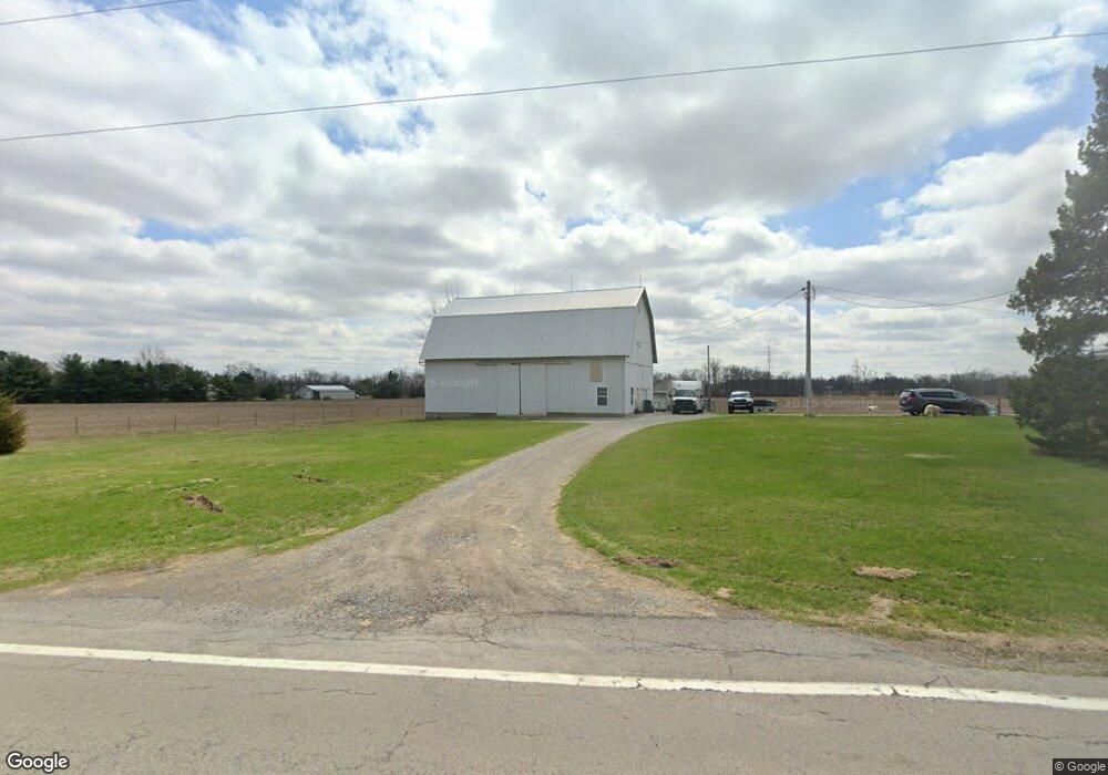
19737 State Route 190 Delphos, OH 45833
Estimated Value: $226,809 - $364,000
4
Beds
2
Baths
2,462
Sq Ft
$114/Sq Ft
Est. Value
About This Home
This home is located at 19737 State Route 190, Delphos, OH 45833 and is currently estimated at $281,270, approximately $114 per square foot. 19737 State Route 190 is a home located in Putnam County with nearby schools including Fort Jennings Elementary School, Fort Jennings High School, and Delphos St. John's Elementary School.
Ownership History
Date
Name
Owned For
Owner Type
Purchase Details
Closed on
Jan 16, 2020
Sold by
Bolder Investments Llc
Bought by
Bontrager Nathan D and Bontrager Shilah
Current Estimated Value
Home Financials for this Owner
Home Financials are based on the most recent Mortgage that was taken out on this home.
Original Mortgage
$202,500
Outstanding Balance
$178,917
Interest Rate
3.6%
Mortgage Type
New Conventional
Estimated Equity
$102,353
Purchase Details
Closed on
Oct 26, 2009
Sold by
Elwer Todd and Elwer Jaime
Bought by
Bolder Investment Llc
Create a Home Valuation Report for This Property
The Home Valuation Report is an in-depth analysis detailing your home's value as well as a comparison with similar homes in the area
Home Values in the Area
Average Home Value in this Area
Purchase History
| Date | Buyer | Sale Price | Title Company |
|---|---|---|---|
| Bontrager Nathan D | $225,000 | None Available | |
| Bolder Investment Llc | -- | None Available |
Source: Public Records
Mortgage History
| Date | Status | Borrower | Loan Amount |
|---|---|---|---|
| Open | Bontrager Nathan D | $202,500 |
Source: Public Records
Tax History Compared to Growth
Tax History
| Year | Tax Paid | Tax Assessment Tax Assessment Total Assessment is a certain percentage of the fair market value that is determined by local assessors to be the total taxable value of land and additions on the property. | Land | Improvement |
|---|---|---|---|---|
| 2024 | $1,908 | $64,040 | $5,740 | $58,300 |
| 2023 | $1,974 | $51,860 | $4,430 | $47,430 |
| 2022 | $1,779 | $51,860 | $4,431 | $47,429 |
| 2021 | $1,747 | $50,730 | $4,430 | $46,300 |
| 2020 | $1,754 | $35,560 | $3,720 | $31,840 |
| 2019 | $1,510 | $44,180 | $4,430 | $39,750 |
| 2018 | $1,487 | $44,180 | $4,430 | $39,750 |
| 2017 | $1,205 | $44,180 | $4,430 | $39,750 |
| 2016 | $1,205 | $35,560 | $3,720 | $31,840 |
| 2015 | $1,323 | $35,560 | $3,720 | $31,840 |
| 2014 | $1,339 | $35,560 | $3,720 | $31,840 |
| 2013 | $1,367 | $35,560 | $3,720 | $31,840 |
Source: Public Records
Map
Nearby Homes
- 7510 State Route 66
- 0 Road 24-Q
- 1220 Rose Anna Dr
- 1303 Carolyn Dr
- 0 Heritage Cir Unit 6112034
- 0 Heritage Cir Unit 303239
- 320 Auglaize St
- 810 N Franklin St
- 650 E 6th St
- 704 N Franklin St
- 628 N Pierce St
- 610 N Washington St
- 914 E 3rd St
- 903 E 3rd St
- 821 E 3rd St
- 405 N Franklin St
- 604 W 6th St
- 503 W 6th St
- 8951 Brickner Rd
- 17736 Road 20p
- 19649 State Route 190
- 19629 State Route 190
- 19866 State Route 190
- 19599 State Route 190
- 20119 Road 24
- 19559 State Route 190
- 19560 State Route 190
- 20101 Road 24
- 19485 State Route 190
- 19383 State Route 190
- 19461 State Route 190
- 19435 State Route 190
- 20334 Road 24
- 24266 Road T
- 20344 Road 24
- 20339 Road
- 20339 Road 24
- 19307 Road 23s
- 20360 Road 24
- 20379 Road 24