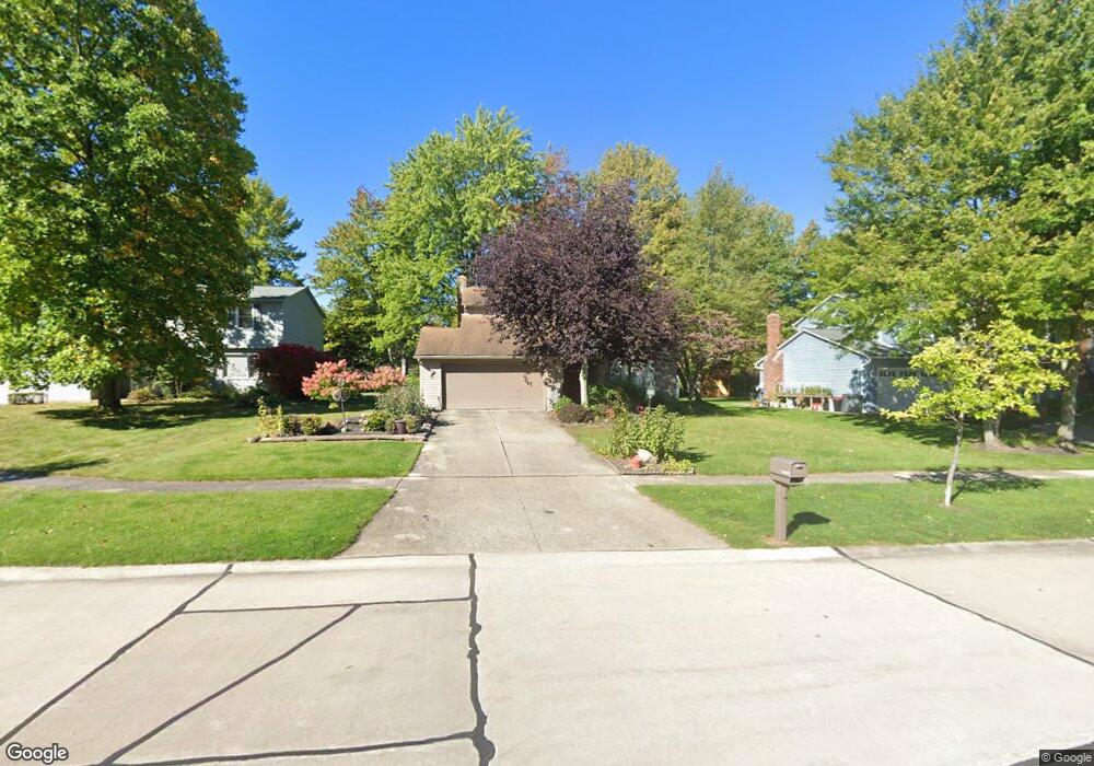
19738 Jamestown Cir Strongsville, OH 44136
Estimated Value: $301,000 - $343,000
3
Beds
3
Baths
1,527
Sq Ft
$206/Sq Ft
Est. Value
About This Home
This home is located at 19738 Jamestown Cir, Strongsville, OH 44136 and is currently estimated at $314,678, approximately $206 per square foot. 19738 Jamestown Cir is a home located in Cuyahoga County with nearby schools including Strongsville High School, Royal Redeemer Lutheran School, and Saint Ambrose Catholic School.
Ownership History
Date
Name
Owned For
Owner Type
Purchase Details
Closed on
Apr 18, 1988
Sold by
Yates Madeline
Bought by
Muza Glenn M
Current Estimated Value
Purchase Details
Closed on
May 16, 1984
Sold by
Yates Norman R
Bought by
Yates Madeline
Purchase Details
Closed on
Nov 21, 1978
Sold by
Pate William B
Bought by
Yates Norman R
Purchase Details
Closed on
Jan 1, 1978
Bought by
Pate William B
Create a Home Valuation Report for This Property
The Home Valuation Report is an in-depth analysis detailing your home's value as well as a comparison with similar homes in the area
Home Values in the Area
Average Home Value in this Area
Purchase History
| Date | Buyer | Sale Price | Title Company |
|---|---|---|---|
| Muza Glenn M | $111,500 | -- | |
| Yates Madeline | -- | -- | |
| Yates Norman R | $82,800 | -- | |
| Pate William B | -- | -- |
Source: Public Records
Tax History Compared to Growth
Tax History
| Year | Tax Paid | Tax Assessment Tax Assessment Total Assessment is a certain percentage of the fair market value that is determined by local assessors to be the total taxable value of land and additions on the property. | Land | Improvement |
|---|---|---|---|---|
| 2024 | $4,123 | $87,815 | $21,000 | $66,815 |
| 2023 | $4,405 | $70,350 | $16,170 | $54,180 |
| 2022 | $4,373 | $70,350 | $16,170 | $54,180 |
| 2021 | $4,338 | $70,350 | $16,170 | $54,180 |
| 2020 | $4,022 | $57,680 | $13,270 | $44,420 |
| 2019 | $3,904 | $164,800 | $37,900 | $126,900 |
| 2018 | $3,462 | $57,680 | $13,270 | $44,420 |
| 2017 | $3,444 | $51,910 | $10,290 | $41,620 |
| 2016 | $3,416 | $51,910 | $10,290 | $41,620 |
| 2015 | $3,464 | $51,910 | $10,290 | $41,620 |
| 2014 | $3,464 | $51,910 | $10,290 | $41,620 |
Source: Public Records
Map
Nearby Homes
- 14292 Trenton Ave
- 3137 Blackburn Ln
- 106 Briarleigh Dr
- 15188 Trails Landing
- 18987 Laurell Cir
- 19297 Hunt Rd
- 19252 Hidden Woods Ln
- 19740 Benbow Rd
- 15604-REAR Boston Rd
- 3003 Alda Pkwy
- 15772 Boston Rd
- 266 Bettie Ln
- 18323 Benbow Rd
- 13335 Tradewinds Dr
- 13448 Compass Point Dr
- 14132 Walking Stick Way
- 3125 Portsmouth Dr
- 75 Weathervane Ln
- 97 Weathervane Ln
- 2882 Marion Pkwy
- 19706 Jamestown Cir
- 19780 Jamestown Cir
- 19684 Jamestown Cir
- 19792 Jamestown Cir
- 19719 Jamestown Cir
- 14317 E Hartford Dr
- 19799 Jamestown Cir
- 19652 Jamestown Cir
- 19813 Cross Trail S
- 19783 Jamestown Cir
- 19791 Jamestown Cir
- 14285 E Hartford Dr
- 19825 Cross Trail S
- 19801 Cross Trail S
- 14350 Boston Rd
- 14318 Boston Rd
- 236 E Hartford Dr
- 14302 Boston Rd
- 14426 Boston Rd
- 19820 Cross Trail S