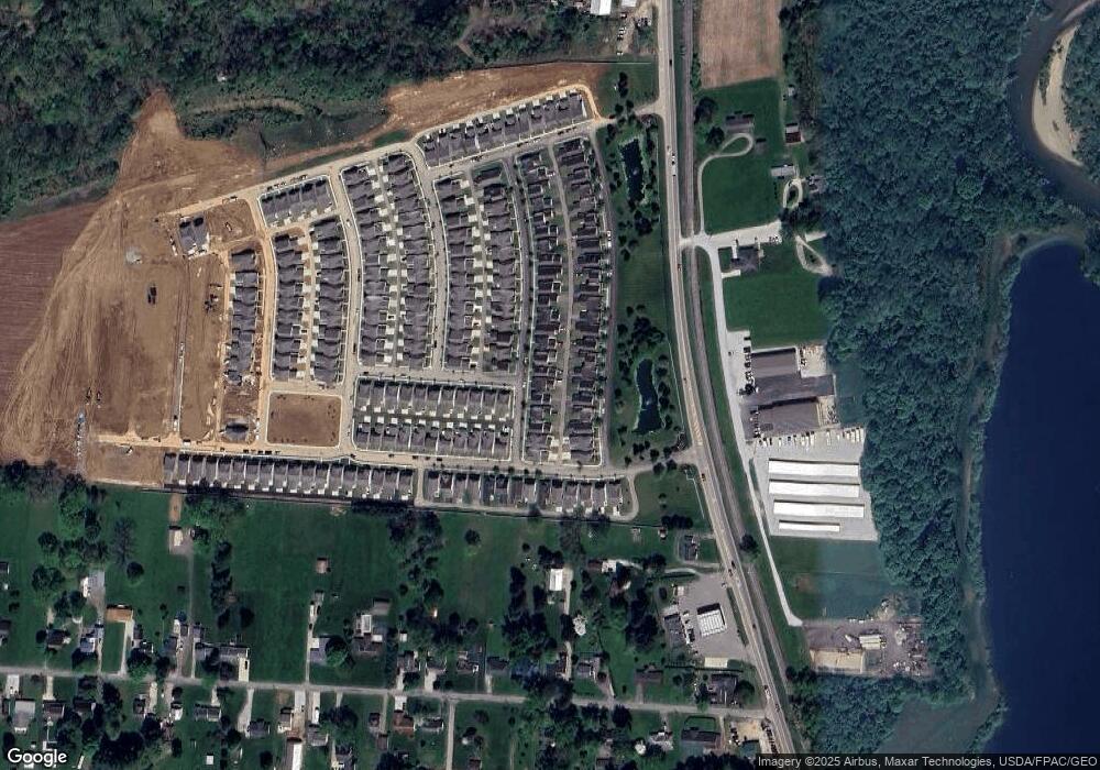
1974 Dumont St Unit 96 Newark, OH 43055
Estimated Value: $251,000 - $257,000
2
Beds
2
Baths
1,344
Sq Ft
$188/Sq Ft
Est. Value
About This Home
This home is located at 1974 Dumont St Unit 96, Newark, OH 43055 and is currently estimated at $252,969, approximately $188 per square foot. 1974 Dumont St Unit 96 is a home located in Licking County with nearby schools including Utica High School, St. Francis DeSales School, and Newark Catholic High School.
Ownership History
Date
Name
Owned For
Owner Type
Purchase Details
Closed on
May 5, 2021
Sold by
Estate Of Shirley L Davis
Bought by
Paniels Barbara S
Current Estimated Value
Purchase Details
Closed on
Jun 26, 2009
Sold by
National City Bank
Bought by
Davis Shirley L
Home Financials for this Owner
Home Financials are based on the most recent Mortgage that was taken out on this home.
Original Mortgage
$55,000
Interest Rate
5.32%
Mortgage Type
Purchase Money Mortgage
Purchase Details
Closed on
Aug 8, 2008
Sold by
Thomas Julie K
Bought by
National City Bank
Purchase Details
Closed on
May 27, 2005
Sold by
Dominion Homes Inc
Bought by
Thomas Julie K
Home Financials for this Owner
Home Financials are based on the most recent Mortgage that was taken out on this home.
Original Mortgage
$113,320
Interest Rate
6.12%
Mortgage Type
Fannie Mae Freddie Mac
Create a Home Valuation Report for This Property
The Home Valuation Report is an in-depth analysis detailing your home's value as well as a comparison with similar homes in the area
Home Values in the Area
Average Home Value in this Area
Purchase History
| Date | Buyer | Sale Price | Title Company |
|---|---|---|---|
| Paniels Barbara S | -- | None Available | |
| Davis Shirley L | $76,500 | Attorney | |
| National City Bank | $86,667 | None Available | |
| Thomas Julie K | $141,700 | Alliance Title |
Source: Public Records
Mortgage History
| Date | Status | Borrower | Loan Amount |
|---|---|---|---|
| Previous Owner | Davis Shirley L | $55,000 | |
| Previous Owner | Thomas Julie K | $113,320 | |
| Closed | Thomas Julie K | $28,330 |
Source: Public Records
Tax History Compared to Growth
Tax History
| Year | Tax Paid | Tax Assessment Tax Assessment Total Assessment is a certain percentage of the fair market value that is determined by local assessors to be the total taxable value of land and additions on the property. | Land | Improvement |
|---|---|---|---|---|
| 2024 | $2,002 | $66,820 | $11,900 | $54,920 |
| 2023 | $2,003 | $66,820 | $11,900 | $54,920 |
| 2022 | $1,465 | $44,940 | $10,500 | $34,440 |
| 2021 | $1,539 | $44,940 | $10,500 | $34,440 |
| 2020 | $1,539 | $44,940 | $10,500 | $34,440 |
| 2019 | $1,229 | $34,230 | $4,550 | $29,680 |
| 2018 | $1,237 | $0 | $0 | $0 |
| 2017 | $1,243 | $0 | $0 | $0 |
| 2016 | $1,233 | $0 | $0 | $0 |
| 2015 | $1,221 | $0 | $0 | $0 |
| 2014 | $1,652 | $0 | $0 | $0 |
| 2013 | $1,255 | $0 | $0 | $0 |
Source: Public Records
Map
Nearby Homes
- 1994 Dumont St Unit 91
- 73 Glenridge Dr
- 2034 Dumont St Unit 81
- 2026 Freehold St
- 1968 High Bridge St
- 1960 Jamesburg St
- 1981 Iselin St
- 1989 Iselin St
- 1993 Iselin St
- 1977 Iselin St
- 1973 Iselin St
- 1954 Iselin St
- Mt Vernon Rd Unit LotWP001
- 1821 Mount Vernon Rd
- 342 W Hunters Dr
- 32 N Utah Ave
- 412 Hunters Ct
- 437 Hunters Ct
- 152 Lincoln Dr
- 395 Quail Run Ct
- 1978 Dumont St Unit 95
- 1970 Dumont St
- 1970 Dumont St Unit 97
- 1982 Dumont St Unit 94
- 1966 Dumont St Unit 98
- 1986 Dumont St Unit 93
- 1973 Cumberland St Unit 107
- 63 Neptune Ave
- 1969 Dumont St
- 1969 Cumberland St Unit 106
- 1977 Cumberland St Unit 108
- 1965 Cumberland St Unit 105
- 1981 Cumberland St Unit 109
- 1990 Dumont St Unit 92
- 1953 Cumberland St
- 1958 Dumont St
- 1961 Cumberland St Unit 104
- 1985 Cumberland St Unit 110
- 1987 Dumont St
- 71 Neptune Ave
