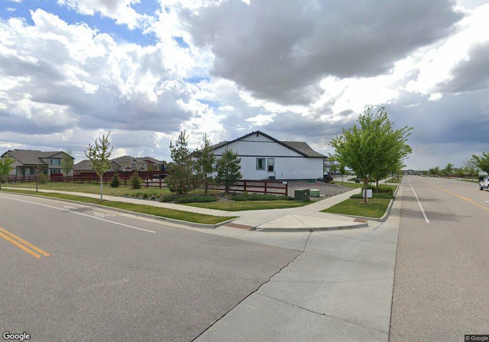
1975 Covered Bridge Pkwy Windsor, CO 80550
Estimated Value: $816,184 - $932,000
5
Beds
4
Baths
2,323
Sq Ft
$372/Sq Ft
Est. Value
About This Home
This home is located at 1975 Covered Bridge Pkwy, Windsor, CO 80550 and is currently estimated at $863,546, approximately $371 per square foot. 1975 Covered Bridge Pkwy is a home with nearby schools including Windsor Middle School, Windsor High School, and Resurrection Christian School.
Ownership History
Date
Name
Owned For
Owner Type
Purchase Details
Closed on
Mar 12, 2025
Sold by
Rogers Brent Allen and Rogers Rebecca Marie
Bought by
Rogers Brent Allen
Current Estimated Value
Purchase Details
Closed on
Apr 27, 2021
Sold by
Artesia Lot Holdings Llc
Bought by
Rogers Brent and Rogers Rebecca
Home Financials for this Owner
Home Financials are based on the most recent Mortgage that was taken out on this home.
Original Mortgage
$548,250
Interest Rate
3%
Mortgage Type
New Conventional
Create a Home Valuation Report for This Property
The Home Valuation Report is an in-depth analysis detailing your home's value as well as a comparison with similar homes in the area
Home Values in the Area
Average Home Value in this Area
Purchase History
| Date | Buyer | Sale Price | Title Company |
|---|---|---|---|
| Rogers Brent Allen | -- | None Listed On Document | |
| Rogers Brent | $708,548 | Land Title Guarantee Company |
Source: Public Records
Mortgage History
| Date | Status | Borrower | Loan Amount |
|---|---|---|---|
| Previous Owner | Rogers Brent | $548,250 |
Source: Public Records
Tax History Compared to Growth
Tax History
| Year | Tax Paid | Tax Assessment Tax Assessment Total Assessment is a certain percentage of the fair market value that is determined by local assessors to be the total taxable value of land and additions on the property. | Land | Improvement |
|---|---|---|---|---|
| 2025 | $6,529 | $48,630 | $6,250 | $42,380 |
| 2024 | $6,529 | $48,630 | $6,250 | $42,380 |
| 2023 | $6,317 | $50,330 | $7,100 | $43,230 |
| 2022 | $5,781 | $40,780 | $6,260 | $34,520 |
| 2021 | $1,655 | $12,660 | $6,440 | $6,220 |
| 2020 | $584 | $4,500 | $4,500 | $0 |
| 2019 | $308 | $2,380 | $2,380 | $0 |
| 2018 | $6 | $10 | $10 | $0 |
Source: Public Records
Map
Nearby Homes
- 1960 Thundercloud Dr
- 1954 Covered Bridge Pkwy
- 1932 Thundercloud Dr
- 1934 Covered Bridge Pkwy
- 1726 Bounty Dr
- 1961 Rose Petal Dr
- 1922 Covered Bridge Pkwy
- 2012 Day Spring Dr
- 1903 Rolling Wind Dr
- 1773 Nightfall Dr
- 1956 Blossom Grove Dr
- 1781 Summer Bloom Dr
- 1649 Winter Glow Dr
- 1637 Winter Glow Dr
- 1633 Winter Glow Dr
- 1678 Winter Glow Dr
- 2000 Seasons Dawn Ct
- 1996 Seasons Dawn Ct
- 1617 Winter Glow Dr
- 1675 Sundown Run Dr
- 1981 Covered Bridge Pkwy
- 1987 Covered Bridge Pkwy
- 1968 Thundercloud Dr
- 1972 Thundercloud Dr
- 1961 Covered Bridge Pkwy
- 1988 Covered Bridge Pkwy
- 1993 Covered Bridge Pkwy
- 1964 Thundercloud Dr
- 1976 Thundercloud Dr
- 1999 Covered Bridge Pkwy
- 1980 Thundercloud Dr
- 1996 Covered Bridge Pkwy
- 1957 Covered Bridge Pkwy
- 1968 Covered Bridge Pkwy
- 2000 Covered Bridge Pkwy
- 1984 Thundercloud Dr
- 1956 Thundercloud Dr
- 1956 Thunder Cloud Dr
- 2004 Covered Bridge Pkwy
- 1955 Thundercloud Dr