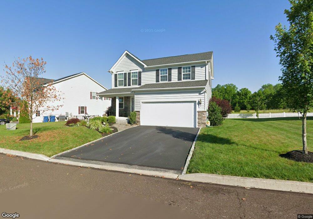
1975 Crossing Way Quakertown, PA 18951
Milford-Quakertown NeighborhoodEstimated Value: $533,000 - $600,000
3
Beds
4
Baths
1,800
Sq Ft
$312/Sq Ft
Est. Value
About This Home
This home is located at 1975 Crossing Way, Quakertown, PA 18951 and is currently estimated at $561,474, approximately $311 per square foot. 1975 Crossing Way is a home with nearby schools including Pfaff Elementary School, Quakertown Community Senior High School, and United Friends School.
Ownership History
Date
Name
Owned For
Owner Type
Purchase Details
Closed on
Sep 25, 2017
Sold by
Koltun Jonathan
Bought by
Sampson Mark
Current Estimated Value
Home Financials for this Owner
Home Financials are based on the most recent Mortgage that was taken out on this home.
Original Mortgage
$313,712
Outstanding Balance
$262,388
Interest Rate
3.87%
Mortgage Type
FHA
Estimated Equity
$299,086
Purchase Details
Closed on
Jul 8, 2015
Sold by
Nvr Inc
Bought by
Koltun Jonathan
Home Financials for this Owner
Home Financials are based on the most recent Mortgage that was taken out on this home.
Original Mortgage
$276,624
Interest Rate
4.01%
Mortgage Type
New Conventional
Purchase Details
Closed on
Apr 7, 2015
Sold by
Liberty Commercial Development Corporati
Bought by
Nvr Inc and Ryan Homes
Purchase Details
Closed on
May 18, 2011
Sold by
C & M Homes At Milford Llc
Bought by
Liberty Commercial Development Corp
Create a Home Valuation Report for This Property
The Home Valuation Report is an in-depth analysis detailing your home's value as well as a comparison with similar homes in the area
Home Values in the Area
Average Home Value in this Area
Purchase History
| Date | Buyer | Sale Price | Title Company |
|---|---|---|---|
| Sampson Mark | $319,500 | Mid Atlantic Regional Abstra | |
| Koltun Jonathan | $345,782 | Attorney | |
| Nvr Inc | $90,000 | None Available | |
| Liberty Commercial Development Corp | $4,140,000 | None Available |
Source: Public Records
Mortgage History
| Date | Status | Borrower | Loan Amount |
|---|---|---|---|
| Open | Sampson Mark | $313,712 | |
| Previous Owner | Koltun Jonathan | $276,624 |
Source: Public Records
Tax History Compared to Growth
Tax History
| Year | Tax Paid | Tax Assessment Tax Assessment Total Assessment is a certain percentage of the fair market value that is determined by local assessors to be the total taxable value of land and additions on the property. | Land | Improvement |
|---|---|---|---|---|
| 2025 | $6,854 | $33,990 | $5,330 | $28,660 |
| 2024 | $6,854 | $33,990 | $5,330 | $28,660 |
| 2023 | $6,786 | $33,990 | $5,330 | $28,660 |
| 2022 | $6,672 | $33,990 | $5,330 | $28,660 |
| 2021 | $6,672 | $33,990 | $5,330 | $28,660 |
| 2020 | $6,672 | $33,990 | $5,330 | $28,660 |
| 2019 | $6,487 | $33,990 | $5,330 | $28,660 |
| 2018 | $6,262 | $33,990 | $5,330 | $28,660 |
| 2017 | $6,068 | $33,990 | $5,330 | $28,660 |
| 2016 | $6,068 | $33,990 | $5,330 | $28,660 |
| 2015 | -- | $4,260 | $4,260 | $0 |
| 2014 | -- | $4,260 | $4,260 | $0 |
Source: Public Records
Map
Nearby Homes
- 1926 Alamingo Dr
- 1999 Crossing Way
- 2064 Allentown Rd
- 0 Krammes Rd Unit PABU2104522
- 444 Enclave Dr Unit COVINGTON
- 444 Enclave Dr Unit DEVONSHIRE
- 444 Enclave Dr Unit HAWTHORNE
- 444 Enclave Dr Unit SAVANNAH
- 444 Enclave Dr Unit SEBASTIAN
- 444 Enclave Dr Unit PARKER
- 1844 Enclave Dr
- 1832 Enclave Dr
- 2120 Brinkman Rd
- 1813 Sycamore Dr
- 1690 Kumry Rd
- 1715 Kumry Rd
- 1715 Weidner Ct
- 1706 Weidner Ct
- 2255 Spinnerstown Rd
- 2420 Bannerstone Dr
- 1975 Milford Square Pike
- 1979 Milford Square Pike
- 1979 Crossing Way
- 1971 Crossing Way
- 1971 Milford Square Pike
- 1983 Milford Square Pike
- 1983 Crossing Way
- 1948 Alamingo Dr
- 1713 Kitaning Ln
- 1987 Milford Square Pike
- 1987 Crossing Way
- 1709 Kitaning Ln
- 1607 Tamanend Dr
- 1717 Kitaning Ln
- 1983 Alamingo Dr
- 1611 Tamanend Dr
- 1953 Alamingo Dr
- 1971 Alamingo Dr
- 1940 Alamingo Dr
- 1949 Alamingo Dr