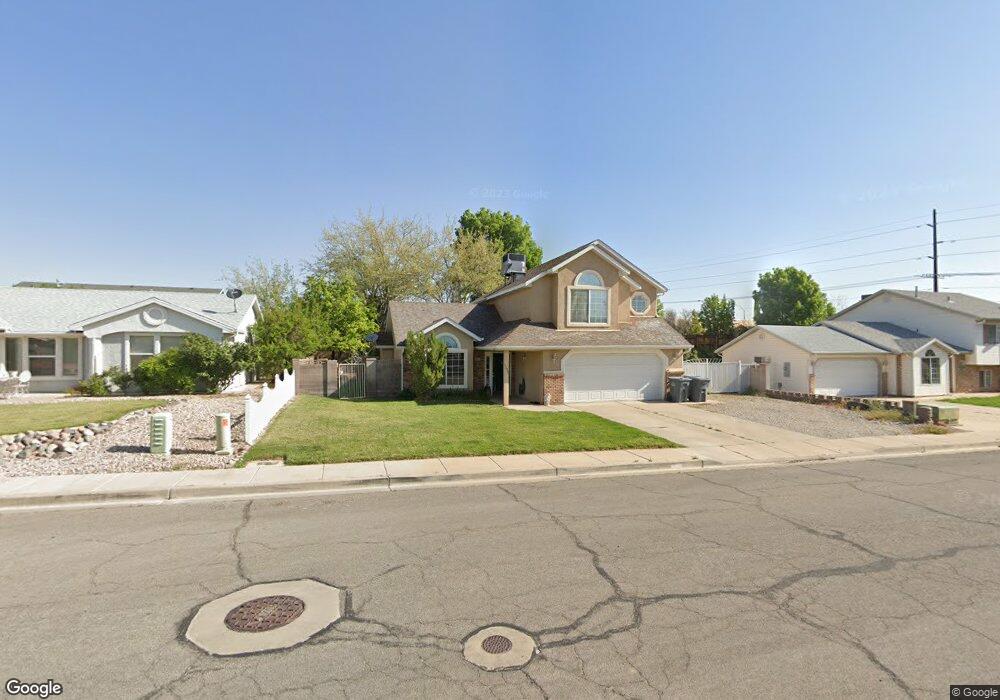
1975 E 10 Cir N St. George, UT 84790
Estimated Value: $408,000 - $497,000
4
Beds
3
Baths
1,630
Sq Ft
$273/Sq Ft
Est. Value
About This Home
This home is located at 1975 E 10 Cir N, St. George, UT 84790 and is currently estimated at $444,547, approximately $272 per square foot. 1975 E 10 Cir N is a home located in Washington County with nearby schools including Panorama School, Pine View Middle School, and Fossil Ridge Intermediate School.
Ownership History
Date
Name
Owned For
Owner Type
Purchase Details
Closed on
Jan 6, 2010
Sold by
Hsbc Mortgage Services Inc
Bought by
Mendez Carlos C and Mendez Teresa R
Current Estimated Value
Home Financials for this Owner
Home Financials are based on the most recent Mortgage that was taken out on this home.
Original Mortgage
$159,948
Outstanding Balance
$104,588
Interest Rate
4.87%
Mortgage Type
FHA
Estimated Equity
$339,959
Purchase Details
Closed on
Nov 5, 2009
Sold by
Willie Robert R and Willie Teresa W
Bought by
Hsbc Mortgage Services Inc
Create a Home Valuation Report for This Property
The Home Valuation Report is an in-depth analysis detailing your home's value as well as a comparison with similar homes in the area
Purchase History
| Date | Buyer | Sale Price | Title Company |
|---|---|---|---|
| Mendez Carlos C | -- | Backman Ntp | |
| Hsbc Mortgage Services Inc | -- | Inwest Title Services Salt L |
Source: Public Records
Mortgage History
| Date | Status | Borrower | Loan Amount |
|---|---|---|---|
| Open | Mendez Carlos C | $159,948 |
Source: Public Records
Tax History
| Year | Tax Paid | Tax Assessment Tax Assessment Total Assessment is a certain percentage of the fair market value that is determined by local assessors to be the total taxable value of land and additions on the property. | Land | Improvement |
|---|---|---|---|---|
| 2025 | $1,482 | $217,525 | $59,400 | $158,125 |
| 2023 | $1,524 | $227,645 | $52,800 | $174,845 |
| 2022 | $1,600 | $224,785 | $49,665 | $175,120 |
| 2021 | $1,420 | $297,600 | $76,000 | $221,600 |
| 2020 | $1,278 | $252,200 | $57,000 | $195,200 |
| 2019 | $1,269 | $244,600 | $57,000 | $187,600 |
| 2018 | $1,237 | $119,570 | $0 | $0 |
| 2017 | $1,031 | $99,660 | $0 | $0 |
| 2016 | $1,071 | $95,755 | $0 | $0 |
| 2015 | $1,035 | $88,715 | $0 | $0 |
| 2014 | $971 | $83,765 | $0 | $0 |
Source: Public Records
Map
Nearby Homes
- 77 S 2000 E
- 1932 E 40 South Cir
- 210 N Mall Dr Unit 115
- 210 N Mall Dr Unit 27
- 145 N Mall Dr Unit 57
- 4204 S Crimson Cir Unit 10
- 4186 S Crimson Cir Unit 13
- 201 S 2020 East Cir
- 24 S Arroyo Dr
- 86 S Acantilado Dr
- 232 S Acantilado Cir
- 2294 E 170 N
- 5664 S Carnelian Pkwy
- 1646 E 90 Cir S
- 345 N 2450 E Unit 130
- 345 N 2450 E Unit 220
- 345 N 2450 E Unit 117
- 345 N 2450 E Unit 234
- 345 N 2450 E Unit 152
- 345 N 2450 E Unit 152
- 1975 E 10 North Cir
- 1963 E 10 North Cir
- 1987 E 10 North Cir
- 1987 E 10 Cir N
- 1966 E 40 N
- 1978 E 40 N
- 1954 E 40 N
- 1970 Circle
- 1970 Circle Unit Lot 4
- 1949 E 10 Cir N
- 1949 E 10 North Cir
- 1982 E 10 North Cir
- 1982 E 10 Cir N
- 1960 E 10 Cir N
- 1960 E 10 North Cir
- 1992 E 40 N
- 1942 E 40 N
- 1990 E 10 Cir N
- 2087 E 10 Cir N
- 1990 E 10 North Cir
Your Personal Tour Guide
Ask me questions while you tour the home.