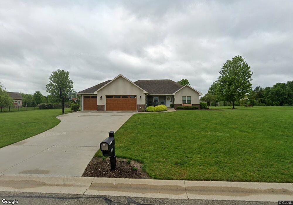
1975 Highland Ct Slinger, WI 53086
Estimated Value: $580,266 - $631,000
3
Beds
2
Baths
1,688
Sq Ft
$357/Sq Ft
Est. Value
About This Home
This home is located at 1975 Highland Ct, Slinger, WI 53086 and is currently estimated at $601,817, approximately $356 per square foot. 1975 Highland Ct is a home located in Washington County with nearby schools including Slinger High School and St Peter Elementary School.
Ownership History
Date
Name
Owned For
Owner Type
Purchase Details
Closed on
Jun 1, 2017
Sold by
Thompson Andrew
Bought by
Towner Joshua
Current Estimated Value
Purchase Details
Closed on
Mar 28, 2014
Sold by
Hendricks Neil A and Hendricks Jenny A
Bought by
Thompson Andrew and Thompson Elizabeth
Home Financials for this Owner
Home Financials are based on the most recent Mortgage that was taken out on this home.
Original Mortgage
$292,600
Interest Rate
4.29%
Mortgage Type
New Conventional
Purchase Details
Closed on
Dec 18, 2009
Sold by
Neuville Louis H
Bought by
Hendricks Neil A and Hendricks Jenny A
Home Financials for this Owner
Home Financials are based on the most recent Mortgage that was taken out on this home.
Original Mortgage
$212,000
Interest Rate
4.9%
Mortgage Type
New Conventional
Create a Home Valuation Report for This Property
The Home Valuation Report is an in-depth analysis detailing your home's value as well as a comparison with similar homes in the area
Home Values in the Area
Average Home Value in this Area
Purchase History
| Date | Buyer | Sale Price | Title Company |
|---|---|---|---|
| Towner Joshua | $328,000 | -- | |
| Thompson Andrew | $308,000 | Abstract & Title Co | |
| Hendricks Neil A | $265,000 | None Available |
Source: Public Records
Mortgage History
| Date | Status | Borrower | Loan Amount |
|---|---|---|---|
| Previous Owner | Thompson Andrew | $292,600 | |
| Previous Owner | Hendricks Neil A | $212,000 |
Source: Public Records
Tax History
| Year | Tax Paid | Tax Assessment Tax Assessment Total Assessment is a certain percentage of the fair market value that is determined by local assessors to be the total taxable value of land and additions on the property. | Land | Improvement |
|---|---|---|---|---|
| 2025 | $6,271 | $520,200 | $101,400 | $418,800 |
| 2024 | $5,897 | $520,200 | $101,400 | $418,800 |
| 2023 | $5,362 | $400,000 | $78,000 | $322,000 |
| 2022 | $5,490 | $400,000 | $78,000 | $322,000 |
| 2021 | $5,245 | $400,000 | $78,000 | $322,000 |
| 2020 | $5,206 | $348,700 | $72,500 | $276,200 |
| 2019 | $5,142 | $348,700 | $72,500 | $276,200 |
| 2018 | $5,096 | $348,700 | $72,500 | $276,200 |
| 2017 | $5,196 | $339,300 | $69,000 | $270,300 |
| 2016 | $4,952 | $292,600 | $69,000 | $223,600 |
| 2015 | $5,175 | $292,600 | $69,000 | $223,600 |
| 2014 | $5,175 | $292,600 | $69,000 | $223,600 |
| 2013 | $4,727 | $265,000 | $76,000 | $189,000 |
Source: Public Records
Map
Nearby Homes
- 1900 Hillside Rd
- 3140 Wisconsin 164
- Lt62 Boulder Dr
- Lt84 Boulder Dr
- Lt60 Boulder Dr
- Lt86 Boulder Dr
- Lt58 Boulder Dr
- Lt92 Boulder Dr
- Lt77 Boulder Dr
- Lt90 Boulder Dr
- Lt88 Boulder Dr
- Lt74 Boulder Dr
- 2456 Boulder Dr
- 2474 Boulder Dr
- 2470 Boulder Dr
- 469 Limestone Ln
- 2491 Boulder Dr
- 2497 Boulder Dr
- 457 Limestone Ln
- 2484 Boulder Dr
- 2000 Highland Ct
- 1950 Highland Ct
- 2025 Highland Ct
- 2025 Highland Ct Unit 2025
- 1925 Highland Ct
- 2020 Highland Ct
- 1900 Highland Ct
- 2050 Highland Ct
- 1875 Highland Ct
- 1950 Hillside Rd
- 1870 Highland Ct
- 2115 Grandview Dr
- 2005 Grandview Dr
- 2095 Grandview Dr
- 2100 Grandview Dr
- 3206 Hillside Rd
- 2125 Grandview Dr
- 1955 Ravine Ct
- 1950 Ravine Ct
- 2085 Grandview Dr
Your Personal Tour Guide
Ask me questions while you tour the home.