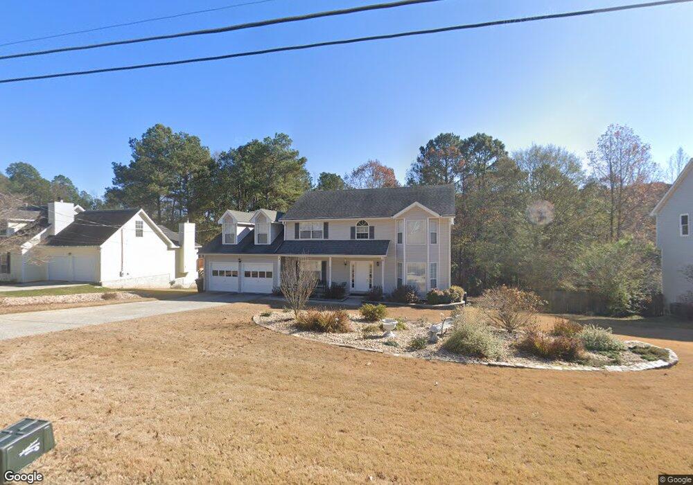
1975 Rocksram Dr Buford, GA 30519
Estimated Value: $415,000 - $434,504
3
Beds
3
Baths
2,619
Sq Ft
$162/Sq Ft
Est. Value
About This Home
This home is located at 1975 Rocksram Dr, Buford, GA 30519 and is currently estimated at $424,876, approximately $162 per square foot. 1975 Rocksram Dr is a home located in Gwinnett County with nearby schools including Woodward Mill Elementary School, Twin Rivers Middle School, and Mountain View High School.
Ownership History
Date
Name
Owned For
Owner Type
Purchase Details
Closed on
Apr 28, 1997
Sold by
Erin Redding P
Bought by
Dale Norman L and Dale Jeannie S
Current Estimated Value
Home Financials for this Owner
Home Financials are based on the most recent Mortgage that was taken out on this home.
Original Mortgage
$138,200
Outstanding Balance
$18,928
Interest Rate
8%
Mortgage Type
New Conventional
Estimated Equity
$405,948
Purchase Details
Closed on
Oct 20, 1994
Sold by
Cloutier William Barker
Bought by
Christiansen P Erin
Home Financials for this Owner
Home Financials are based on the most recent Mortgage that was taken out on this home.
Original Mortgage
$115,200
Interest Rate
8.68%
Create a Home Valuation Report for This Property
The Home Valuation Report is an in-depth analysis detailing your home's value as well as a comparison with similar homes in the area
Home Values in the Area
Average Home Value in this Area
Purchase History
| Date | Buyer | Sale Price | Title Company |
|---|---|---|---|
| Dale Norman L | $135,500 | -- | |
| Christiansen P Erin | $128,000 | -- |
Source: Public Records
Mortgage History
| Date | Status | Borrower | Loan Amount |
|---|---|---|---|
| Open | Dale Norman L | $138,200 | |
| Previous Owner | Christiansen P Erin | $115,200 |
Source: Public Records
Tax History Compared to Growth
Tax History
| Year | Tax Paid | Tax Assessment Tax Assessment Total Assessment is a certain percentage of the fair market value that is determined by local assessors to be the total taxable value of land and additions on the property. | Land | Improvement |
|---|---|---|---|---|
| 2024 | $990 | $181,000 | $28,000 | $153,000 |
| 2023 | $990 | $180,760 | $28,000 | $152,760 |
| 2022 | $948 | $126,280 | $16,000 | $110,280 |
| 2021 | $3,243 | $111,800 | $16,000 | $95,800 |
| 2020 | $3,269 | $111,800 | $16,000 | $95,800 |
| 2019 | $3,067 | $105,480 | $16,000 | $89,480 |
| 2018 | $3,002 | $99,960 | $16,000 | $83,960 |
| 2016 | $2,591 | $80,040 | $12,400 | $67,640 |
| 2015 | $2,364 | $68,840 | $8,400 | $60,440 |
| 2014 | $2,374 | $68,840 | $8,400 | $60,440 |
Source: Public Records
Map
Nearby Homes
- 2317 Rocksram Ct
- 2237 Rocksram Ct
- 2292 Rocksram Ct Unit 3
- 2375 Rock Springs Rd
- 2250 Charleston Oak Cir
- 2199 Sunny Hill Rd
- 2159 Sunny Hill Rd
- 2004 Brittlebank Ln
- 2115 Sun Valley Ct
- 1570 Jami Hollow Way
- 1755 Stoney Creek Cir
- 1876 Hanover West Dr
- 2415 Mitchell Rd
- 2066 Holland Creek Ct
- 2350 Walnut Tree Ct Unit 1
- 2365 Valley Mill Dr Unit 1
- 2012 Arbor Springs Way
- 1985 Rocksram Dr
- 1965 Rocksram Dr
- 1995 Rocksram Dr
- 1955 Rocksram Dr
- 1970 Rocksram Dr
- 1980 Rocksram Dr
- 1960 Rocksram Dr
- 1990 Rocksram Dr Unit GA1224
- 1990 Rocksram Dr
- 1990 Rocksram Dr Unit GA12243
- 2005 Rocksram Dr Unit 2
- 2005 Rocksram Dr
- 2005 Rocksram Dr Unit 2005
- 1945 Rocksram Dr Unit 1
- 1950 Rocksram Dr Unit 2
- 1940 Rocksram Dr Unit 1
- 2015 Rocksram Dr
- 1935 Rocksram Dr
- 2000 Rocksram Dr
- 2010 Rocksram Dr