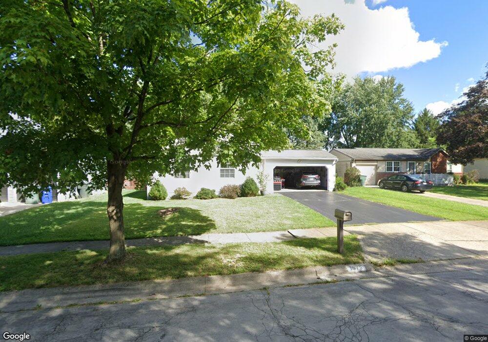
1975 Wolverhampton Rd Powell, OH 43065
Smoky Ridge Estates NeighborhoodEstimated Value: $333,000 - $365,000
3
Beds
3
Baths
1,568
Sq Ft
$222/Sq Ft
Est. Value
About This Home
This home is located at 1975 Wolverhampton Rd, Powell, OH 43065 and is currently estimated at $347,637, approximately $221 per square foot. 1975 Wolverhampton Rd is a home located in Franklin County with nearby schools including Liberty Elementary School, McCord Middle School, and Worthington Kilbourne High School.
Ownership History
Date
Name
Owned For
Owner Type
Purchase Details
Closed on
Apr 12, 2024
Sold by
Gruss Gary A
Bought by
Borchers Douglas George
Current Estimated Value
Home Financials for this Owner
Home Financials are based on the most recent Mortgage that was taken out on this home.
Original Mortgage
$294,566
Outstanding Balance
$290,156
Interest Rate
6.87%
Mortgage Type
FHA
Estimated Equity
$57,481
Purchase Details
Closed on
Aug 4, 2005
Sold by
Stevens Lori L and Stevens Daniel R
Bought by
Gruss Gary A
Home Financials for this Owner
Home Financials are based on the most recent Mortgage that was taken out on this home.
Original Mortgage
$135,920
Interest Rate
5.5%
Mortgage Type
Fannie Mae Freddie Mac
Purchase Details
Closed on
Sep 1, 1993
Purchase Details
Closed on
Jun 5, 1990
Create a Home Valuation Report for This Property
The Home Valuation Report is an in-depth analysis detailing your home's value as well as a comparison with similar homes in the area
Home Values in the Area
Average Home Value in this Area
Purchase History
| Date | Buyer | Sale Price | Title Company |
|---|---|---|---|
| Borchers Douglas George | $300,000 | Crown Search Box | |
| Gruss Gary A | $169,900 | Valmer Land | |
| -- | $97,000 | -- | |
| -- | $86,000 | -- |
Source: Public Records
Mortgage History
| Date | Status | Borrower | Loan Amount |
|---|---|---|---|
| Open | Borchers Douglas George | $294,566 | |
| Previous Owner | Gruss Gary A | $135,920 |
Source: Public Records
Tax History
| Year | Tax Paid | Tax Assessment Tax Assessment Total Assessment is a certain percentage of the fair market value that is determined by local assessors to be the total taxable value of land and additions on the property. | Land | Improvement |
|---|---|---|---|---|
| 2025 | $6,045 | $98,460 | $32,660 | $65,800 |
| 2024 | $6,045 | $98,460 | $32,660 | $65,800 |
| 2023 | $5,781 | $98,460 | $32,660 | $65,800 |
| 2022 | $4,525 | $61,150 | $17,360 | $43,790 |
| 2021 | $4,174 | $61,150 | $17,360 | $43,790 |
| 2020 | $4,021 | $61,150 | $17,360 | $43,790 |
| 2019 | $3,655 | $50,160 | $14,460 | $35,700 |
| 2018 | $3,557 | $50,160 | $14,460 | $35,700 |
| 2017 | $3,275 | $50,160 | $14,460 | $35,700 |
| 2016 | $3,573 | $50,330 | $13,720 | $36,610 |
| 2015 | $3,574 | $50,330 | $13,720 | $36,610 |
| 2014 | $3,573 | $50,330 | $13,720 | $36,610 |
| 2013 | $1,777 | $50,330 | $13,720 | $36,610 |
Source: Public Records
Map
Nearby Homes
- 3326 Brentwood Ct
- 2000 Dina Ct
- 1751 Darrow Dr
- 8207 Copperfield Dr
- 2300 Cove Point Ct
- 8245 Markhaven Ct
- 8377 Waco Ln
- 1810 Calico Ct
- 1502 Markland St
- 1967 Woodlands Place
- 8213 Longhorn Rd
- 1908 Lost Valley Rd
- 2514 Tevis Ann Ct
- 8205 Longhorn Rd
- 1448 Clubview Blvd N
- 1539 Clubview Blvd S
- 471 Commons Dr Unit 471
- 450 Shale Ridge Ct
- 7685 Starmont Ct
- 1729 Laredo Ct
- 1971 Wolverhampton Rd
- 1979 Wolverhampton Rd
- 8841 Knighton Ct
- 1967 Wolverhampton Rd
- 8833 Knighton Ct
- 8849 Knighton Ct
- 1983 Wolverhampton Rd
- 1992 Wolverhampton Rd
- 8857 Knighton Ct
- 1991 Edmunds Ct
- 1987 Wolverhampton Rd
- 8825 Knighton Ct
- 2000 Wolverhampton Rd
- 1991 Wolverhampton Rd
- 1999 Edmunds Ct
- 1999 Wolverhampton Rd
- 1966 Wolverhampton Rd
- 1972 Wolverhampton Rd
- 2008 Wolverhampton Rd
- 1960 Wolverhampton Rd
Your Personal Tour Guide
Ask me questions while you tour the home.