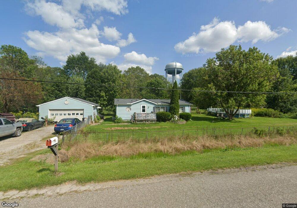
1976 Maple Rd Kimball, MI 48074
Estimated Value: $162,000 - $210,000
3
Beds
2
Baths
1,148
Sq Ft
$162/Sq Ft
Est. Value
About This Home
This home is located at 1976 Maple Rd, Kimball, MI 48074 and is currently estimated at $185,505, approximately $161 per square foot. 1976 Maple Rd is a home located in St. Clair County with nearby schools including Kimball Elementary School, Central Middle School, and Port Huron High School.
Ownership History
Date
Name
Owned For
Owner Type
Purchase Details
Closed on
Feb 4, 2005
Sold by
Harrison Brian J
Bought by
Harrison Kristen A
Current Estimated Value
Create a Home Valuation Report for This Property
The Home Valuation Report is an in-depth analysis detailing your home's value as well as a comparison with similar homes in the area
Home Values in the Area
Average Home Value in this Area
Purchase History
| Date | Buyer | Sale Price | Title Company |
|---|---|---|---|
| Harrison Kristen A | -- | None Available |
Source: Public Records
Tax History Compared to Growth
Tax History
| Year | Tax Paid | Tax Assessment Tax Assessment Total Assessment is a certain percentage of the fair market value that is determined by local assessors to be the total taxable value of land and additions on the property. | Land | Improvement |
|---|---|---|---|---|
| 2025 | $1,629 | $88,900 | $0 | $0 |
| 2024 | $901 | $82,700 | $0 | $0 |
| 2023 | $826 | $80,000 | $0 | $0 |
| 2022 | $1,485 | $67,200 | $0 | $0 |
| 2021 | $1,353 | $63,900 | $0 | $0 |
| 2020 | $1,353 | $63,300 | $63,300 | $0 |
| 2019 | $1,316 | $53,000 | $0 | $0 |
| 2018 | $1,522 | $56,700 | $0 | $0 |
| 2017 | $1,356 | $55,800 | $0 | $0 |
| 2016 | $684 | $55,800 | $0 | $0 |
| 2015 | -- | $54,200 | $54,200 | $0 |
| 2014 | -- | $48,100 | $48,100 | $0 |
| 2013 | -- | $61,200 | $0 | $0 |
Source: Public Records
Map
Nearby Homes
- 1979 Allen Rd
- V/L Allen
- 1701 Allen Rd
- 1830 Leland Rd
- 1604 Allen Rd
- 5510 Griswold Rd
- 0 Allen Rd Unit 20250008597
- 0 Allen Rd Unit 20250008612
- 00 Howard Rd
- 4632 Cloverdale Ln
- 1876 Morningstar Ave
- 4595 Griswold Rd
- 0 Wadhams Rd Unit 50155021
- 0000 Range Rd
- 2007 Edward Ln E
- 2022 Edward Ln W
- 2047 Edward Ln E
- 1405 Range Rd
- 2019 Edward Ln E
- 00 Range Rd
- 1980 Maple Rd
- 5125 Griswold Rd
- 5155 Griswold Rd
- 1934 Maple Rd
- 5135 Griswold Rd
- 5145 Griswold Rd
- 5159 Griswold Rd
- 5165 Griswold Rd
- 1939 Maple Rd
- 1928 Maple Rd
- 1933 Maple Rd
- 5117 Griswold Rd
- 5115 Griswold Rd
- 5173 Griswold Rd
- 1931 Maple Rd
- 5177 Griswold Rd
- 5105 Griswold Rd
- 5183 Griswold Rd
- 00 Vac Carman
- 1914 Maple Rd