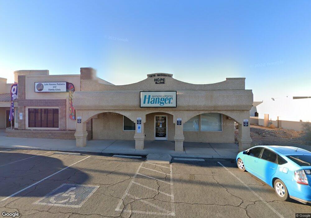
1976 Mesquite Ave Lake Havasu City, AZ 86403
Estimated Value: $1,013,240
--
Bed
--
Bath
2,968
Sq Ft
$341/Sq Ft
Est. Value
About This Home
This home is located at 1976 Mesquite Ave, Lake Havasu City, AZ 86403 and is currently estimated at $1,013,240, approximately $341 per square foot. 1976 Mesquite Ave is a home located in Mohave County with nearby schools including Smoketree Elementary School, Thunderbolt Middle School, and Lake Havasu High School.
Ownership History
Date
Name
Owned For
Owner Type
Purchase Details
Closed on
Dec 11, 2014
Sold by
Chrzanowski Ronald and Chrzanowski Betty
Bought by
Chrzanowski Family Trust
Current Estimated Value
Purchase Details
Closed on
Dec 1, 2014
Sold by
Mcgill Consultants Inc
Bought by
Chrzanowski Ronald and Chrzanowski Betty
Purchase Details
Closed on
Sep 27, 2012
Sold by
Mcgill Consultants Inc
Bought by
Mcgill Consultants Inc
Purchase Details
Closed on
May 29, 2009
Sold by
Mcgill John Garth
Bought by
Mcgill Consultants Inc
Create a Home Valuation Report for This Property
The Home Valuation Report is an in-depth analysis detailing your home's value as well as a comparison with similar homes in the area
Home Values in the Area
Average Home Value in this Area
Purchase History
| Date | Buyer | Sale Price | Title Company |
|---|---|---|---|
| Chrzanowski Family Trust | -- | None Available | |
| Chrzanowski Ronald | $460,000 | Stewart Title & Trust Of Pho | |
| Mcgill Consultants Inc | -- | Pioneer Title Agency Inc | |
| Mcgill Consultants Inc | -- | None Available |
Source: Public Records
Tax History Compared to Growth
Tax History
| Year | Tax Paid | Tax Assessment Tax Assessment Total Assessment is a certain percentage of the fair market value that is determined by local assessors to be the total taxable value of land and additions on the property. | Land | Improvement |
|---|---|---|---|---|
| 2026 | -- | -- | -- | -- |
| 2025 | $4,225 | $76,726 | $0 | $0 |
| 2024 | $4,225 | $68,540 | $0 | $0 |
| 2023 | $4,225 | $48,710 | $0 | $0 |
| 2022 | $4,411 | $45,500 | $0 | $0 |
| 2021 | $4,756 | $44,304 | $0 | $0 |
| 2019 | $4,497 | $48,919 | $0 | $0 |
| 2018 | $4,335 | $55,006 | $0 | $0 |
| 2017 | $4,299 | $49,903 | $0 | $0 |
| 2016 | $3,949 | $40,200 | $0 | $0 |
| 2015 | $3,866 | $36,982 | $0 | $0 |
Source: Public Records
Map
Nearby Homes
- 1989 Mesquite Ave Unit 74
- 1989 Mesquite Ave Unit 32
- 1989 Mesquite Ave Unit 17
- 1989 Mesquite Ave Unit 46
- 1989 Mesquite Ave Unit 2
- 1989 Mesquite Ave Unit 29
- 1957 Mesquite Ave Unit 23B
- 1957 Mesquite Ave Unit 46A
- 2094 Mesquite Ave Unit 113
- 2094 Mesquite Ave Unit 126
- 1926 Swanson Ave
- 2085 Mesquite Ave Unit 64
- 2085 Mesquite Ave Unit 61
- 1910 Swanson Ave Unit A22
- 1910 Swanson Ave Unit B11
- 1910 Swanson Ave Unit B19
- 2095 Mesquite Ave Unit 19
- 0000 Sunrise Plan On Your Lot
- 2030 Mimosa Dr
- 72 Mariposa Dr Unit D
- 1980 Mesquite Ave Unit 102-103
- 1980 Mesquite Ave
- 1972 Mesquite Ave
- 1987 Mcculloch Blvd N Unit 202
- 1987 Mcculloch Blvd N
- 1987 Mcculloch Blvd N Unit 101
- 1987 Mcculloch Blvd N Unit 1,2,3,4
- 1987 Mcculloch Blvd N Unit 108
- 1968 Mesquite Ave
- 0000 Jays Way
- 1971 Mcculloch Blvd N Unit 200
- 1971 Mcculloch Blvd N Unit 102
- 1971 Mcculloch Blvd N
- 1979 Mcculloch Blvd N Unit 101/102
- 1979 Mcculloch Blvd N Unit 105/106
- 1979 Mcculloch Blvd N Unit 106
- 1979 Mcculloch Blvd N
- 1979 Mcculloch Blvd N Unit 104
- 1979 Mcculloch Blvd N Unit 102
- 1979 Mcculloch Blvd N Unit 203