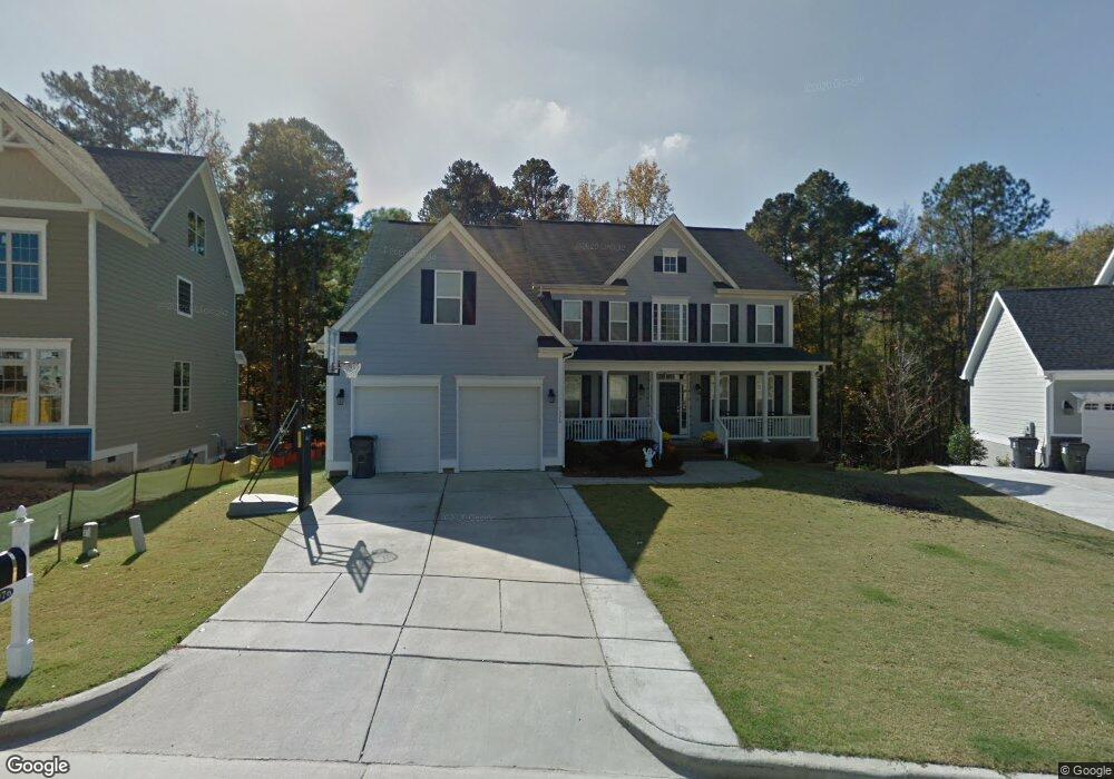
1976 Old Byre Way Apex, NC 27502
Friendship NeighborhoodEstimated Value: $948,000 - $1,105,000
--
Bed
4
Baths
3,854
Sq Ft
$261/Sq Ft
Est. Value
About This Home
This home is located at 1976 Old Byre Way, Apex, NC 27502 and is currently estimated at $1,007,477, approximately $261 per square foot. 1976 Old Byre Way is a home located in Wake County with nearby schools including Scotts Ridge Elementary School, Apex Friendship Middle School, and Apex Friendship High School.
Ownership History
Date
Name
Owned For
Owner Type
Purchase Details
Closed on
Jul 23, 2008
Sold by
Comstock Holland Road Llc
Bought by
Hepburn David M and Hepburn Kari L
Current Estimated Value
Home Financials for this Owner
Home Financials are based on the most recent Mortgage that was taken out on this home.
Original Mortgage
$373,075
Outstanding Balance
$243,110
Interest Rate
6.27%
Mortgage Type
Purchase Money Mortgage
Estimated Equity
$764,367
Create a Home Valuation Report for This Property
The Home Valuation Report is an in-depth analysis detailing your home's value as well as a comparison with similar homes in the area
Home Values in the Area
Average Home Value in this Area
Purchase History
| Date | Buyer | Sale Price | Title Company |
|---|---|---|---|
| Hepburn David M | $474,000 | None Available |
Source: Public Records
Mortgage History
| Date | Status | Borrower | Loan Amount |
|---|---|---|---|
| Open | Hepburn David M | $373,075 |
Source: Public Records
Tax History Compared to Growth
Tax History
| Year | Tax Paid | Tax Assessment Tax Assessment Total Assessment is a certain percentage of the fair market value that is determined by local assessors to be the total taxable value of land and additions on the property. | Land | Improvement |
|---|---|---|---|---|
| 2025 | $7,897 | $902,198 | $170,000 | $732,198 |
| 2024 | $7,720 | $902,198 | $170,000 | $732,198 |
| 2023 | $5,847 | $531,161 | $105,000 | $426,161 |
| 2022 | $5,488 | $531,161 | $105,000 | $426,161 |
| 2021 | $5,279 | $531,161 | $105,000 | $426,161 |
| 2020 | $5,225 | $531,161 | $105,000 | $426,161 |
| 2019 | $5,693 | $499,510 | $105,000 | $394,510 |
| 2018 | $5,362 | $499,510 | $105,000 | $394,510 |
| 2017 | $4,990 | $499,510 | $105,000 | $394,510 |
| 2016 | $4,918 | $499,510 | $105,000 | $394,510 |
| 2015 | $5,148 | $510,491 | $78,000 | $432,491 |
| 2014 | $4,866 | $500,613 | $78,000 | $422,613 |
Source: Public Records
Map
Nearby Homes
- 1952 Combine Cir
- 2805 Evans Rd
- 7104 Camp Branch Ln
- 1897 Lazio Ln
- 2048 Lazio Ln
- 1956 Lazio Ln
- 1126 Woodlands Creek Way
- 1124 Woodlands Creek Way
- 2908 Evans Rd
- 2170 Vittorio Ln
- 2428 Vetrina Way
- 2429 Vetrina Way
- 2437 Vetrina Way
- 2495 Vetrina Way
- 2499 Vetrina Way
- 2505 Vetrina Way
- 2511 Vetrina Way
- 2508 Whistling Quail Run
- 2108 Jerimouth Dr
- 2006 Driskill Ct
- 1980 Old Byre Way
- 1972 Old Byre Way
- 1984 Old Byre Way
- 1968 Old Byre Way
- 1977 Old Byre Way
- 1969 Old Byre Way
- 1983 Old Byre Way
- 1988 Old Byre Way
- 1963 Old Byre Way
- 1987 Old Byre Way
- 1956 Combine Cir
- 1992 Old Byre Way
- 1960 Combine Cir
- 1960 Old Byre Way
- 1959 Old Byre Way
- 1991 Old Byre Way
- 1964 Combine Cir
- 1996 Old Byre Way
- 2404 Castello Ct Unit 161
- 2404 Castello Ct