--
Bed
--
Bath
--
Sq Ft
6.33
Acres
About This Home
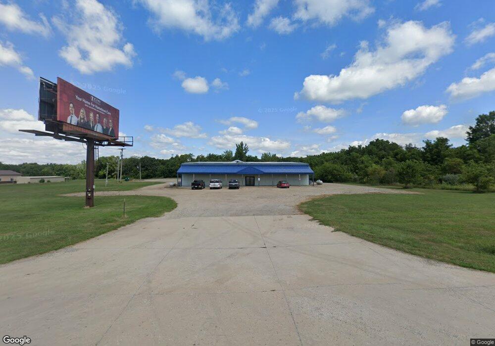
This home is located at 19764 Illinois Route 9, Pekin, IL 61554. 19764 Illinois Route 9 is a home located in Tazewell County with nearby schools including Tremont Elementary School, Tremont Middle School, and Tremont High School.
Ownership History
Date
Name
Owned For
Owner Type
Purchase Details
Closed on
Jan 16, 2019
Sold by
Draear Douglas L and Draear Cheryl
Bought by
Route 9 Building Llc
Purchase Details
Closed on
Sep 4, 2015
Sold by
Busey Bank
Bought by
Draear Douglas L and Draear Cheryl A
Purchase Details
Closed on
Nov 14, 2011
Sold by
Glassey Brent
Bought by
Tibbs Steven W and Tibbs Connie L
Home Financials for this Owner
Home Financials are based on the most recent Mortgage that was taken out on this home.
Original Mortgage
$315,000
Interest Rate
4.02%
Mortgage Type
Commercial
Create a Home Valuation Report for This Property
The Home Valuation Report is an in-depth analysis detailing your home's value as well as a comparison with similar homes in the area
Home Values in the Area
Average Home Value in this Area
Purchase History
| Date | Buyer | Sale Price | Title Company |
|---|---|---|---|
| Route 9 Building Llc | -- | None Available | |
| Draear Douglas L | $126,000 | -- | |
| Tibbs Steven W | $415,000 | None Available |
Source: Public Records
Mortgage History
| Date | Status | Borrower | Loan Amount |
|---|---|---|---|
| Previous Owner | Tibbs Steven W | $315,000 |
Source: Public Records
Tax History Compared to Growth
Tax History
| Year | Tax Paid | Tax Assessment Tax Assessment Total Assessment is a certain percentage of the fair market value that is determined by local assessors to be the total taxable value of land and additions on the property. | Land | Improvement |
|---|---|---|---|---|
| 2024 | $3,271 | $50,570 | $30,620 | $19,950 |
| 2023 | $3,271 | $46,430 | $28,110 | $18,320 |
| 2022 | $3,178 | $43,230 | $26,170 | $17,060 |
| 2021 | $3,090 | $41,560 | $25,160 | $16,400 |
| 2020 | $3,056 | $40,750 | $24,670 | $16,080 |
| 2019 | $3,058 | $40,750 | $24,670 | $16,080 |
| 2018 | $3,005 | $40,750 | $24,670 | $16,080 |
| 2017 | $2,954 | $40,350 | $24,430 | $15,920 |
| 2016 | $3,296 | $45,630 | $24,430 | $21,200 |
| 2015 | $3,213 | $0 | $0 | $0 |
| 2013 | $4,905 | $69,920 | $24,190 | $45,730 |
Source: Public Records
Map
Nearby Homes
- 116 Lost Creek Ct
- 107 Lost Creek Ct
- 105 Royal Point Ct
- 1920-1922 Mayflower Dr
- 1960-1962 Mayflower Dr
- 16810 Springfield Rd
- 3858 Sunset Dr
- 5559 Broadway Rd
- 5859 Broadway Rd
- 13694 Egg Ranch Rd
- 227 Indian Creek Dr
- 17902 Red Shale Hill Rd
- 313 W South St
- 316 N Locust St
- 9 Cypress Point
- 305 Conaghan Dr
- 3747 Grandview Ct
- 1922 Highwood Ave
- Lot 37 Grandview Ct
- Lot 2 Grandview Ct
- 19764 Il Route 9
- 20022 State Route 9
- 19720 State Route 9
- 19720 State Route 9
- 20100 State Route 9
- 19555 Illinois 9
- 19572 State Route 9
- 19555 State Route 9
- 19568 State Route 9
- 20176 State Route 9
- 19551 State Route 9
- 19871 State Route 9
- 126 Lost Creek Ct
- 122 Lost Creek Ct
- 127 Lost Creek Ct
- 123 Lost Creek Ct
- 112 Lost Creek Ct
- 20231 State Route 9
- 108 Lost Creek Ct
- 119 Lost Creek Ct