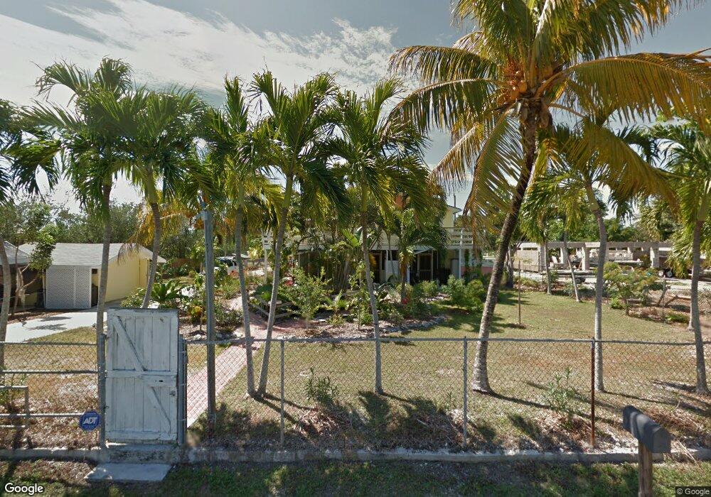
19769 Date Palm Dr Summerland Key, FL 33042
Estimated Value: $764,000 - $806,000
3
Beds
2
Baths
1,588
Sq Ft
$498/Sq Ft
Est. Value
About This Home
This home is located at 19769 Date Palm Dr, Summerland Key, FL 33042 and is currently estimated at $791,398, approximately $498 per square foot. 19769 Date Palm Dr is a home located in Monroe County with nearby schools including Sugarloaf School and Key West High School.
Ownership History
Date
Name
Owned For
Owner Type
Purchase Details
Closed on
Aug 27, 2008
Sold by
Deutsche Bank Trust Co Americas
Bought by
Hodies Perry and Hodies Sherri
Current Estimated Value
Home Financials for this Owner
Home Financials are based on the most recent Mortgage that was taken out on this home.
Original Mortgage
$280,000
Outstanding Balance
$185,882
Interest Rate
6.48%
Mortgage Type
Purchase Money Mortgage
Estimated Equity
$605,516
Purchase Details
Closed on
Aug 26, 2008
Sold by
National City Mortgage Co
Bought by
Deutsche Bank Trust Co Americas
Home Financials for this Owner
Home Financials are based on the most recent Mortgage that was taken out on this home.
Original Mortgage
$280,000
Outstanding Balance
$185,882
Interest Rate
6.48%
Mortgage Type
Purchase Money Mortgage
Estimated Equity
$605,516
Purchase Details
Closed on
Feb 15, 2008
Sold by
Parente Lesley and Parente Peter
Bought by
National City Mortgage Co
Purchase Details
Closed on
Feb 5, 2008
Sold by
Parente Lesley and Parente Peter
Bought by
National City Mortgage Co
Purchase Details
Closed on
Aug 29, 2003
Sold by
Dunn Thomas P and Dunn Sharon F
Bought by
Parente Lesley A
Home Financials for this Owner
Home Financials are based on the most recent Mortgage that was taken out on this home.
Original Mortgage
$358,200
Interest Rate
6.33%
Mortgage Type
Purchase Money Mortgage
Purchase Details
Closed on
Jul 27, 1995
Sold by
Jones Todd W and Jones Nora D
Bought by
Dunn Thomas P and Dunn Sharon F
Home Financials for this Owner
Home Financials are based on the most recent Mortgage that was taken out on this home.
Original Mortgage
$135,000
Interest Rate
7.46%
Purchase Details
Closed on
Jul 1, 1995
Bought by
Hodies Perry and Hodies Sherri
Home Financials for this Owner
Home Financials are based on the most recent Mortgage that was taken out on this home.
Original Mortgage
$135,000
Interest Rate
7.46%
Purchase Details
Closed on
Jul 8, 1994
Sold by
Lewis James E and Lewis Carol A
Bought by
Jones Todd W and Jones Nora D
Purchase Details
Closed on
Sep 7, 1993
Sold by
Earnest Averil A and Herrick Averil A
Bought by
Lewis James E and Lewis Carol A
Purchase Details
Closed on
Aug 1, 1993
Bought by
Hodies Perry and Hodies Sherri
Create a Home Valuation Report for This Property
The Home Valuation Report is an in-depth analysis detailing your home's value as well as a comparison with similar homes in the area
Home Values in the Area
Average Home Value in this Area
Purchase History
| Date | Buyer | Sale Price | Title Company |
|---|---|---|---|
| Hodies Perry | $350,000 | New House Title Llc | |
| Deutsche Bank Trust Co Americas | -- | New House Title Llc | |
| National City Mortgage Co | -- | Attorney | |
| National City Mortgage Co | -- | None Available | |
| Parente Lesley A | $398,000 | True Title Agency Inc | |
| Dunn Thomas P | $169,000 | -- | |
| Hodies Perry | $169,000 | -- | |
| Jones Todd W | -- | -- | |
| Lewis James E | $22,000 | -- | |
| Hodies Perry | $22,000 | -- |
Source: Public Records
Mortgage History
| Date | Status | Borrower | Loan Amount |
|---|---|---|---|
| Open | Hodies Perry | $280,000 | |
| Previous Owner | Parente Lesley A | $358,200 | |
| Previous Owner | Lewis James E | $75,000 | |
| Previous Owner | Dunn Thomas P | $135,000 |
Source: Public Records
Tax History Compared to Growth
Tax History
| Year | Tax Paid | Tax Assessment Tax Assessment Total Assessment is a certain percentage of the fair market value that is determined by local assessors to be the total taxable value of land and additions on the property. | Land | Improvement |
|---|---|---|---|---|
| 2024 | $3,513 | $383,041 | -- | -- |
| 2023 | $3,513 | $371,885 | $0 | $0 |
| 2022 | $3,458 | $361,054 | $0 | $0 |
| 2021 | $3,534 | $350,538 | $0 | $0 |
| 2020 | $3,515 | $345,699 | $0 | $0 |
| 2019 | $3,450 | $337,927 | $0 | $0 |
| 2018 | $3,462 | $331,627 | $0 | $0 |
| 2017 | $3,368 | $324,807 | $0 | $0 |
| 2016 | $3,386 | $318,127 | $0 | $0 |
| 2015 | $3,561 | $311,146 | $0 | $0 |
| 2014 | $3,271 | $242,653 | $0 | $0 |
Source: Public Records
Map
Nearby Homes
- Lot 16 Date Palm Dr
- 19749 Date Palm Dr
- 19657 Seminole St
- 19512 Aztec St
- Lot 32 Caloosa St
- 0 Lot 15 Blk 2 Rd Unit 613920
- 687 & 689 Crane Blvd
- 0 Adams Rd
- 813 Hawksbill Ln
- 20771 2nd Ave W
- 20816 4th Ave W
- 20844 4th Ave W
- 20841 8th Ave W
- 20889 7th Ave W
- 21073 7th Ave
- 20822 1st Ave
- 653 Sawyer Dr
- 489 Sawyer Dr
- 94 Sacarma Dr
- 21470 Overseas Hwy
- 19788 Canal Dr
- 19831 Date Palm Dr
- 19760 Date Palm Dr
- 19780 Date Palm Dr
- 19748 Canal Dr
- 19617 Date Palm Dr
- BK 1 LT 16 Date Palm Dr
- 0 Date Palm Dr
- Lot 13 Date Palm Dr
- 19841 Date Palm Dr
- 19812 Date Palm Dr
- 19728 Canal Dr
- 19861 Date Palm Dr
- 19720 Date Palm Dr
- 19822 Date Palm Dr
- 19686 Canal Dr
- 19881 Date Palm Dr
- 19688 Date Palm Dr
- 19913 Date Palm Dr
- 19657 Date Palm Dr