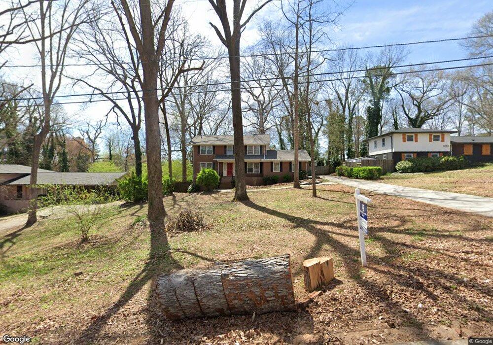
1977 Annette Ln Austell, GA 30106
Estimated Value: $332,000 - $389,000
4
Beds
3
Baths
2,808
Sq Ft
$126/Sq Ft
Est. Value
About This Home
This home is located at 1977 Annette Ln, Austell, GA 30106 and is currently estimated at $353,804, approximately $125 per square foot. 1977 Annette Ln is a home located in Cobb County with nearby schools including Deerwood Elementary School, Austell Elementary School, and Garrett Middle School.
Ownership History
Date
Name
Owned For
Owner Type
Purchase Details
Closed on
Jan 26, 2011
Sold by
Nationscredit Finl Svcs Corp
Bought by
Thomas Teresa and Thomas Derrick
Current Estimated Value
Purchase Details
Closed on
Jun 1, 2010
Sold by
Stewart James R and Stewart Bonnie
Bought by
Nationscredit Finl Svcs Corp
Create a Home Valuation Report for This Property
The Home Valuation Report is an in-depth analysis detailing your home's value as well as a comparison with similar homes in the area
Home Values in the Area
Average Home Value in this Area
Purchase History
| Date | Buyer | Sale Price | Title Company |
|---|---|---|---|
| Thomas Teresa | $25,000 | -- | |
| Nationscredit Finl Svcs Corp | $41,696 | -- |
Source: Public Records
Tax History Compared to Growth
Tax History
| Year | Tax Paid | Tax Assessment Tax Assessment Total Assessment is a certain percentage of the fair market value that is determined by local assessors to be the total taxable value of land and additions on the property. | Land | Improvement |
|---|---|---|---|---|
| 2025 | $5,923 | $196,568 | $26,000 | $170,568 |
| 2024 | $4,893 | $162,300 | $24,000 | $138,300 |
| 2023 | $3,863 | $128,132 | $18,000 | $110,132 |
| 2022 | $1,937 | $63,808 | $10,000 | $53,808 |
| 2021 | $1,937 | $63,808 | $10,000 | $53,808 |
| 2020 | $2,000 | $65,908 | $10,000 | $55,908 |
| 2019 | $1,994 | $65,704 | $10,000 | $55,704 |
| 2018 | $1,601 | $52,748 | $7,200 | $45,548 |
| 2017 | $1,320 | $45,924 | $5,600 | $40,324 |
| 2016 | $1,320 | $45,924 | $5,600 | $40,324 |
| 2015 | $825 | $28,000 | $8,000 | $20,000 |
| 2014 | $832 | $28,000 | $0 | $0 |
Source: Public Records
Map
Nearby Homes
- 1971 Annette Ln
- 1943 Arnold Dr
- 1803 Gherry Dr
- 1 Perkerson Mill Rd SW
- 1841 Mobley St
- 5164 Medford Ln
- 5154 Medford Ln
- 0 Harris St Unit 7661273
- 5466 Davis Dr
- 2136 Perkerson Mill Rd SW
- Bayberry Plan at Sawmill Creek - Bungalow Series
- Wisteria Plan at Sawmill Creek - Bungalow Series
- Redbud Plan at Sawmill Creek - Bungalow Series
- 5410 Beth Dr
- Laurel Plan at Avenbrook
- Rosedale Plan at Avenbrook
- Fulmont at Avenbrook Plan at Avenbrook
- Addison Plan at Avenbrook
- Conley Plan at Avenbrook
- 1645 Fulmont Cir
- 1967 Annette Ln
- 1987 Annette Ln
- 1978 Brannon Dr
- 1997 Annette Ln
- 1968 Brannon Dr
- 1988 Brannon Dr
- 1998 Brannon Dr
- 1988 Annette Ln
- 1978 Annette Ln Unit 1
- 1944 Brannon Dr Unit 2
- 2040 Brannon Dr
- 1998 Annette Ln
- 1947 Annette Ln SW
- 1947 Annette Ln Unit 8
- 1932 Annette Ln
- 2030 Brannon Dr
- 0 Brannon Dr Unit 8870039
- 0 Brannon Dr Unit 8676418
- 0 Brannon Dr Unit 8451087
- 0 Brannon Dr Unit 8386875