1977 Maple St Millport, NY 14864
Estimated Value: $77,000 - $123,000
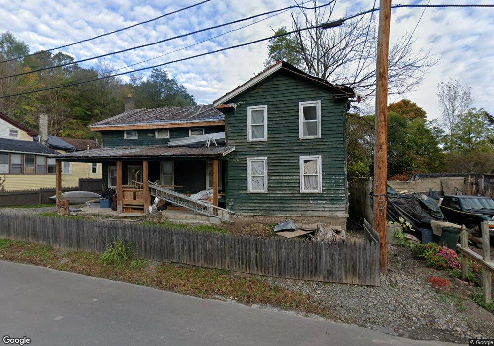
About This Home
This home is located at 1977 Maple St, Millport, NY 14864 and is currently estimated at $98,470, approximately $71 per square foot. 1977 Maple St is a home located in Chemung County with nearby schools including Gardner Road Elementary School, Horseheads Middle School, and Horseheads Intermediate School.
Ownership History
We collect this data history from publicly available records. To have your information removed, we recommend requesting removal directly through your county’s website.
Purchase Details
Purchase Details
Purchase Details
Purchase Details
Home Values in the Area
Average Home Value in this Area
Purchase History
We collect this data history from publicly available records. To have your information removed, we recommend requesting removal directly through your county’s website.
| Date | Buyer | Sale Price | Title Company |
|---|---|---|---|
| $20,000 | None Available | ||
| $5,000 | -- | ||
| $5,000 | -- | ||
| $2,000 | -- | ||
| $1,406 | -- |
Tax History
We collect this data history from publicly available records. To have your information removed, we recommend requesting removal directly through your county’s website.
| Year | Tax Paid | Tax Assessment Tax Assessment Total Assessment is a certain percentage of the fair market value that is determined by local assessors to be the total taxable value of land and additions on the property. | Land | Improvement |
|---|---|---|---|---|
| 2025 | $1,809 | $54,000 | $11,000 | $43,000 |
| 2024 | $1,809 | $44,000 | $5,800 | $38,200 |
| 2023 | $1,374 | $44,000 | $5,800 | $38,200 |
| 2022 | $1,431 | $44,000 | $5,800 | $38,200 |
| 2021 | $1,212 | $44,000 | $5,800 | $38,200 |
| 2020 | $1,481 | $44,000 | $5,800 | $38,200 |
| 2019 | $419 | $44,000 | $5,800 | $38,200 |
| 2018 | $1,210 | $44,000 | $5,800 | $38,200 |
| 2017 | $780 | $23,500 | $5,000 | $18,500 |
| 2016 | $1,462 | $23,500 | $5,000 | $18,500 |
| 2015 | -- | $23,500 | $5,000 | $18,500 |
| 2014 | -- | $23,500 | $5,000 | $18,500 |
Map
- 5551 Maiden Ln
- 4643 Watkins Rd
- 1899 Woods Edge Dr
- 0 Johnson Hollow & Buck Mountain Rd Unit R1637675
- 332 Vanderhoff Rd
- 168 Burch Hill Rd
- 1229B Middle Rd
- 0 Middle Rd
- 795 Middle Rd
- 0 Dunn Rd
- 0 Mead Rd Unit R1678799
- 287 Dunn Rd
- 0(1) Dunn Rd
- 1287 Croton Rd
- 0(2) Dunn Rd
- 294 Jennings Rd E
- 3753 Watkins Rd
- 186 Pine Valley Rd
- 8 Hill Rd
- 19 Fox Ridge Rd
- 1983 Maple St
- 1975 Maple St
- 1978 Maple St
- 1974 Maple St
- 5522 State St
- 5529 State St
- 1995 Maple St
- 1984 Maple St
- 5516 State St
- 1986 Maple St
- 5536 Lewis St
- 1996 Maple St
- 00 E Side Veteran Hill Rd
- 5540 State St
- 2006 Crescent St
- 2001 Maple St
- 5545 State St
- 2000 Crescent St
- 5545 State St
- 2010 Crescent St
Ask me questions while you tour the home.