Estimated Value: $156,000 - $223,000
3
Beds
2
Baths
975
Sq Ft
$208/Sq Ft
Est. Value
About This Home
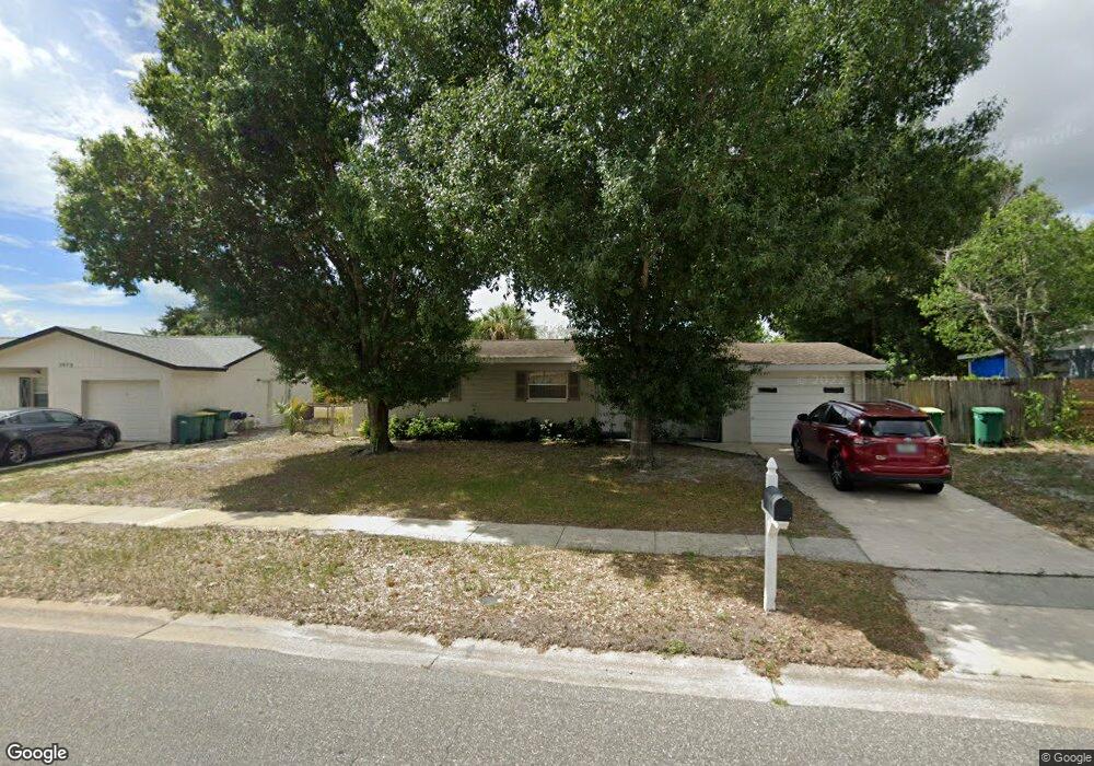
This home is located at 1977 Otterbein Ave, Cocoa, FL 32926 and is currently estimated at $202,876, approximately $208 per square foot. 1977 Otterbein Ave is a home located in Brevard County with nearby schools including Cambridge Elementary Magnet School, Cocoa High School, and Space Coast Christian Academy.
Ownership History
Date
Name
Owned For
Owner Type
Purchase Details
Closed on
Sep 20, 2017
Sold by
Villaverde Agustin
Bought by
Battreal Randall J and Battreal Catherine J
Current Estimated Value
Home Financials for this Owner
Home Financials are based on the most recent Mortgage that was taken out on this home.
Original Mortgage
$15,000
Interest Rate
5%
Mortgage Type
Purchase Money Mortgage
Purchase Details
Closed on
Oct 19, 1994
Sold by
Sims Guy Lee
Bought by
Sims Rebecca A
Create a Home Valuation Report for This Property
The Home Valuation Report is an in-depth analysis detailing your home's value as well as a comparison with similar homes in the area
Home Values in the Area
Average Home Value in this Area
Purchase History
| Date | Buyer | Sale Price | Title Company |
|---|---|---|---|
| Battreal Randall J | $115,000 | Secure Title Ins Co Inc | |
| Sims Rebecca A | $21,000 | -- |
Source: Public Records
Mortgage History
| Date | Status | Borrower | Loan Amount |
|---|---|---|---|
| Closed | Battreal Randall J | $15,000 |
Source: Public Records
Tax History
| Year | Tax Paid | Tax Assessment Tax Assessment Total Assessment is a certain percentage of the fair market value that is determined by local assessors to be the total taxable value of land and additions on the property. | Land | Improvement |
|---|---|---|---|---|
| 2025 | $1,539 | $113,950 | -- | -- |
| 2024 | $1,486 | $110,740 | -- | -- |
| 2023 | $1,486 | $107,520 | $0 | $0 |
| 2022 | $1,418 | $104,390 | $0 | $0 |
| 2021 | $1,400 | $101,350 | $0 | $0 |
| 2020 | $1,366 | $99,960 | $0 | $0 |
| 2019 | $1,336 | $97,720 | $0 | $0 |
| 2018 | $1,250 | $95,900 | $35,000 | $60,900 |
| 2017 | $1,295 | $61,300 | $30,000 | $31,300 |
| 2016 | $1,187 | $50,440 | $19,000 | $31,440 |
| 2015 | $1,103 | $43,560 | $19,000 | $24,560 |
| 2014 | $1,032 | $42,080 | $19,000 | $23,080 |
Source: Public Records
Map
Nearby Homes
- 1942 Quail Ridge Ct Unit 504
- 1933 Quail Ridge Ct Unit 1101
- 1956 Quail Ridge Ct Unit 1802
- 2111 Otterbein Ave
- 0000 Unknown
- 00 N Unknown
- 1612 Calvados Dr
- 2426 Granville Dr
- 2430 Legay St
- 2413 Cherbourg Rd
- 3057 Skyline Dr
- 2713 Winchester Dr
- 2702 Winchester Dr
- 117 Gary Ln
- 3120 Winchester Dr
- 108 River Heights Dr
- 11 Highview Dr
- 324 Bellaire Dr
- 1704 University Ln Unit 702
- 308 Bellair Dr
- 1973 Otterbein Ave
- 1981 Otterbein Ave
- 1982 Hofstra Dr
- 1967 Hofstra Dr
- 1972 Otterbein Ave
- 1985 Otterbein Ave
- 1976 Otterbein Ave
- 2908 Colby Ct
- 1980 Otterbein Ave
- 1986 Hofstra Dr
- 1971 Hofstra Dr
- 1939 Quail Ridge Ct Unit 303
- 1939 Quail Ridge Ct Unit 301
- 1939 Quail Ridge Ct Unit 302
- 1939 Quail Ridge Ct Unit 304
- 1975R Hofstra Dr
- 1984 Otterbein Ave
- 1970 Otterbein Ave Unit 1202
- 1970 Otterbein Ave Unit 1201
- 1970 Otterbein Ave Unit 1204
Your Personal Tour Guide
Ask me questions while you tour the home.