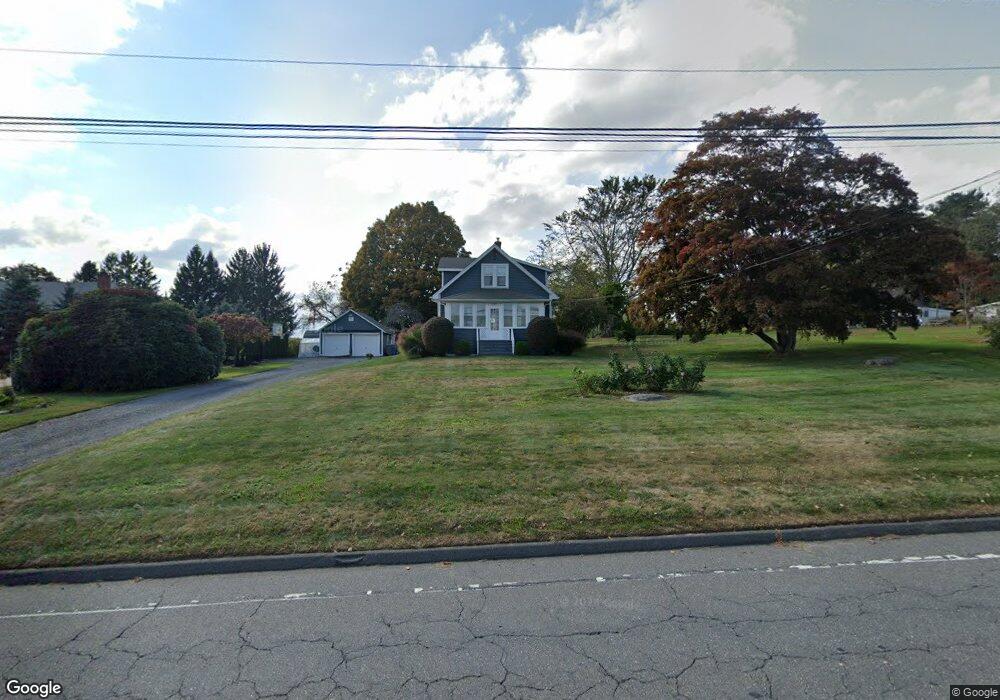
1977 Perkins St Bristol, CT 06010
North Bristol NeighborhoodEstimated Value: $308,000 - $374,000
2
Beds
1
Bath
1,109
Sq Ft
$311/Sq Ft
Est. Value
About This Home
This home is located at 1977 Perkins St, Bristol, CT 06010 and is currently estimated at $344,766, approximately $310 per square foot. 1977 Perkins St is a home located in Hartford County with nearby schools including Edgewood School, Chippens Hill Middle School, and Bristol Central High School.
Ownership History
Date
Name
Owned For
Owner Type
Purchase Details
Closed on
Jul 29, 2015
Sold by
Boucher Neringa
Bought by
Reddy Neringa and Reddy Patrick
Current Estimated Value
Purchase Details
Closed on
Jul 12, 2011
Sold by
Fnma
Bought by
Boucher Neringa
Home Financials for this Owner
Home Financials are based on the most recent Mortgage that was taken out on this home.
Original Mortgage
$141,300
Interest Rate
4.6%
Purchase Details
Closed on
Jul 27, 2010
Sold by
One West Bk
Bought by
Federal National Mortgage Association
Purchase Details
Closed on
May 27, 2010
Sold by
Rainey Gregory L
Bought by
Onewest Bk
Purchase Details
Closed on
Dec 30, 2004
Sold by
Barnes Thomas O
Bought by
Rainey Gregory L and Rainey Nancy T
Purchase Details
Closed on
Dec 3, 2003
Sold by
Radke Joshua J
Bought by
Barnes Thomas O
Create a Home Valuation Report for This Property
The Home Valuation Report is an in-depth analysis detailing your home's value as well as a comparison with similar homes in the area
Home Values in the Area
Average Home Value in this Area
Purchase History
| Date | Buyer | Sale Price | Title Company |
|---|---|---|---|
| Reddy Neringa | -- | -- | |
| Boucher Neringa | -- | -- | |
| Federal National Mortgage Association | -- | -- | |
| Onewest Bk | -- | -- | |
| Rainey Gregory L | $200,000 | -- | |
| Barnes Thomas O | $160,000 | -- |
Source: Public Records
Mortgage History
| Date | Status | Borrower | Loan Amount |
|---|---|---|---|
| Previous Owner | Barnes Thomas O | $141,300 | |
| Previous Owner | Barnes Thomas O | $244,000 |
Source: Public Records
Tax History Compared to Growth
Tax History
| Year | Tax Paid | Tax Assessment Tax Assessment Total Assessment is a certain percentage of the fair market value that is determined by local assessors to be the total taxable value of land and additions on the property. | Land | Improvement |
|---|---|---|---|---|
| 2025 | $5,663 | $167,790 | $62,650 | $105,140 |
| 2024 | $5,344 | $167,790 | $62,650 | $105,140 |
| 2023 | $5,092 | $167,790 | $62,650 | $105,140 |
| 2022 | $4,827 | $125,860 | $48,930 | $76,930 |
| 2021 | $4,827 | $125,860 | $48,930 | $76,930 |
| 2020 | $4,827 | $125,860 | $48,930 | $76,930 |
| 2019 | $4,789 | $125,860 | $48,930 | $76,930 |
| 2018 | $4,642 | $125,860 | $48,930 | $76,930 |
| 2017 | $4,936 | $136,990 | $66,640 | $70,350 |
| 2016 | $4,936 | $136,990 | $66,640 | $70,350 |
| 2015 | $4,741 | $136,990 | $66,640 | $70,350 |
| 2014 | $4,741 | $136,990 | $66,640 | $70,350 |
Source: Public Records
Map
Nearby Homes
- 116 Larkspur Ln
- 126 Harvard Place
- 276 Hart St
- 68 Hart St
- 1970 Perkins St
- 0 Hart St Unit 170255530
- 114 El Toro Dr
- 62 (Lot 13-1) James P Casey Rd
- 8 Briar Cliff
- 90 Battle St
- 35 James P Casey Rd
- 439 James P Casey Rd
- 6 El Toro Dr
- 335 Pennwood Place
- 15 Bittersweet Ln
- 454 Maple Ave
- 66 Intervale Rd
- 117 W Chippen Hill Rd
- 58 W Chippen Hill Rd
- 48 Boivin St
- 1985 Perkins St
- 1975 Perkins St
- 1987 Perkins St
- 2010 Perkins St
- 2001 Perkins St
- 1960 Perkins St
- 2020 Perkins St
- 1939 Perkins St
- 2015 Perkins St
- 2030 Perkins St
- 164 Southdown Dr
- 2044 Perkins St
- 2023 Perkins St
- 148 Southdown Dr
- 2033 Perkins St
- 153 Southdown Dr
- 134 Southdown Dr
- 230 Chapel St
- 165 Southdown Dr
- 120 Southdown Dr