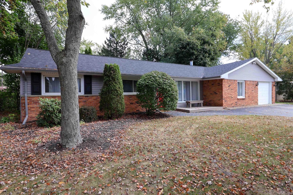
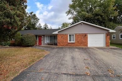
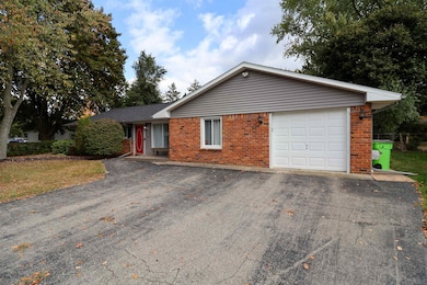

1977 Swaranne Dr West Bloomfield, MI 48324
Highlights
- Ranch Style House
- 1 Car Attached Garage
- Forced Air Heating System
About This Home
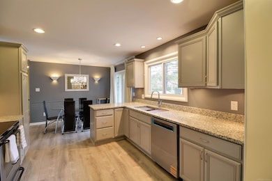
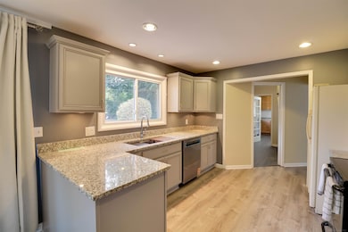
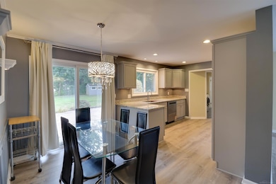
This beautifully renovated 3-bedroom, 1-bathroom home in West Bloomfield offers 1,400 sq. ft. of modern, comfortable living in a quiet neighborhood. The home has been fully updated from top to bottom, featuring a new, fully equipped kitchen with stainless steel appliances, soft-close cabinets, and a touchless faucet. The living spaces are bright and inviting, with a washer and dryer included, a dishwasher, microwave, and refrigerator. Two of the bedrooms are furnished with beds, while the third can be used as an office or additional bedroom, making it perfect for families or roommates. Step outside to enjoy a private fenced backyard complete with a firepit and BBQ grill, along with a shed for extra storage. Additional amenities include a 1-car garage, driveway parking, TV, kitchen table and chairs, curtains, and shades throughout. The home is ideally located within walking or biking distance to lakes and parks, offering both convenience and a relaxing suburban lifestyle. With its thoughtful updates and spacious layout, this home is ready for you to move in and enjoy everything West Bloomfield has to offer.
Home Details
Home Type
- Single Family
Year Built
- Built in 1956
Lot Details
- 0.28 Acre Lot
- Lot Dimensions are 100 x 60 x 140 x 143
Parking
- 1 Car Attached Garage
Home Design
- 1,309 Sq Ft Home
- Ranch Style House
- Brick Exterior Construction
- Slab Foundation
- Vinyl Siding
Bedrooms and Bathrooms
- 2 Bedrooms
- 1 Full Bathroom
Utilities
- Forced Air Heating System
- Heating System Uses Natural Gas
Community Details
- Bloomfield Knolls Subdivision
Listing and Financial Details
- Security Deposit $3,375
- $55 Application Fee
- Assessor Parcel Number 18-05-252-003
Map
Source: Michigan Multiple Listing Service
MLS Number: 50194561
APN: 18-05-252-003
Disclaimer: Certain information contained herein is derived from information provided by parties other than Homes.com. All information provided is deemed reliable, but is not guaranteed to be accurate and should be independently verified.
![]() Source MLS: MiRealSource
Source MLS: MiRealSource
Provided through IDX via MiRealSource. Courtesy of MiRealSource Shareholder. Copyright MiRealSource.
The information published and disseminated by MiRealSource is communicated verbatim, without change by MiRealSource, as filed with MiRealSource by its members. The accuracy of all information, regardless of source, is not guaranteed or warranted. All information should be independently verified.
Copyright 2025 MiRealSource. All rights reserved. The information provided hereby constitutes proprietary information of MiRealSource, Inc. and its shareholders, affiliates and licensees and may not be reproduced or transmitted in any form or by any means, electronic or mechanical, including photocopy, recording, scanning or any information storage and retrieval system, without written permission from MiRealSource, Inc.
- 1992 Swaranne Dr
- 1837 Henbert Rd
- 1811 Henbert Rd
- 6620 Red Cedar Ln Unit 37
- 1985 Christopher Ct
- 6726 Red Cedar Ln
- 2112 Keylon Dr
- 1604 Petrolia
- 6034 Beachwood Dr
- 2236 Locklin Ln
- VAC Mercedes Ave
- 6057 Beachwood Dr
- 2140 Timberridge Ct
- 1276 Jay St Unit 6
- VL Tamson St
- 5699 Applegrove Dr
- Lot 94 Hiller Rd
- 2110 Peachtree Ct
- 6289 Lindsay Ct
- 1844 Poppleton Dr
- 1811 Henbert Rd
- 6726 Red Cedar Ln
- 1684 Petrolia
- 1340 Briarwood Dr
- 1644 Marylestone Dr
- 1758 Poppleton Dr
- 7420 Locklin
- 7035 Round Hill Dr
- 5145 Greer Rd
- 2475 Horace St
- 5523 Ashby Ct Unit 2
- 2893 Treyburn Ln
- 941 Shoshone Cir
- 5278 Rosamond Ln
- 5135 Cass Elizabeth Rd
- 8020 Wadi Blvd
- 8135 Kenwick Dr
- 7980 Billingham Rd
- 3333 W Shore Dr
- 2649 Grove Cir
