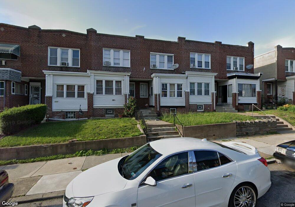
1977 W Sparks St Philadelphia, PA 19141
East Germantown NeighborhoodEstimated Value: $182,000 - $208,478
3
Beds
1
Bath
1,180
Sq Ft
$165/Sq Ft
Est. Value
About This Home
This home is located at 1977 W Sparks St, Philadelphia, PA 19141 and is currently estimated at $194,370, approximately $164 per square foot. 1977 W Sparks St is a home located in Philadelphia County with nearby schools including Joseph Pennell School, Gen. Louis Wagner Middle School, and Martin Luther King High School.
Ownership History
Date
Name
Owned For
Owner Type
Purchase Details
Closed on
Nov 27, 2007
Sold by
Smj Investment Co
Bought by
Polk Alisha
Current Estimated Value
Home Financials for this Owner
Home Financials are based on the most recent Mortgage that was taken out on this home.
Original Mortgage
$94,242
Outstanding Balance
$59,867
Interest Rate
6.37%
Mortgage Type
FHA
Estimated Equity
$134,503
Purchase Details
Closed on
Aug 31, 2006
Sold by
Harrison David C and Spiller Brad J
Bought by
Smj Investment Co
Create a Home Valuation Report for This Property
The Home Valuation Report is an in-depth analysis detailing your home's value as well as a comparison with similar homes in the area
Home Values in the Area
Average Home Value in this Area
Purchase History
| Date | Buyer | Sale Price | Title Company |
|---|---|---|---|
| Polk Alisha | $95,000 | Fidelity Natl Title Ins Co | |
| Smj Investment Co | $10,000 | None Available |
Source: Public Records
Mortgage History
| Date | Status | Borrower | Loan Amount |
|---|---|---|---|
| Open | Polk Alisha | $94,242 |
Source: Public Records
Tax History Compared to Growth
Tax History
| Year | Tax Paid | Tax Assessment Tax Assessment Total Assessment is a certain percentage of the fair market value that is determined by local assessors to be the total taxable value of land and additions on the property. | Land | Improvement |
|---|---|---|---|---|
| 2025 | $1,863 | $174,900 | $34,980 | $139,920 |
| 2024 | $1,863 | $174,900 | $34,980 | $139,920 |
| 2023 | $1,863 | $133,100 | $26,620 | $106,480 |
| 2022 | $708 | $88,100 | $26,620 | $61,480 |
| 2021 | $1,338 | $0 | $0 | $0 |
| 2020 | $1,338 | $0 | $0 | $0 |
| 2019 | $1,397 | $0 | $0 | $0 |
| 2018 | $1,058 | $0 | $0 | $0 |
| 2017 | $1,478 | $0 | $0 | $0 |
| 2016 | $1,058 | $0 | $0 | $0 |
| 2015 | $1,013 | $0 | $0 | $0 |
| 2014 | -- | $105,600 | $15,400 | $90,200 |
| 2012 | -- | $8,192 | $1,191 | $7,001 |
Source: Public Records
Map
Nearby Homes
- 1938 W Godfrey Ave
- 1936 W Godfrey Ave
- 6142 N Woodstock St
- 5833 N Woodstock St
- 6709 N Woodstock St
- 6152 N Lambert St
- 6190-92 Limekiln Pike
- 5963 65 N Opal St
- 6012 Ogontz Ave
- 6010 N Lambert St
- 6168 Limekiln Pike
- 1955 Medary Ave
- 5982 N 20th St
- 6075 N Norwood St
- 6144 N Norwood St
- 6102 N Norwood St
- 1802 Church Ln
- 6302 Ogontz Ave
- 6018 N 19th St
- 2138 W Godfrey Ave
- 1975 W Sparks St
- 1979 W Sparks St
- 1981 W Sparks St
- 1973 W Sparks St
- 1971 W Sparks St
- 1969 W Sparks St
- 1965 W Sparks St
- 1963 W Sparks St
- 1964 W Godfrey Ave
- 1961 W Sparks St
- 1962 W Godfrey Ave
- 1960 W Godfrey Ave
- 1958 W Godfrey Ave
- 1956 W Godfrey Ave
- 1959 W Sparks St
- 1954 W Godfrey Ave
- 1957 W Sparks St
- 1952 W Godfrey Ave
- 6140 N 20th St
- 1972 W Sparks St