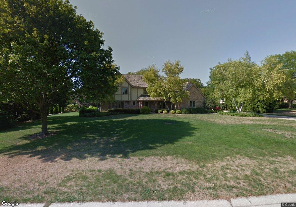
19770 Brian Dr Brookfield, WI 53045
Estimated Value: $771,823 - $953,000
4
Beds
4
Baths
3,742
Sq Ft
$225/Sq Ft
Est. Value
About This Home
This home is located at 19770 Brian Dr, Brookfield, WI 53045 and is currently estimated at $840,706, approximately $224 per square foot. 19770 Brian Dr is a home located in Waukesha County with nearby schools including Brookfield Elementary School, Wisconsin Hills Middle School, and Brookfield Central High School.
Ownership History
Date
Name
Owned For
Owner Type
Purchase Details
Closed on
Feb 1, 2018
Sold by
Benning Thomas A
Bought by
Koepsel Benning Kay L
Current Estimated Value
Home Financials for this Owner
Home Financials are based on the most recent Mortgage that was taken out on this home.
Original Mortgage
$377,000
Outstanding Balance
$324,036
Interest Rate
4.6%
Mortgage Type
New Conventional
Estimated Equity
$516,670
Purchase Details
Closed on
Apr 17, 1998
Sold by
Carroll Patrick E and Carroll Mary J
Bought by
Benning Thomas A and Benning Kay L
Home Financials for this Owner
Home Financials are based on the most recent Mortgage that was taken out on this home.
Original Mortgage
$320,000
Interest Rate
7.27%
Mortgage Type
Purchase Money Mortgage
Purchase Details
Closed on
Jul 25, 1996
Sold by
Carroll Patrick E and Carroll Mary
Bought by
Carroll Patrick E and Carroll Mary J
Create a Home Valuation Report for This Property
The Home Valuation Report is an in-depth analysis detailing your home's value as well as a comparison with similar homes in the area
Home Values in the Area
Average Home Value in this Area
Purchase History
| Date | Buyer | Sale Price | Title Company |
|---|---|---|---|
| Koepsel Benning Kay L | -- | None Available | |
| Benning Thomas A | $342,500 | -- | |
| Carroll Patrick E | -- | -- |
Source: Public Records
Mortgage History
| Date | Status | Borrower | Loan Amount |
|---|---|---|---|
| Open | Koepsel Benning Kay L | $377,000 | |
| Closed | Benning Thomas A | $320,000 |
Source: Public Records
Tax History
| Year | Tax Paid | Tax Assessment Tax Assessment Total Assessment is a certain percentage of the fair market value that is determined by local assessors to be the total taxable value of land and additions on the property. | Land | Improvement |
|---|---|---|---|---|
| 2024 | $8,575 | $695,600 | $180,000 | $515,600 |
| 2023 | $8,686 | $695,600 | $180,000 | $515,600 |
| 2022 | $8,825 | $568,400 | $160,000 | $408,400 |
| 2021 | $8,736 | $568,400 | $160,000 | $408,400 |
| 2020 | $9,456 | $568,400 | $160,000 | $408,400 |
| 2019 | $8,926 | $568,400 | $160,000 | $408,400 |
| 2018 | $8,665 | $548,800 | $160,000 | $388,800 |
| 2017 | $9,819 | $548,800 | $160,000 | $388,800 |
| 2016 | $8,768 | $548,800 | $160,000 | $388,800 |
| 2015 | $8,710 | $548,800 | $160,000 | $388,800 |
| 2014 | $9,036 | $548,800 | $160,000 | $388,800 |
| 2013 | $9,036 | $548,800 | $160,000 | $388,800 |
Source: Public Records
Map
Nearby Homes
- 1775 Derrin Ln
- 19775 Trilby Ct
- 1825 Derrin Ln
- 2000 Kathlynn Ct
- 18865 Tanala Dr
- 850 Janacek Rd
- Lt0 Russet Dr
- 18825 Madeline Ln Unit D
- 1040 Lansdowne Ct Unit V6
- 20305 Downing Ct
- 1930 Cotton Tail Ln
- 19260 Brookdale Dr
- 18500 Brookfield Lake Dr Unit 74
- 18775 Brookfield Lake Dr Unit 8
- 165 Aerie Cir Unit 105
- 18925 Eagle Dr Unit 101
- 18925 Eagle Dr Unit 102
- 18925 Eagle Dr Unit 202
- 18925 Eagle Dr Unit 201
- 18275 Brookfield Lake Dr Unit 93
- 1515 Barrington Woods Dr
- 1510 Brian Ct
- 1545 Barrington Woods Dr
- 1540 Brian Ct
- 19755 Brian Dr
- 19775 Brian Dr
- 19825 Brian Dr
- 1565 Barrington Woods Dr
- 1485 Barrington Woods Dr
- 1510 Barrington Woods Dr
- 1560 Brian Ct
- 1550 Barrington Woods Dr
- 1435 Barrington Woods Dr
- 1585 Barrington Woods Dr
- 1415 Barrington Woods Dr
- 1430 Brian Ct
- 1490 Barrington Woods Dr
- 1395 Barrington Woods Dr
- 1575 Brian Ct
- 1590 Barrington Woods Dr
Your Personal Tour Guide
Ask me questions while you tour the home.