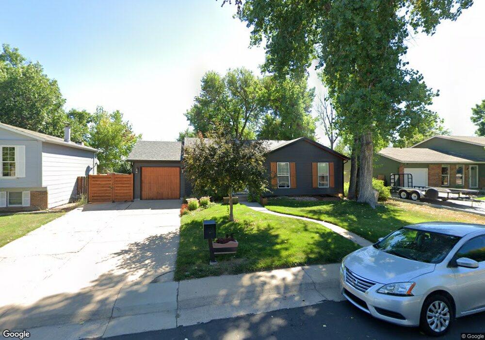
1978 Cedar St Broomfield, CO 80020
Northmoor Estates NeighborhoodEstimated Value: $454,581 - $515,000
3
Beds
2
Baths
1,072
Sq Ft
$460/Sq Ft
Est. Value
About This Home
This home is located at 1978 Cedar St, Broomfield, CO 80020 and is currently estimated at $492,895, approximately $459 per square foot. 1978 Cedar St is a home located in Broomfield County with nearby schools including Aspen Creek K-8 School, Birch Elementary School, and Broomfield High School.
Ownership History
Date
Name
Owned For
Owner Type
Purchase Details
Closed on
Dec 12, 2013
Sold by
Burns Patrick M and Heredia Erica M
Bought by
Burns Patrick M and Burns Erica Marie Heredia
Current Estimated Value
Home Financials for this Owner
Home Financials are based on the most recent Mortgage that was taken out on this home.
Original Mortgage
$191,000
Outstanding Balance
$142,364
Interest Rate
4.14%
Mortgage Type
New Conventional
Estimated Equity
$350,531
Purchase Details
Closed on
Jan 31, 2006
Sold by
Moran Judy C and Moran David M
Bought by
Burns Patrick M and Heredia Erica M
Home Financials for this Owner
Home Financials are based on the most recent Mortgage that was taken out on this home.
Original Mortgage
$41,800
Interest Rate
5.74%
Mortgage Type
Stand Alone Second
Purchase Details
Closed on
Mar 29, 1978
Purchase Details
Closed on
Nov 5, 1975
Create a Home Valuation Report for This Property
The Home Valuation Report is an in-depth analysis detailing your home's value as well as a comparison with similar homes in the area
Home Values in the Area
Average Home Value in this Area
Purchase History
| Date | Buyer | Sale Price | Title Company |
|---|---|---|---|
| Burns Patrick M | -- | Heritage Title | |
| Burns Patrick M | $209,000 | Fahtco | |
| -- | $43,500 | -- | |
| -- | $28,900 | -- |
Source: Public Records
Mortgage History
| Date | Status | Borrower | Loan Amount |
|---|---|---|---|
| Open | Burns Patrick M | $191,000 | |
| Closed | Burns Patrick M | $41,800 | |
| Closed | Burns Patrick M | $167,200 |
Source: Public Records
Tax History
| Year | Tax Paid | Tax Assessment Tax Assessment Total Assessment is a certain percentage of the fair market value that is determined by local assessors to be the total taxable value of land and additions on the property. | Land | Improvement |
|---|---|---|---|---|
| 2025 | $2,782 | $31,090 | $8,710 | $22,380 |
| 2024 | $2,782 | $29,690 | $7,750 | $21,940 |
| 2023 | $2,777 | $34,620 | $9,040 | $25,580 |
| 2022 | $2,376 | $24,580 | $5,910 | $18,670 |
| 2021 | $2,364 | $25,290 | $6,080 | $19,210 |
| 2020 | $2,178 | $23,150 | $5,720 | $17,430 |
| 2019 | $2,174 | $23,310 | $5,760 | $17,550 |
| 2018 | $1,830 | $19,390 | $4,320 | $15,070 |
| 2017 | $1,802 | $21,440 | $4,780 | $16,660 |
| 2016 | $1,468 | $15,570 | $5,450 | $10,120 |
| 2015 | $1,418 | $13,640 | $5,450 | $8,190 |
| 2014 | $1,270 | $13,640 | $5,450 | $8,190 |
Source: Public Records
Map
Nearby Homes
- 1736 Cottonwood St
- 1705 Dover St
- 5313 Heather Ct
- 13864 Quail Ridge Dr
- 583 Redstone Dr
- 13924 Quail Ridge Dr
- 13848 Teal Creek Dr
- 370 Golden Eagle Dr
- 13961 Brookside Ct
- 13495 Wild Basin Way
- 477 Rifle Way
- 1732 Peregrine Ln
- 5124 River Rock Ln
- 133 Fairplay Ave
- 14115 Blue Stem St
- 4560 Red Deer Trail
- 14119 Blue Stem St
- 4527 Maroon Cir
- 14025 Blue River Trail
- 14123 Blue Stem St
- 1938 Cedar St
- 1998 Cedar St
- 1979 Cottonwood St
- 1939 Cottonwood St
- 1999 Cottonwood St
- 1908 Cedar St
- 5706 W 136th Ave
- 1909 Cottonwood St
- 1105 E 19th Ave
- 1868 Cedar St
- 1869 Cottonwood St
- 5726 W 136th Ave
- 1095 E 19th Ave
- 1976 Cottonwood St
- 1996 Cottonwood St
- 1936 Cottonwood St
- 1839 Cottonwood St
- 5746 W 136th Ave
- 1906 Cottonwood St
- 1899 Cedar St
Your Personal Tour Guide
Ask me questions while you tour the home.