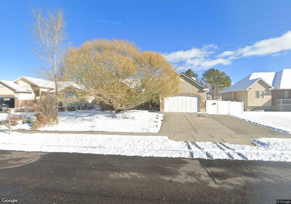
1978 N 2895 W Clearfield, UT 84015
Estimated Value: $429,000 - $537,000
4
Beds
2
Baths
1,398
Sq Ft
$355/Sq Ft
Est. Value
About This Home
This home is located at 1978 N 2895 W, Clearfield, UT 84015 and is currently estimated at $495,959, approximately $354 per square foot. 1978 N 2895 W is a home located in Davis County with nearby schools including West Clinton Elementary School, West Point Junior High School, and Clearfield High School.
Ownership History
Date
Name
Owned For
Owner Type
Purchase Details
Closed on
May 29, 2008
Sold by
Lyman Kurt W and Lyman Linda S
Bought by
Lyman Kurt W
Current Estimated Value
Purchase Details
Closed on
Aug 13, 2003
Sold by
Lyman Kurt W
Bought by
Lyman Kurt W and Lyman Linda S
Home Financials for this Owner
Home Financials are based on the most recent Mortgage that was taken out on this home.
Original Mortgage
$157,500
Interest Rate
4.65%
Mortgage Type
Purchase Money Mortgage
Purchase Details
Closed on
Apr 25, 2002
Sold by
Stevenson Bryce Daren and Stevenson Janica
Bought by
Lyman Kurt W
Home Financials for this Owner
Home Financials are based on the most recent Mortgage that was taken out on this home.
Original Mortgage
$159,505
Interest Rate
7.08%
Purchase Details
Closed on
Jul 20, 2001
Sold by
U S Development Inc
Bought by
Stevenson Bryce Darren and Stevenson Janica
Home Financials for this Owner
Home Financials are based on the most recent Mortgage that was taken out on this home.
Original Mortgage
$116,800
Interest Rate
7.15%
Mortgage Type
Construction
Create a Home Valuation Report for This Property
The Home Valuation Report is an in-depth analysis detailing your home's value as well as a comparison with similar homes in the area
Home Values in the Area
Average Home Value in this Area
Purchase History
| Date | Buyer | Sale Price | Title Company |
|---|---|---|---|
| Lyman Kurt W | -- | None Available | |
| Lyman Kurt W | -- | First American Title Co | |
| Lyman Kurt W | -- | Heritage West Title Insuranc | |
| Stevenson Bryce Darren | -- | Bonneville Title Company Inc |
Source: Public Records
Mortgage History
| Date | Status | Borrower | Loan Amount |
|---|---|---|---|
| Closed | Lyman Kurt W | $157,500 | |
| Closed | Lyman Kurt W | $159,505 | |
| Previous Owner | Stevenson Bryce Darren | $116,800 |
Source: Public Records
Tax History Compared to Growth
Tax History
| Year | Tax Paid | Tax Assessment Tax Assessment Total Assessment is a certain percentage of the fair market value that is determined by local assessors to be the total taxable value of land and additions on the property. | Land | Improvement |
|---|---|---|---|---|
| 2025 | $2,643 | $254,100 | $85,155 | $168,945 |
| 2024 | $2,663 | $257,400 | $94,124 | $163,276 |
| 2023 | $2,516 | $450,000 | $106,177 | $343,823 |
| 2022 | $2,691 | $266,201 | $66,072 | $200,129 |
| 2021 | $2,419 | $355,000 | $80,820 | $274,180 |
| 2020 | $2,086 | $303,000 | $67,689 | $235,311 |
| 2019 | $1,994 | $283,000 | $80,934 | $202,066 |
| 2018 | $1,851 | $258,000 | $68,602 | $189,398 |
| 2016 | $1,715 | $123,476 | $26,505 | $96,971 |
| 2015 | $1,642 | $112,421 | $26,505 | $85,916 |
| 2014 | $1,413 | $98,254 | $26,505 | $71,749 |
| 2013 | -- | $105,419 | $24,320 | $81,099 |
Source: Public Records
Map
Nearby Homes
- 1958 N 2750 W
- 3941 W 1800 N
- 2617 N 2080 W Unit 176
- 1648 N 2615 W
- 2413 N Eurasian Crane Rd
- Linden Plan at
- Sycamore Plan at
- 2642 W 1500 N
- 339 N 3250 W Unit 12
- 2322 N 2500 W
- 2434 W 2250 N
- 1509 N 2475 W
- 1449 N 2475 W
- 2259 W 1800 N
- 2921 W 1300 N
- 2162 N 2290 W
- 3168 W 1300 N
- 2118 Snowy Crane Dr
- 1458 N 2400 W
- 1694 N 2225 W
- 1992 N 2895 W
- 1964 N 2895 W
- 2006 N 2895 W
- 2006 N 2895 W Unit 11
- 1969 N 2895 W
- 1946 N 2895 W
- 1981 N 2895 W
- 1981 N 2895 W Unit 27
- 2918 W 1950 N Unit 28
- 1993 N 2895 W
- 1993 N 2895 W Unit 26
- 2018 N 2895 W
- 1932 N 2895 W
- 2017 N 2895 W
- 2913 W 2025 N
- 2913 W 2025 N Unit 25
- 2934 W 1950 N
- 2934 W 1950 N Unit 29
- 2913 W 1950 N
- 2937 W 2025 N