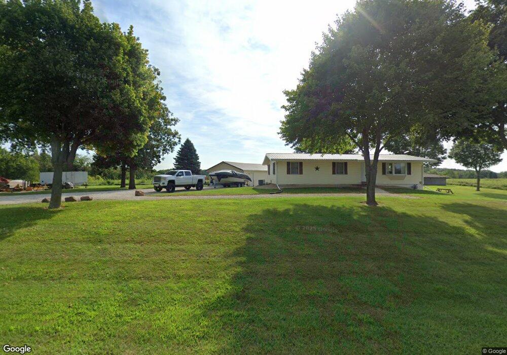
1979 150th St Cameron, IL 61423
Estimated Value: $86,000 - $179,000
--
Bed
--
Bath
--
Sq Ft
1.72
Acres
About This Home
This home is located at 1979 150th St, Cameron, IL 61423 and is currently estimated at $136,333. 1979 150th St is a home with nearby schools including Steele School and Lombard Middle School.
Ownership History
Date
Name
Owned For
Owner Type
Purchase Details
Closed on
Apr 30, 2019
Sold by
Magnison James Jimmy and Kara Magnison Land Trust
Bought by
Magnison Austin J
Current Estimated Value
Home Financials for this Owner
Home Financials are based on the most recent Mortgage that was taken out on this home.
Original Mortgage
$208,870
Outstanding Balance
$183,639
Interest Rate
4.2%
Mortgage Type
New Conventional
Estimated Equity
-$47,306
Purchase Details
Closed on
Aug 28, 2008
Sold by
Magnison Lila Rae
Bought by
Magnison James A and Newcomb Laurie
Create a Home Valuation Report for This Property
The Home Valuation Report is an in-depth analysis detailing your home's value as well as a comparison with similar homes in the area
Home Values in the Area
Average Home Value in this Area
Purchase History
| Date | Buyer | Sale Price | Title Company |
|---|---|---|---|
| Magnison Austin J | $285,000 | Westren Illinois Title | |
| Magnison James A | -- | None Available |
Source: Public Records
Mortgage History
| Date | Status | Borrower | Loan Amount |
|---|---|---|---|
| Open | Magnison Austin J | $208,870 |
Source: Public Records
Tax History Compared to Growth
Tax History
| Year | Tax Paid | Tax Assessment Tax Assessment Total Assessment is a certain percentage of the fair market value that is determined by local assessors to be the total taxable value of land and additions on the property. | Land | Improvement |
|---|---|---|---|---|
| 2024 | $2,119 | $35,410 | $3,140 | $32,270 |
| 2023 | $2,119 | $33,490 | $2,970 | $30,520 |
| 2022 | $1,911 | $30,970 | $2,750 | $28,220 |
| 2021 | $1,760 | $28,940 | $2,570 | $26,370 |
| 2020 | $1,738 | $28,940 | $2,570 | $26,370 |
| 2019 | $2,163 | $28,370 | $2,520 | $25,850 |
| 2018 | $2,165 | $28,570 | $2,540 | $26,030 |
| 2017 | $2,115 | $28,180 | $2,490 | $25,690 |
| 2016 | $2,284 | $29,870 | $2,430 | $27,440 |
| 2015 | -- | $28,750 | $2,340 | $26,410 |
| 2014 | -- | $28,350 | $2,310 | $26,040 |
| 2013 | -- | $29,010 | $2,360 | $26,650 |
Source: Public Records
Map
Nearby Homes
- 523 Church St
- 224 Academy St
- 1685 160th Ave
- 4351 Maple Dr
- 4256 Evergreen Dr
- 1424 245th Ave
- 2443 140th St
- 400 BLK S Linwood Rd
- 22 Knox Road 1800 N
- 1517 Monmouth Blvd
- 2049 W Losey St
- 1589 W Water St
- 1548 W North St
- 2325 100th St
- 98 Dieterich Ave
- 1030 W Berrien St
- 652 S Henderson St
- 1501 Bridge Ave
- 1450 Bridge Ave
- 1286 W Losey St
- 1985 150th St
- 1940 150th St
- 1506 190th Ave
- 1476 190th Ave
- 1526 190th Ave
- 1453 190th Ave
- 2038 150th St
- 1953 140th St
- 1590 195th Ave
- 1558 190th Ave
- 1967 140th St
- 1977 140th St
- 1555 190th Ave
- 1975 140th St
- 2014 155th St
- 1973 140th St
- 1973 140th St Unit 1973 140th. Street
- 1973 140th St Unit 1973
- 1565 190th Ave
- 1565 190th Ave