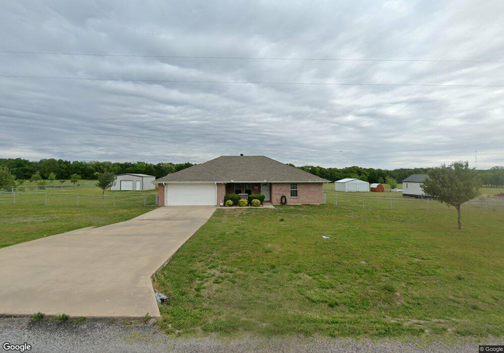
1979 Bethany Rd Sherman, TX 75090
Estimated Value: $378,851 - $497,000
4
Beds
2
Baths
1,748
Sq Ft
$251/Sq Ft
Est. Value
About This Home
This home is located at 1979 Bethany Rd, Sherman, TX 75090 and is currently estimated at $437,926, approximately $250 per square foot. 1979 Bethany Rd is a home located in Grayson County with nearby schools including Jefferson Elementary School, Piner Middle School, and Dillingham Intermediate School.
Ownership History
Date
Name
Owned For
Owner Type
Purchase Details
Closed on
Jun 22, 2005
Sold by
Wright Jimmy Don and Wright Rose Marie
Bought by
West Richard and West Cherl
Current Estimated Value
Purchase Details
Closed on
Dec 10, 2004
Sold by
Lclh 2003
Bought by
West Richard B and West Cherl P
Home Financials for this Owner
Home Financials are based on the most recent Mortgage that was taken out on this home.
Original Mortgage
$125,775
Interest Rate
5.7%
Mortgage Type
Purchase Money Mortgage
Create a Home Valuation Report for This Property
The Home Valuation Report is an in-depth analysis detailing your home's value as well as a comparison with similar homes in the area
Home Values in the Area
Average Home Value in this Area
Purchase History
| Date | Buyer | Sale Price | Title Company |
|---|---|---|---|
| West Richard | -- | -- | |
| West Richard B | -- | -- |
Source: Public Records
Mortgage History
| Date | Status | Borrower | Loan Amount |
|---|---|---|---|
| Previous Owner | West Richard B | $125,775 |
Source: Public Records
Tax History
| Year | Tax Paid | Tax Assessment Tax Assessment Total Assessment is a certain percentage of the fair market value that is determined by local assessors to be the total taxable value of land and additions on the property. | Land | Improvement |
|---|---|---|---|---|
| 2025 | $1,773 | $346,084 | -- | -- |
| 2024 | $5,314 | $314,622 | $0 | $0 |
| 2023 | $1,771 | $286,020 | $0 | $0 |
| 2022 | $4,882 | $260,018 | $0 | $0 |
| 2021 | $4,780 | $271,520 | $54,372 | $217,148 |
| 2020 | $4,600 | $214,891 | $44,205 | $170,686 |
| 2019 | $4,447 | $208,115 | $26,633 | $181,482 |
| 2018 | $3,712 | $211,897 | $26,633 | $185,264 |
| 2017 | $3,397 | $173,380 | $26,633 | $146,747 |
| 2016 | $3,088 | $146,958 | $26,633 | $120,325 |
Source: Public Records
Map
Nearby Homes
- 591 Mitchell Rd
- 979 Mitchell Rd
- 22.278 Acres Baker Ridge Rd
- 11086 State Highway 56
- 67 Mitchell Rd
- 2828 Baker Ridge Rd
- 225 Caleb Rd
- 262 Pecan Valley Ct
- 344 Jp Cave Rd
- 2233 E Tuck St
- 739 Copley St
- 743 Copley St
- TBD Lot 4 Adams Rd
- TBD Lot 2 Adams Rd
- TBD Lot 3 Adams Rd
- TBD Lot 1 Adams Rd
- 617 Patricia Dr
- 216 Acres Jp Cave Rd
- 520 Hillside Dr
- 701 Hillside Dr
- 2021 Bethany Rd
- 1949 Bethany Rd
- 2051 Bethany Rd
- 1911 Bethany Rd
- 2081 Bethany Rd
- 1857 Bethany Rd
- 2113 Bethany Rd
- 2149 Bethany Rd
- 2200 Bethany Rd
- 2191 Bethany Rd
- 2214 Bethany Rd
- 2201 Bethany Rd
- 2139 Bethany Rd
- 131 Junction Rd
- 000 Junction Rd
- 2393 Bethany Rd
- 2420 Bethany Rd
- 23 Junction Rd
- 2441 Bethany Rd
- TBD 10 Acres Bethany Rd
Your Personal Tour Guide
Ask me questions while you tour the home.