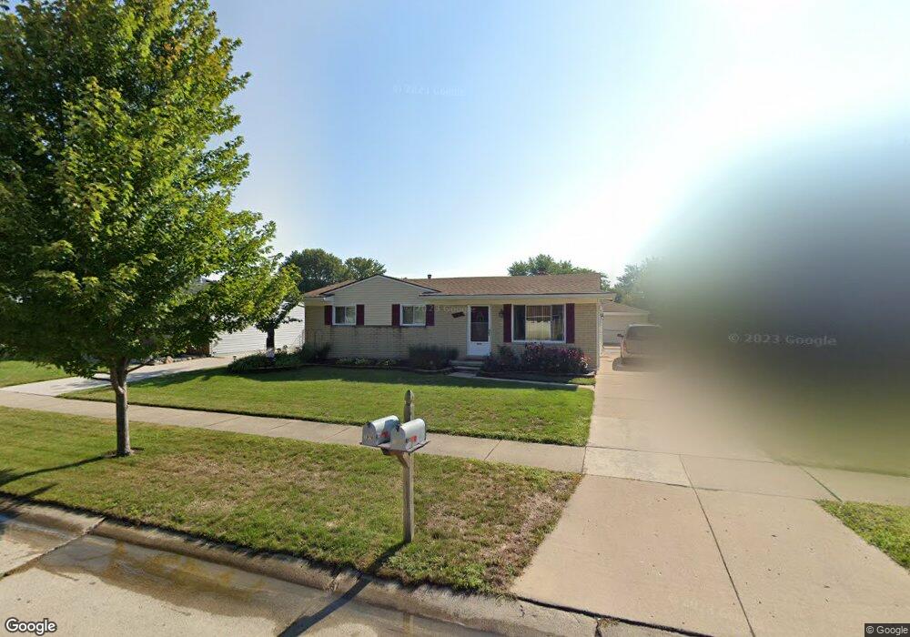
1979 Brookfield St Canton, MI 48188
Estimated Value: $315,000 - $329,000
--
Bed
2
Baths
1,365
Sq Ft
$237/Sq Ft
Est. Value
About This Home
This home is located at 1979 Brookfield St, Canton, MI 48188 and is currently estimated at $323,948, approximately $237 per square foot. 1979 Brookfield St is a home located in Wayne County with nearby schools including Bentley Elementary School, Canton High School, and Salem High School.
Ownership History
Date
Name
Owned For
Owner Type
Purchase Details
Closed on
Oct 23, 2012
Sold by
Reed Eric
Bought by
Reed Eric and Reed Selena
Current Estimated Value
Home Financials for this Owner
Home Financials are based on the most recent Mortgage that was taken out on this home.
Original Mortgage
$116,300
Outstanding Balance
$50,437
Interest Rate
3.4%
Mortgage Type
New Conventional
Estimated Equity
$273,511
Purchase Details
Closed on
Dec 13, 2001
Sold by
Williamson Anne D
Bought by
Reed Eric
Create a Home Valuation Report for This Property
The Home Valuation Report is an in-depth analysis detailing your home's value as well as a comparison with similar homes in the area
Home Values in the Area
Average Home Value in this Area
Purchase History
| Date | Buyer | Sale Price | Title Company |
|---|---|---|---|
| Reed Eric | -- | Abstract Title Agency | |
| Reed Eric | -- | -- |
Source: Public Records
Mortgage History
| Date | Status | Borrower | Loan Amount |
|---|---|---|---|
| Open | Reed Eric | $116,300 |
Source: Public Records
Tax History Compared to Growth
Tax History
| Year | Tax Paid | Tax Assessment Tax Assessment Total Assessment is a certain percentage of the fair market value that is determined by local assessors to be the total taxable value of land and additions on the property. | Land | Improvement |
|---|---|---|---|---|
| 2025 | $1,374 | $138,500 | $0 | $0 |
| 2024 | $1,374 | $136,000 | $0 | $0 |
| 2023 | $1,310 | $125,800 | $0 | $0 |
| 2022 | $2,942 | $115,500 | $0 | $0 |
| 2021 | $2,852 | $109,600 | $0 | $0 |
| 2020 | $2,813 | $108,300 | $0 | $0 |
| 2019 | $2,762 | $93,100 | $0 | $0 |
| 2018 | $1,114 | $86,600 | $0 | $0 |
| 2017 | $2,881 | $84,200 | $0 | $0 |
| 2016 | $2,521 | $82,100 | $0 | $0 |
| 2015 | $6,119 | $76,980 | $0 | $0 |
| 2013 | $5,928 | $65,260 | $0 | $0 |
| 2010 | -- | $65,510 | $29,510 | $36,000 |
Source: Public Records
Map
Nearby Homes
- 2349 Abbey Ct
- 1937 S Cavalier Dr
- 2562 Woodmont Dr E
- 1619 Nowland Ct
- 2785 Woodmont Dr E
- 43661 Antietam Ct
- 2210 Woodmont Dr W
- 2435 Woodmont Dr W
- 45179 Rudgate Rd
- 1834 Maple Park Dr W Unit 9
- 43871 Yorktown St
- 43450 Fredericksburg St
- 43664 Appomattox Ct
- 345 Canton Center Rd
- 46449 Killarney Ct Unit Bldg-Unit160
- 46502 Killarney Cir Unit 191
- 44125 Michigan Ave
- 49963 Kent Ct
- 49976 Kent Ct
- 49937 Kent Ct
- 1967 Brookfield St
- 1991 Brookfield St
- 1980 Bellingham St
- 1955 Brookfield St
- 2005 Brookfield St
- 1992 Bellingham St
- 1968 Bellingham St
- 2006 Bellingham St
- 1956 Bellingham St
- 2017 Brookfield St
- 1943 Brookfield St
- 1984 Brookfield St
- 1972 Brookfield St
- 1996 Brookfield St
- 1960 Brookfield St
- 1944 Bellingham St
- 2008 Brookfield St
- 2031 Brookfield St
- 1931 Brookfield St
- 1948 Brookfield St