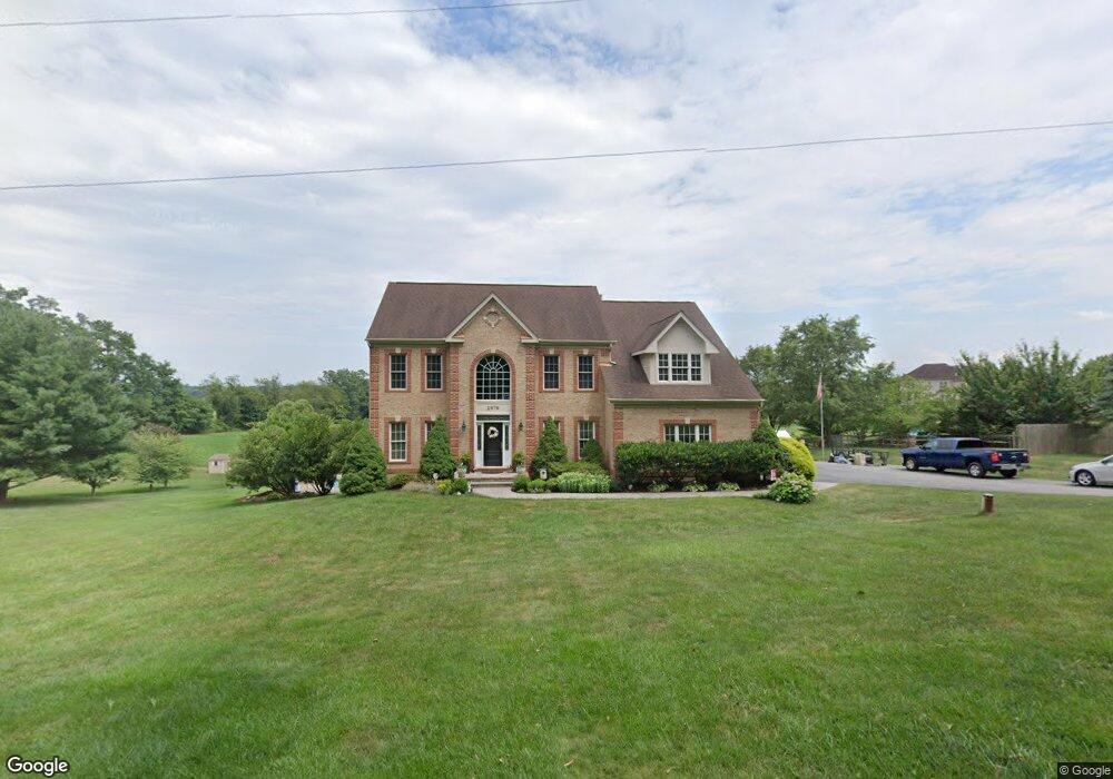
1979 Dennings Rd New Windsor, MD 21776
Estimated Value: $758,569 - $938,000
--
Bed
4
Baths
3,601
Sq Ft
$239/Sq Ft
Est. Value
About This Home
This home is located at 1979 Dennings Rd, New Windsor, MD 21776 and is currently estimated at $859,642, approximately $238 per square foot. 1979 Dennings Rd is a home located in Carroll County with nearby schools including Winfield Elementary School, Mount Airy Middle School, and South Carroll High School.
Ownership History
Date
Name
Owned For
Owner Type
Purchase Details
Closed on
Sep 6, 2006
Sold by
Strzelczyk Scott A
Bought by
Strzelczyk Scott A and Strzelczyk Jessica M
Current Estimated Value
Home Financials for this Owner
Home Financials are based on the most recent Mortgage that was taken out on this home.
Original Mortgage
$417,000
Outstanding Balance
$252,058
Interest Rate
6.79%
Mortgage Type
Stand Alone Refi Refinance Of Original Loan
Estimated Equity
$607,584
Purchase Details
Closed on
Aug 18, 2006
Sold by
Strzelczyk Scott A
Bought by
Strzelczyk Scott A and Strzelczyk Jessica M
Home Financials for this Owner
Home Financials are based on the most recent Mortgage that was taken out on this home.
Original Mortgage
$417,000
Outstanding Balance
$252,058
Interest Rate
6.79%
Mortgage Type
Stand Alone Refi Refinance Of Original Loan
Estimated Equity
$607,584
Purchase Details
Closed on
Feb 21, 2002
Sold by
White Dale E
Bought by
Strzelczyk Scott A
Purchase Details
Closed on
Jun 4, 2001
Sold by
Garst Donald L
Bought by
White Dale E
Create a Home Valuation Report for This Property
The Home Valuation Report is an in-depth analysis detailing your home's value as well as a comparison with similar homes in the area
Home Values in the Area
Average Home Value in this Area
Purchase History
| Date | Buyer | Sale Price | Title Company |
|---|---|---|---|
| Strzelczyk Scott A | -- | -- | |
| Strzelczyk Scott A | -- | -- | |
| Strzelczyk Scott A | $389,000 | -- | |
| White Dale E | $75,000 | -- |
Source: Public Records
Mortgage History
| Date | Status | Borrower | Loan Amount |
|---|---|---|---|
| Open | Strzelczyk Scott A | $417,000 | |
| Closed | Strzelczyk Scott A | $417,000 |
Source: Public Records
Tax History Compared to Growth
Tax History
| Year | Tax Paid | Tax Assessment Tax Assessment Total Assessment is a certain percentage of the fair market value that is determined by local assessors to be the total taxable value of land and additions on the property. | Land | Improvement |
|---|---|---|---|---|
| 2025 | $5,839 | $582,133 | $0 | $0 |
| 2024 | $5,839 | $516,100 | $132,300 | $383,800 |
| 2023 | $5,783 | $511,100 | $0 | $0 |
| 2022 | $5,727 | $506,100 | $0 | $0 |
| 2021 | $11,565 | $501,100 | $132,300 | $368,800 |
| 2020 | $5,542 | $485,100 | $0 | $0 |
| 2019 | $5,361 | $469,100 | $0 | $0 |
| 2018 | $5,134 | $453,100 | $132,300 | $320,800 |
| 2017 | $5,134 | $453,100 | $0 | $0 |
| 2016 | -- | $453,100 | $0 | $0 |
| 2015 | -- | $474,300 | $0 | $0 |
| 2014 | -- | $472,667 | $0 | $0 |
Source: Public Records
Map
Nearby Homes
- PARCEL 198 Dennings Rd
- 2900 Marston Rd
- 2208 Bluebird Dr
- 2322 Nicodemus Rd
- Lot 15 Westview Dr
- 3319 Mail Rd
- 3174 Cardinal Dr
- 1530 Bowersox Rd
- 2995 Sams Creek Rd
- 1802 Ridge Rd
- 3400 Chula Dr
- 3526 Ellen Dr
- 3204 Hooper Rd
- 3489 Salem Bottom Rd
- 1142 Western Chapel Rd
- 3536 Hooper Rd
- 732 Muller Rd
- 1433 Ridge Rd
- 1110 Algernon Dr
- 2822 Town View Cir
- 1977 Dennings Rd
- 1981 Dennings Rd
- 2612 Garstlynn Ct
- 1957 Dennings Rd
- 1976 Dennings Rd
- 2610 Garstlynn Ct
- 1980 Dennings Rd
- 2614 Garstlynn Ct
- 1953 Dennings Rd
- 2000 Dennings Rd
- Garstlynn Ct
- Garstlynn Ct
- LOT #12 Garstlynn Ct
- 0 Garstlynn Ct
- 2608 Garstlynn Ct
- 1990 Dennings Rd
- 0 Lot 10 Garstlynn Ct Unit 1008029136
- 0 Lot 8 Garstlynn Ct Unit 1008029056
- 0 Lot 10 Garstlynn Ct Unit CR8747756
- 0 Lot 8 Garstlynn Ct Unit CR8747707