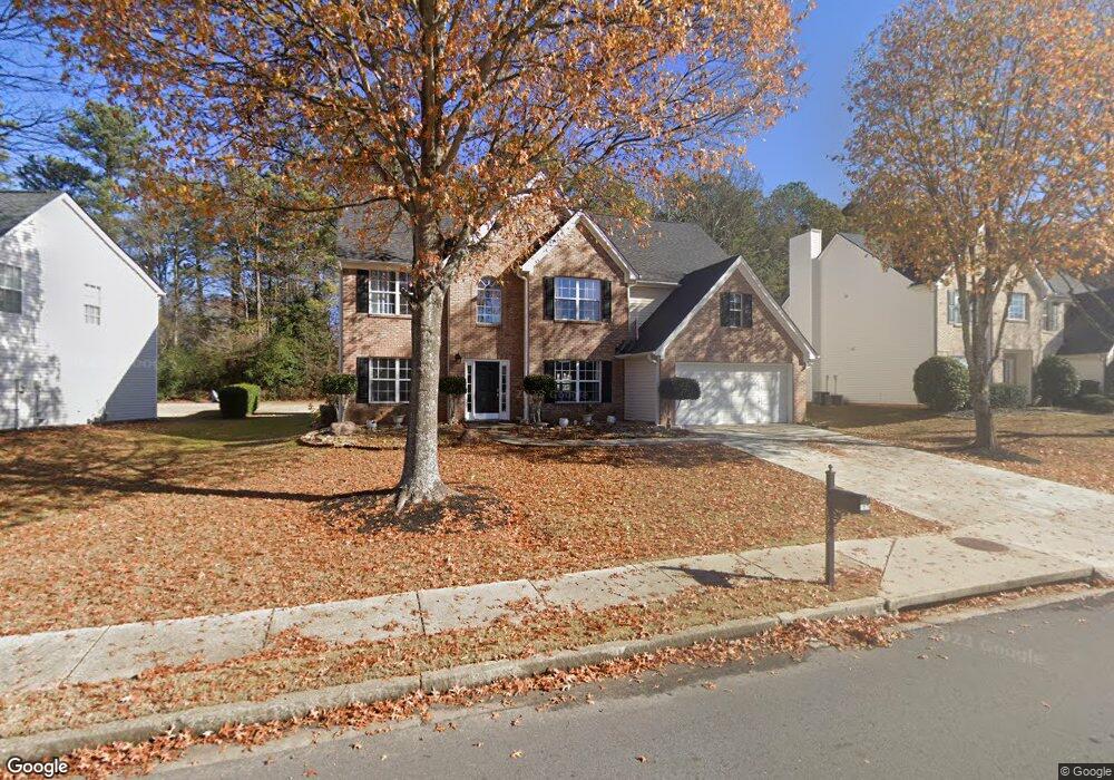
1979 Johns Place Ct Buford, GA 30519
Estimated Value: $454,000 - $476,552
5
Beds
3
Baths
2,886
Sq Ft
$161/Sq Ft
Est. Value
About This Home
This home is located at 1979 Johns Place Ct, Buford, GA 30519 and is currently estimated at $464,388, approximately $160 per square foot. 1979 Johns Place Ct is a home located in Gwinnett County with nearby schools including Freeman's Mill Elementary School, Twin Rivers Middle School, and Mountain View High School.
Ownership History
Date
Name
Owned For
Owner Type
Purchase Details
Closed on
Apr 24, 2002
Sold by
Hagag Abdel M
Bought by
Hagag Abdel M
Current Estimated Value
Home Financials for this Owner
Home Financials are based on the most recent Mortgage that was taken out on this home.
Original Mortgage
$168,750
Outstanding Balance
$70,541
Interest Rate
7.07%
Mortgage Type
New Conventional
Estimated Equity
$393,847
Create a Home Valuation Report for This Property
The Home Valuation Report is an in-depth analysis detailing your home's value as well as a comparison with similar homes in the area
Home Values in the Area
Average Home Value in this Area
Purchase History
| Date | Buyer | Sale Price | Title Company |
|---|---|---|---|
| Hagag Abdel M | -- | -- | |
| Hagag Abdel M | $184,000 | -- |
Source: Public Records
Mortgage History
| Date | Status | Borrower | Loan Amount |
|---|---|---|---|
| Open | Hagag Abdel M | $168,750 |
Source: Public Records
Tax History Compared to Growth
Tax History
| Year | Tax Paid | Tax Assessment Tax Assessment Total Assessment is a certain percentage of the fair market value that is determined by local assessors to be the total taxable value of land and additions on the property. | Land | Improvement |
|---|---|---|---|---|
| 2025 | $4,783 | $179,480 | $26,000 | $153,480 |
| 2024 | $4,750 | $171,160 | $30,000 | $141,160 |
| 2023 | $4,750 | $171,160 | $30,000 | $141,160 |
| 2022 | $4,232 | $147,840 | $28,000 | $119,840 |
| 2021 | $3,267 | $116,360 | $20,000 | $96,360 |
| 2020 | $3,379 | $103,120 | $20,000 | $83,120 |
| 2019 | $3,288 | $103,120 | $20,000 | $83,120 |
| 2018 | $3,177 | $97,880 | $16,800 | $81,080 |
| 2016 | $2,779 | $78,560 | $12,800 | $65,760 |
| 2015 | $2,688 | $73,200 | $11,200 | $62,000 |
| 2014 | $2,699 | $73,200 | $11,200 | $62,000 |
Source: Public Records
Map
Nearby Homes
- 2045 Amber Creek Dr
- 2439 Canter Brook Ct Unit 1
- 2585 Braselton Hwy
- 2375 Matlin Way
- 2346 Hampton Park Dr Unit I
- 2431 Lance Ridge Way
- 2228 Lakeview Bend Way
- 2032 Shin Ct NE
- 0 Hog Mountain Church Road and Auburn Rd
- 2305 Braselton Hwy
- 2144 Beacon Crest Dr
- 1603 Fort Perry Way
- 2425 Fort Daniels Dr Unit 3A
- 1720 Fort Daniels Trail
- 2402 Bancroft Way
- 1827 Scouts Walk
- 2256 Hansford Pass
- 1979 Johns Place Ct NE
- 1969 Johns Place Ct
- 1999 Johns Place Ct Unit 1
- 1959 Johns Pl Ct NE
- 1959 Johns Place Ct
- 1988 Johns Place Ct Unit 1
- 1978 Johns Place Ct Unit I
- 1958 Johns Place Ct Unit 1
- 1968 Johns Place Ct Unit 1
- 1998 Johns Place Ct
- 1947 Pierce Way
- 1947 Pierce Way NE
- 1967 Pierce Way Unit 1
- 2454 Braselton Hwy
- 2464 Braselton Hwy
- 1937 Pierce Way Unit 1
- 2095 Morgans Run Trail
- 2474 Braselton Hwy
- 3005 Morgans Run Trail Unit 1
- 2085 Morgans Run Trail Unit GA251