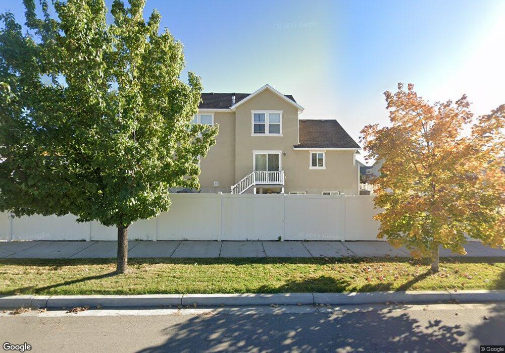
1979 N 3100 W Unit 2 Provo, UT 84601
Lakeview NeighborhoodEstimated Value: $608,000 - $677,000
3
Beds
3
Baths
3,041
Sq Ft
$209/Sq Ft
Est. Value
About This Home
This home is located at 1979 N 3100 W Unit 2, Provo, UT 84601 and is currently estimated at $635,984, approximately $209 per square foot. 1979 N 3100 W Unit 2 is a home located in Utah County with nearby schools including Vineyard Elementary School, Lakeridge Jr High School, and Mountain View High School.
Ownership History
Date
Name
Owned For
Owner Type
Purchase Details
Closed on
Mar 7, 2020
Sold by
Compres Luis Felipe
Bought by
Hernandez Gabriela
Current Estimated Value
Purchase Details
Closed on
Nov 26, 2014
Sold by
Hernandez Gabriela Compres
Bought by
Hernandez Gabriela Compres and Compres Luis Felipe
Home Financials for this Owner
Home Financials are based on the most recent Mortgage that was taken out on this home.
Original Mortgage
$264,048
Interest Rate
3.75%
Mortgage Type
FHA
Purchase Details
Closed on
Nov 25, 2014
Sold by
Edge Land 12 Llc
Bought by
Hernandez Gabriela Compres
Home Financials for this Owner
Home Financials are based on the most recent Mortgage that was taken out on this home.
Original Mortgage
$264,048
Interest Rate
3.75%
Mortgage Type
FHA
Purchase Details
Closed on
Oct 25, 2010
Sold by
Greyfields Llc
Bought by
Bbr Development Llc
Create a Home Valuation Report for This Property
The Home Valuation Report is an in-depth analysis detailing your home's value as well as a comparison with similar homes in the area
Home Values in the Area
Average Home Value in this Area
Purchase History
| Date | Buyer | Sale Price | Title Company |
|---|---|---|---|
| Hernandez Gabriela | -- | Pinnacle Title | |
| Hernandez Gabriela Compres | -- | Provo Land Title Co | |
| Hernandez Gabriela Compres | -- | Provo Land Title Co | |
| Bbr Development Llc | -- | Atlas Title |
Source: Public Records
Mortgage History
| Date | Status | Borrower | Loan Amount |
|---|---|---|---|
| Previous Owner | Hernandez Gabriela Compres | $264,048 |
Source: Public Records
Tax History Compared to Growth
Tax History
| Year | Tax Paid | Tax Assessment Tax Assessment Total Assessment is a certain percentage of the fair market value that is determined by local assessors to be the total taxable value of land and additions on the property. | Land | Improvement |
|---|---|---|---|---|
| 2025 | $3,268 | $338,470 | $297,700 | $317,700 |
| 2024 | $3,268 | $321,695 | $0 | $0 |
| 2023 | $3,239 | $314,270 | $0 | $0 |
| 2022 | $3,495 | $341,990 | $0 | $0 |
| 2021 | $2,718 | $463,800 | $167,900 | $295,900 |
| 2020 | $2,610 | $417,500 | $146,000 | $271,500 |
| 2019 | $2,334 | $388,300 | $146,000 | $242,300 |
| 2018 | $2,152 | $363,100 | $135,300 | $227,800 |
| 2017 | $1,924 | $178,365 | $0 | $0 |
| 2016 | $1,851 | $159,940 | $0 | $0 |
| 2015 | $1,755 | $153,285 | $0 | $0 |
| 2014 | $798 | $72,700 | $0 | $0 |
Source: Public Records
Map
Nearby Homes
- 1965 N 3050 W
- 1871 S 1030 W
- 3157 W 1690 N
- 3206 W 1670 N
- 3191 W 1670 N
- Kirkwood Scandia Plan at Broadview Shores - Cottages
- Kirkwood Farmhouse Plan at Broadview Shores - Cottages
- Sundance Ballpark Plan at Broadview Shores - Cottages
- Nyborg Plan at Broadview Shores - Cottages
- Goteborg Plan at Broadview Shores - Cottages
- Keystone Scandia Plan at Broadview Shores - Cottages
- 543 W 1770 S
- 537 W 1770 S
- 1217 W 1860 S
- 1533 N 3150 W
- 1501 N 3250 W
- 1532 N 3200 W
- 1458 N 3300 W
- 1418 N 3250 W
- 1415 N 3300 W
- 1971 N 3100 W Unit 3
- 1971 N 3100 W
- 1987 N 3100 W
- 1959 N 3100 W
- 838 W 2000 S
- 1931 N 3100 W Unit 6
- 1939 N 3100 W
- 1988 N 3100 W
- 1988 N 3100 W Unit 13
- 2000 S Geneva Rd
- 2000 S Geneva Rd Unit 404
- 2000 S Geneva Rd Unit 402
- 2000 S Geneva Rd Unit 403
- 2000 S Geneva Rd Unit 407
- 2000 S Geneva Rd Unit 413
- 2000 S Geneva Rd Unit 406
- 2000 S Geneva Rd Unit 401
- 1942 N 3100 W Unit 14
- 1942 N 3100 W
- 1906 N Geneva Rd