Estimated Value: $594,081 - $645,000
3
Beds
2
Baths
2,125
Sq Ft
$295/Sq Ft
Est. Value
About This Home
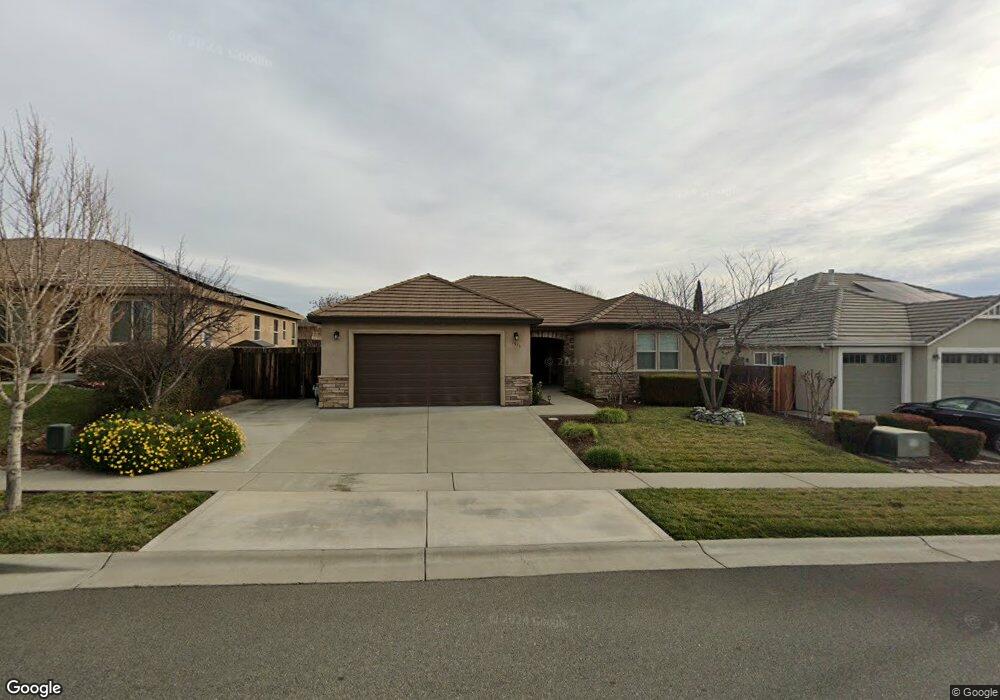
This home is located at 1979 Potter Rd, Chico, CA 95928 and is currently estimated at $627,020, approximately $295 per square foot. 1979 Potter Rd is a home located in Butte County with nearby schools including Little Chico Creek Elementary School, Harry M. Marsh Junior High School, and Chico High School.
Ownership History
Date
Name
Owned For
Owner Type
Purchase Details
Closed on
Sep 13, 2011
Sold by
North Coast Drywall
Bought by
Bechtol Gerald Clayton and Bechtol Christine Carolyn
Current Estimated Value
Purchase Details
Closed on
Mar 29, 2010
Sold by
Premierwest Bank
Bought by
North Coast Drywall
Purchase Details
Closed on
Oct 22, 2009
Sold by
Platinum Construction Llc
Bought by
Premierwest Bank
Create a Home Valuation Report for This Property
The Home Valuation Report is an in-depth analysis detailing your home's value as well as a comparison with similar homes in the area
Purchase History
| Date | Buyer | Sale Price | Title Company |
|---|---|---|---|
| Bechtol Gerald Clayton | $345,000 | Mid Valley Title & Escrow Co | |
| North Coast Drywall | $88,000 | Mid Valley Title & Escrow Co | |
| Premierwest Bank | $170,000 | Mid Valley Title & Escrow Co |
Source: Public Records
Tax History
| Year | Tax Paid | Tax Assessment Tax Assessment Total Assessment is a certain percentage of the fair market value that is determined by local assessors to be the total taxable value of land and additions on the property. | Land | Improvement |
|---|---|---|---|---|
| 2025 | $4,972 | $443,374 | $138,159 | $305,215 |
| 2024 | $4,972 | $434,681 | $135,450 | $299,231 |
| 2023 | $4,866 | $426,159 | $132,795 | $293,364 |
| 2022 | $4,755 | $417,804 | $130,192 | $287,612 |
| 2021 | $4,752 | $409,613 | $127,640 | $281,973 |
| 2020 | $4,722 | $405,414 | $126,332 | $279,082 |
| 2019 | $4,633 | $397,465 | $123,855 | $273,610 |
| 2018 | $4,540 | $389,673 | $121,427 | $268,246 |
| 2017 | $4,566 | $382,034 | $119,047 | $262,987 |
| 2016 | $4,205 | $374,544 | $116,713 | $257,831 |
| 2015 | $4,182 | $368,919 | $114,960 | $253,959 |
| 2014 | $3,941 | $361,694 | $112,709 | $248,985 |
Source: Public Records
Map
Nearby Homes
- 1985 Bancroft Dr
- 1810 Roth St
- 2227 Hutchinson St
- 378 Picholine Way
- 18 Jasper Dr
- 0 Coyote Way Unit 226036023
- 2251 Notre Dame Blvd
- 2220 Notre Dame Blvd Unit 5
- 123 Raley Blvd
- 1802 Notre Dame Blvd
- 2375 Notre Dame Blvd Unit 9
- 2375 Notre Dame Blvd Unit 1
- 1813 Devonshire Dr
- 2099 Hartford Dr Unit 6
- 12 Wrangler Ct
- 2050 Springfield Dr Unit 312
- 2050 Springfield Dr
- 2050 Springfield Dr Unit 212
- 2050 Springfield Dr Unit 323
- 142 Honey Run Rd
- 1975 Potter Rd
- 1983 Potter Rd
- 1984 Bancroft Dr
- 1988 Bancroft Dr Unit 24
- 1988 Bancroft Dr
- 1987 Potter Rd
- 1980 Bancroft Dr Unit 26
- 1992 Bancroft Dr
- 1982 Potter Rd
- 1976 Bancroft Dr
- 1986 Potter Rd
- 1996 Bancroft Dr Unit 22
- 1996 Bancroft Dr
- 1991 Potter Rd Unit 70
- 1991 Potter Rd
- 1967 Potter Rd Unit 8
- 1967 Potter Rd
- 1974 Potter Rd Unit 20
- 1974 Potter Rd
- 1990 Potter Rd
Your Personal Tour Guide
Ask me questions while you tour the home.