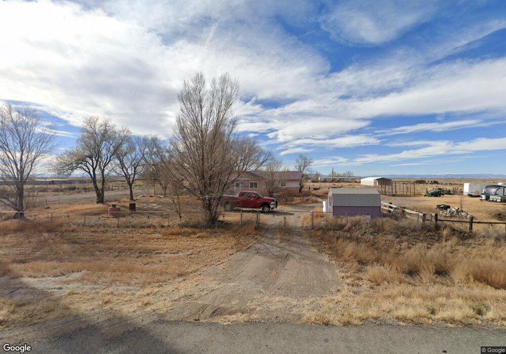
1979 State Highway 17 Alamosa, CO 81101
Estimated Value: $282,000 - $302,000
4
Beds
2
Baths
1,489
Sq Ft
$197/Sq Ft
Est. Value
About This Home
This home is located at 1979 State Highway 17, Alamosa, CO 81101 and is currently estimated at $294,051, approximately $197 per square foot. 1979 State Highway 17 is a home located in Alamosa County with nearby schools including Alamosa Elementary School, Ortega Middle School, and Alamosa High School.
Ownership History
Date
Name
Owned For
Owner Type
Purchase Details
Closed on
Apr 25, 2011
Sold by
Felmlee Donalu
Bought by
Felmlee Donala and Felmlee Scot L
Current Estimated Value
Purchase Details
Closed on
Nov 27, 1996
Sold by
Hill Lucille I
Bought by
Hill Lucille J and Felmlee Donalu
Purchase Details
Closed on
Nov 4, 1996
Sold by
Hill Donald C and Hill Lucille I
Bought by
Hill Lucille I
Purchase Details
Closed on
Feb 26, 1993
Sold by
Hill Donald C
Bought by
Hill Donald C and Hill Lucille I
Purchase Details
Closed on
Sep 27, 1979
Bought by
Hill Donald C and Hill Lucille I
Create a Home Valuation Report for This Property
The Home Valuation Report is an in-depth analysis detailing your home's value as well as a comparison with similar homes in the area
Home Values in the Area
Average Home Value in this Area
Purchase History
| Date | Buyer | Sale Price | Title Company |
|---|---|---|---|
| Felmlee Donala | -- | None Available | |
| Hill Lucille J | -- | -- | |
| Hill Lucille I | -- | -- | |
| Hill Donald C | -- | -- | |
| Hill Donald C | $46,000 | -- |
Source: Public Records
Tax History Compared to Growth
Tax History
| Year | Tax Paid | Tax Assessment Tax Assessment Total Assessment is a certain percentage of the fair market value that is determined by local assessors to be the total taxable value of land and additions on the property. | Land | Improvement |
|---|---|---|---|---|
| 2024 | $943 | $17,620 | $838 | $16,782 |
| 2023 | $968 | $17,792 | $846 | $16,946 |
| 2022 | $907 | $12,722 | $715 | $12,007 |
| 2021 | $939 | $12,722 | $715 | $12,007 |
| 2020 | $843 | $12,722 | $715 | $12,007 |
| 2019 | $846 | $11,210 | $429 | $10,781 |
| 2018 | $792 | $10,343 | $432 | $9,911 |
| 2017 | $794 | $10,343 | $432 | $9,911 |
| 2016 | $849 | $11,086 | $478 | $10,608 |
| 2015 | $849 | $11,086 | $478 | $10,608 |
| 2014 | -- | $11,086 | $478 | $10,608 |
| 2013 | -- | $11,086 | $478 | $10,608 |
Source: Public Records
Map
Nearby Homes
- 307 Road 108 6
- 3495 County Road 112 S
- TRACT B County Road 112 S
- 15023 Twomile Rd
- 00 County Road 112
- 10213 Ln 1 N
- 10075 Ln 1 N
- 18 El Valle Del Sol Estates
- TBD Oxbow Loop
- 7857 Oxbow Loop
- TBD S Co Road 106
- 12417 County Road 5 S
- 1018 State St
- 5895 State Highway 17
- TBD County Road 6 S
- 15 Sunnybrook Place Unit B
- 8 Sangre de Cristo
- 1241 Sarah Ln
- 711 Cottonwood Cir
- 1A N 2 Ln
- 2041 & 2047 S Hwy 17
- 2041 S Hwy 17
- 2041 State Highway 17
- 2041 State Highway 17
- 2041 State Highway 17
- 2047 State Highway 17
- 9775 County Road 2 S
- 9820 County Road 2 S
- 10140 County Road 2 S
- 307 Road 108 6 S
- 10253 County Road 2 S
- 10291 County Road 2 S
- 2468 State Highway 17
- 1439 State Highway 17
- 1255 State Highway 17
- 2697 State Highway 17
- 1363 S Co Road 110
- 1363 County Road 110 S
- S County Road 110
- 1251 State Highway 17