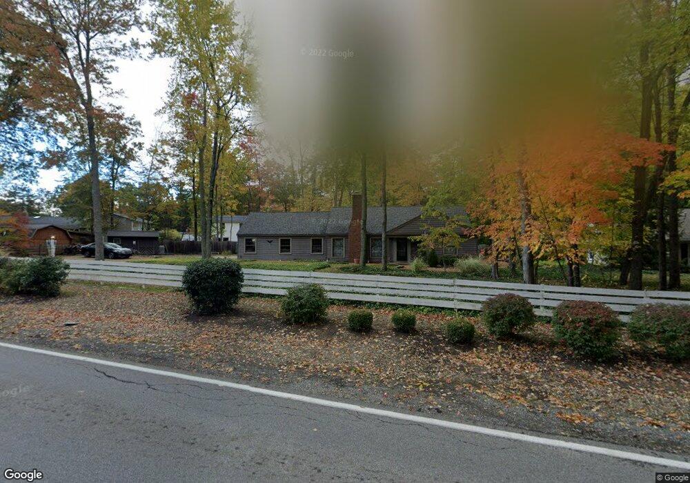
19790 Albion Rd Strongsville, OH 44149
Estimated Value: $330,641 - $368,000
4
Beds
3
Baths
2,145
Sq Ft
$162/Sq Ft
Est. Value
About This Home
This home is located at 19790 Albion Rd, Strongsville, OH 44149 and is currently estimated at $347,160, approximately $161 per square foot. 19790 Albion Rd is a home located in Cuyahoga County with nearby schools including Strongsville High School and Sts Joseph & John Interparochial School.
Ownership History
Date
Name
Owned For
Owner Type
Purchase Details
Closed on
Nov 20, 2001
Sold by
Goodwin James W and Goodwin Lenore D
Bought by
Goodwin James W and Goodwin Lenore D
Current Estimated Value
Purchase Details
Closed on
Mar 22, 1985
Sold by
Goodwin James W
Bought by
Goodwin James W
Purchase Details
Closed on
Dec 1, 1977
Sold by
Black John N
Bought by
Goodwin James W
Purchase Details
Closed on
Jan 18, 1977
Sold by
Black Black J J and Black Ruth D
Bought by
Black John N
Purchase Details
Closed on
Jan 1, 1975
Bought by
Black Black J and Black Ruth D
Create a Home Valuation Report for This Property
The Home Valuation Report is an in-depth analysis detailing your home's value as well as a comparison with similar homes in the area
Home Values in the Area
Average Home Value in this Area
Purchase History
| Date | Buyer | Sale Price | Title Company |
|---|---|---|---|
| Goodwin James W | -- | -- | |
| Goodwin James W | -- | -- | |
| Goodwin James W | $44,000 | -- | |
| Black John N | -- | -- | |
| Black Black J | -- | -- |
Source: Public Records
Tax History Compared to Growth
Tax History
| Year | Tax Paid | Tax Assessment Tax Assessment Total Assessment is a certain percentage of the fair market value that is determined by local assessors to be the total taxable value of land and additions on the property. | Land | Improvement |
|---|---|---|---|---|
| 2024 | $3,842 | $91,630 | $24,220 | $67,410 |
| 2023 | $3,844 | $70,560 | $22,400 | $48,160 |
| 2022 | $3,842 | $70,560 | $22,400 | $48,160 |
| 2021 | $3,812 | $70,560 | $22,400 | $48,160 |
| 2020 | $3,704 | $61,880 | $19,640 | $42,250 |
| 2019 | $3,596 | $176,800 | $56,100 | $120,700 |
| 2018 | $1,632 | $61,880 | $19,640 | $42,250 |
| 2017 | $3,307 | $58,600 | $15,930 | $42,670 |
| 2016 | $3,280 | $58,600 | $15,930 | $42,670 |
| 2015 | $3,212 | $58,600 | $15,930 | $42,670 |
| 2014 | $3,212 | $56,880 | $15,470 | $41,410 |
Source: Public Records
Map
Nearby Homes
- 19890 Idlewood Trail
- 10986 Fawn Meadow Ln
- 19997 Idlewood Trail
- 20050 Idlewood Trail
- 11179 Fawn Meadow Ln
- 20424 Scotch Pine Way
- 19240 Briarwood Ln
- 11432 Pearl Rd
- 20684 Albion Rd
- 11499 Pearl Rd Unit A106
- 9401 Pheasant Run Place
- 10839 Prospect Rd
- 21176 Hickory Branch Trail
- 12385 Corinth Ct
- 12647 Edgepark Cir
- 12539 Olympus Way
- 21355 Hickory Branch Trail
- 12694 Ionia Ct
- 18433 Whitney Rd
- 12651 Alameda Dr
- 19791 Tanbark Ln
- 19759 Tanbark Ln
- 19797 Tanbark Ln
- 19819 Albion Rd
- 19722 Albion Rd
- 19723 Tanbark Ln
- 19759 Albion Rd
- 19854 Idlewood Trail
- 19691 Tanbark Ln
- 19690 Albion Rd
- 19790 Tanbark Ln
- 19751 Albion Rd
- 19754 Tanbark Ln
- 19822 Tanbark Ln
- 10532 Hickory Place
- 19922 Albion Rd
- 19655 Tanback Ln
- 19722 Tanbark Ln
- 10524 Eastland Rd
- 19800 Tanbark Ln