Estimated Value: $216,000 - $282,663
3
Beds
2
Baths
1,144
Sq Ft
$226/Sq Ft
Est. Value
About This Home
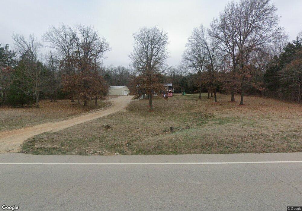
This home is located at 19793 N State Highway 21, Cadet, MO 63630 and is currently estimated at $258,221, approximately $225 per square foot. 19793 N State Highway 21 is a home located in Washington County with nearby schools including Kingston Primary School, Kingston Elementary School, and Kingston Middle School.
Ownership History
Date
Name
Owned For
Owner Type
Purchase Details
Closed on
Mar 25, 2014
Sold by
Alan Alan and Rowe Sylvia
Bought by
Cain Joshua and Cain Brittany
Current Estimated Value
Home Financials for this Owner
Home Financials are based on the most recent Mortgage that was taken out on this home.
Original Mortgage
$127,551
Outstanding Balance
$96,935
Interest Rate
4.41%
Mortgage Type
New Conventional
Estimated Equity
$161,286
Purchase Details
Closed on
Oct 14, 2013
Sold by
Beneficial Financial L Inc Successor
Bought by
Rowe Alan and Rowe Sylvia
Create a Home Valuation Report for This Property
The Home Valuation Report is an in-depth analysis detailing your home's value as well as a comparison with similar homes in the area
Home Values in the Area
Average Home Value in this Area
Purchase History
| Date | Buyer | Sale Price | Title Company |
|---|---|---|---|
| Cain Joshua | -- | -- | |
| Rowe Alan | -- | -- |
Source: Public Records
Mortgage History
| Date | Status | Borrower | Loan Amount |
|---|---|---|---|
| Open | Cain Joshua | $127,551 |
Source: Public Records
Tax History Compared to Growth
Tax History
| Year | Tax Paid | Tax Assessment Tax Assessment Total Assessment is a certain percentage of the fair market value that is determined by local assessors to be the total taxable value of land and additions on the property. | Land | Improvement |
|---|---|---|---|---|
| 2024 | $941 | $17,290 | $1,740 | $15,550 |
| 2023 | $936 | $17,290 | $1,740 | $15,550 |
| 2022 | $936 | $17,290 | $1,740 | $15,550 |
| 2021 | $941 | $17,290 | $1,740 | $15,550 |
| 2020 | $943 | $17,290 | $1,740 | $15,550 |
| 2019 | $943 | $17,290 | $1,740 | $15,550 |
| 2018 | $946 | $17,300 | $0 | $0 |
| 2017 | $943 | $17,300 | $1,750 | $15,550 |
| 2016 | $929 | $17,300 | $1,750 | $15,550 |
| 2014 | -- | $17,290 | $0 | $0 |
| 2013 | -- | $17,290 | $0 | $0 |
| 2012 | -- | $17,290 | $0 | $0 |
Source: Public Records
Map
Nearby Homes
- 10324 Vine Rd
- 10590 Rivermont Rd
- 10686 Peppersville Rd
- 10262 Cannon Mines Rd
- 2 Rita Rd
- 10021 Bugle Rd
- 10330 Bottom Diggins Rd
- 000 Clear Creek Rd
- 13937 W State Highway 47
- 13937 W State Hwy 47
- (125.87 Ac) Tract A-1 Clear Creek Rd
- 10401 Short Rd
- 0 Cyclone Rd
- 7 Lakeview Meadows Lot 7
- 10370 Whispering Hills Dr
- 10740 Lakeshore Dr
- Tract 1 Dusty Rd
- Lot 5 Parkview Dr
- Lot 4 Parkview Dr
- Lot 1 Parkview Dr
- 19793 N State Hwy 21
- 19767 N State Highway 21
- 10051 Kayak Rd
- 19717 N State Highway 21
- 10042 Kayak Rd
- 19653 N State Highway 21
- 10118 Brown Hollow Rd
- 0 Brown Hollow Road Tract #5 Unit 18067953
- 0 Brown Hollow Rd Unit 90038355
- 0 Brown Hollow Rd Unit 19085616
- 0 Brown Hollow Road Tract Entire Unit 18081092
- 20029 N State Highway 21
- 10128 Jl Boyer Ln
- 10146 Brown Hollow Rd
- 10208 Brown Hollow Rd
- 10156 Brown Hollow Rd
- 13523 E State Highway 47
- 20217 Missouri 21
- 0 Brown Hollow Road Tract #2 Unit 18070851
- 0 Brown Hollow Road Tract #4 Unit 18070864