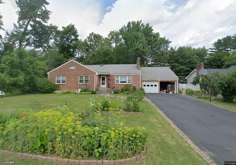
198 Brewster Rd West Hartford, CT 06117
Estimated Value: $486,000 - $656,000
4
Beds
4
Baths
2,746
Sq Ft
$219/Sq Ft
Est. Value
About This Home
This home is located at 198 Brewster Rd, West Hartford, CT 06117 and is currently estimated at $601,568, approximately $219 per square foot. 198 Brewster Rd is a home located in Hartford County with nearby schools including Aiken School, King Philip Middle School, and Delta High School.
Create a Home Valuation Report for This Property
The Home Valuation Report is an in-depth analysis detailing your home's value as well as a comparison with similar homes in the area
Home Values in the Area
Average Home Value in this Area
Tax History Compared to Growth
Tax History
| Year | Tax Paid | Tax Assessment Tax Assessment Total Assessment is a certain percentage of the fair market value that is determined by local assessors to be the total taxable value of land and additions on the property. | Land | Improvement |
|---|---|---|---|---|
| 2025 | $11,576 | $258,510 | $80,220 | $178,290 |
| 2024 | $10,948 | $258,510 | $80,220 | $178,290 |
| 2023 | $10,578 | $258,510 | $80,220 | $178,290 |
| 2022 | $10,516 | $258,510 | $80,220 | $178,290 |
| 2021 | $9,579 | $225,820 | $72,170 | $153,650 |
| 2020 | $9,293 | $222,320 | $64,120 | $158,200 |
| 2019 | $9,293 | $222,320 | $64,120 | $158,200 |
| 2018 | $9,115 | $222,320 | $64,120 | $158,200 |
| 2017 | $9,124 | $222,320 | $64,120 | $158,200 |
| 2016 | $8,911 | $225,540 | $57,680 | $167,860 |
| 2015 | $8,640 | $225,540 | $57,680 | $167,860 |
| 2014 | $8,428 | $225,540 | $57,680 | $167,860 |
Source: Public Records
Map
Nearby Homes
- 139 Mohawk Dr
- 50 Magnolia Hill
- 2581 Albany Ave
- 62 Blue Ridge Ln
- 47 Flagg Rd
- 148 King Philip Dr
- 11 Rye Ridge Pkwy
- 11 Lawler Rd
- 21 Barksdale Rd
- 3 Pilgrim Rd
- 1272 Trout Brook Dr
- 592 Mountain Rd Unit A
- 9 Timberwood Rd
- 320 N Steele Rd
- 1993 Albany Ave
- 10 Ironwood Ln
- 10 Hosmer Dr
- 56 Fox Chase Ln
- 132 N Main St
- 365 Simsbury Rd