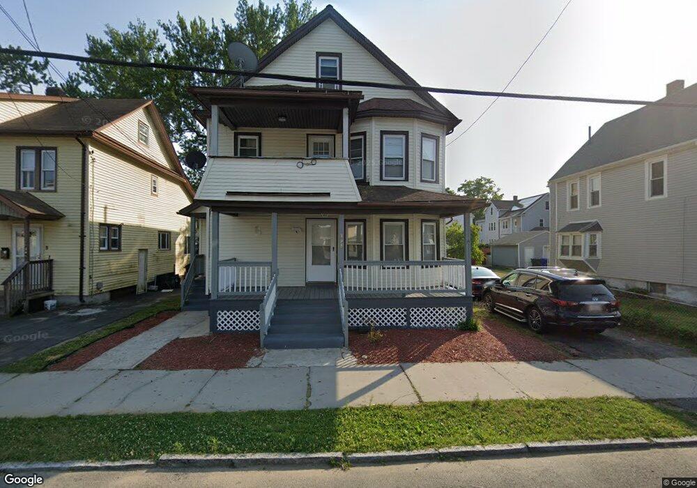
198 Commonwealth Ave Unit 200 Springfield, MA 01108
Forest Park NeighborhoodEstimated Value: $293,003 - $355,000
6
Beds
2
Baths
2,288
Sq Ft
$144/Sq Ft
Est. Value
About This Home
This home is located at 198 Commonwealth Ave Unit 200, Springfield, MA 01108 and is currently estimated at $329,751, approximately $144 per square foot. 198 Commonwealth Ave Unit 200 is a home located in Hampden County with nearby schools including Alice B. Beal Elementary School, Forest Park Middle School, and High School Of Commerce.
Ownership History
Date
Name
Owned For
Owner Type
Purchase Details
Closed on
Apr 12, 2013
Sold by
Anoje Boniface and Anoje Roseline
Bought by
Anoje Roseline
Current Estimated Value
Purchase Details
Closed on
Sep 16, 1998
Sold by
Shea Thomas E and Shea Cynthia L
Bought by
Hollister Gail E
Home Financials for this Owner
Home Financials are based on the most recent Mortgage that was taken out on this home.
Original Mortgage
$57,997
Interest Rate
6.9%
Mortgage Type
Purchase Money Mortgage
Create a Home Valuation Report for This Property
The Home Valuation Report is an in-depth analysis detailing your home's value as well as a comparison with similar homes in the area
Home Values in the Area
Average Home Value in this Area
Purchase History
| Date | Buyer | Sale Price | Title Company |
|---|---|---|---|
| Anoje Roseline | -- | -- | |
| Hollister Gail E | $60,000 | -- |
Source: Public Records
Mortgage History
| Date | Status | Borrower | Loan Amount |
|---|---|---|---|
| Previous Owner | Hollister Gail E | $23,316 | |
| Previous Owner | Hollister Gail E | $25,000 | |
| Previous Owner | Hollister Gail E | $57,997 |
Source: Public Records
Tax History Compared to Growth
Tax History
| Year | Tax Paid | Tax Assessment Tax Assessment Total Assessment is a certain percentage of the fair market value that is determined by local assessors to be the total taxable value of land and additions on the property. | Land | Improvement |
|---|---|---|---|---|
| 2025 | $3,867 | $246,600 | $36,800 | $209,800 |
| 2024 | $4,026 | $250,700 | $36,800 | $213,900 |
| 2023 | $3,366 | $197,400 | $35,100 | $162,300 |
| 2022 | $3,327 | $176,800 | $35,100 | $141,700 |
| 2021 | $3,289 | $174,000 | $31,900 | $142,100 |
| 2020 | $3,119 | $159,700 | $31,900 | $127,800 |
| 2019 | $3,300 | $167,700 | $31,900 | $135,800 |
| 2018 | $2,942 | $149,500 | $31,900 | $117,600 |
| 2017 | $2,851 | $145,000 | $31,900 | $113,100 |
| 2016 | $2,548 | $129,600 | $31,900 | $97,700 |
| 2015 | $2,524 | $128,300 | $31,900 | $96,400 |
Source: Public Records
Map
Nearby Homes
- 11-15 Groveland St
- 137-139 Fountain St
- 35 Carlton St
- 52 Eldridge St
- 40 Eldridge St
- 144 Washington St
- Lot 30 Carver St
- 11 Copeland St
- 114 Sylvan St Unit 116
- 742 Belmont Ave
- 15 Bronson Terrace
- 20 Taft St
- 769-771 Belmont Ave
- 82-84 Maryland St
- 60 Blake St
- 137 Carroll St
- 78 Whittier St
- 855 Belmont Ave
- 147 Belvidere St
- 877 Belmont Ave
- 194 Commonwealth Ave
- 204 Commonwealth Ave
- 188 Commonwealth Ave Unit 190
- 57 Draper St Unit 59
- 208 Commonwealth Ave Unit 210
- 51 Draper St Unit 53
- 61 Draper St Unit 63
- 61-63 Draper St
- 209 Commonwealth Ave
- 47-49 Draper St
- 67 Draper St Unit 69
- 67-69 Draper St
- 182-184 Commonwealth Ave
- 212-214 Commonwealth Ave
- 197 Commonwealth Ave
- 182 Commonwealth Ave Unit 184
- 212 Commonwealth Ave Unit 214
- 47 Draper St Unit 49
- 47 Draper St Unit 2
- 193 Commonwealth Ave