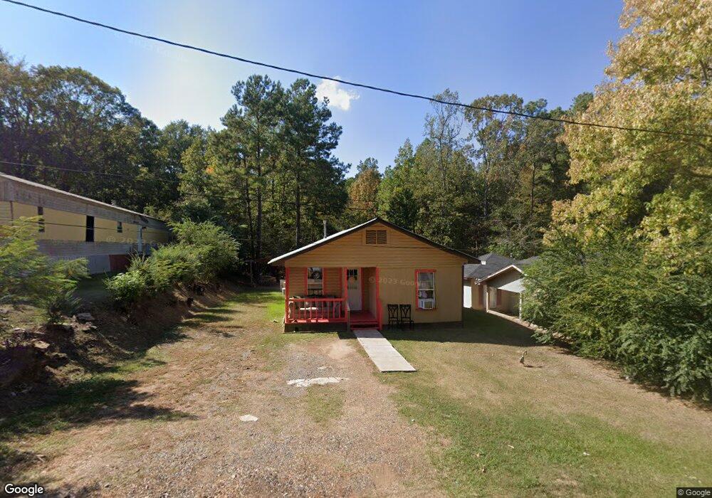
198 Elam St Ruston, LA 71270
Estimated Value: $57,000 - $159,000
Studio
--
Bath
672
Sq Ft
$140/Sq Ft
Est. Value
About This Home
This home is located at 198 Elam St, Ruston, LA 71270 and is currently estimated at $94,048, approximately $139 per square foot. 198 Elam St is a home located in Lincoln Parish with nearby schools including Ruston Elementary School, Hillcrest Elementary School, and Ruston Junior High School.
Ownership History
Date
Name
Owned For
Owner Type
Purchase Details
Closed on
Mar 12, 2013
Sold by
Richard Phillip
Bought by
Nancy Properties Llc
Current Estimated Value
Home Financials for this Owner
Home Financials are based on the most recent Mortgage that was taken out on this home.
Original Mortgage
$29,424
Outstanding Balance
$20,505
Interest Rate
3.57%
Mortgage Type
Future Advance Clause Open End Mortgage
Estimated Equity
$73,543
Purchase Details
Closed on
May 12, 2010
Sold by
Richard Phillip
Bought by
Lincoln Parish Police Jury
Purchase Details
Closed on
Feb 4, 2005
Sold by
White Clair E and White Linda Gage
Bought by
Richard Phillip
Create a Home Valuation Report for This Property
The Home Valuation Report is an in-depth analysis detailing your home's value as well as a comparison with similar homes in the area
Purchase History
| Date | Buyer | Sale Price | Title Company |
|---|---|---|---|
| Nancy Properties Llc | -- | None Available | |
| Lincoln Parish Police Jury | -- | None Available | |
| Richard Phillip | -- | None Available |
Source: Public Records
Mortgage History
| Date | Status | Borrower | Loan Amount |
|---|---|---|---|
| Open | Nancy Properties Llc | $29,424 |
Source: Public Records
Tax History
| Year | Tax Paid | Tax Assessment Tax Assessment Total Assessment is a certain percentage of the fair market value that is determined by local assessors to be the total taxable value of land and additions on the property. | Land | Improvement |
|---|---|---|---|---|
| 2025 | $139 | $840 | $484 | $356 |
| 2024 | $139 | $840 | $484 | $356 |
| 2023 | $132 | $730 | $242 | $488 |
| 2022 | $133 | $730 | $242 | $488 |
| 2021 | $128 | $730 | $242 | $488 |
| 2020 | $128 | $730 | $242 | $488 |
| 2019 | $135 | $846 | $346 | $500 |
| 2018 | $133 | $846 | $346 | $500 |
| 2017 | $134 | $846 | $346 | $500 |
| 2016 | $133 | $0 | $0 | $0 |
| 2015 | $132 | $755 | $346 | $409 |
| 2013 | $133 | $755 | $346 | $409 |
Source: Public Records
Map
Nearby Homes
- 145 Clearwater Cir
- 1304 Lewis St
- 1401 Wyoming Ave
- 000 Eastland Ave
- 900 Cornell Ave
- 1815 E Georgia Ave
- 1200 E Mississippi Ave
- 2003 Jonathan Dr
- 1203 Kenwood Dr
- 2301 E Georgia Ave
- 09 Moores Dairy Rd
- 14 Moores Dairy Rd
- 08 Moores Dairy Rd
- 10 Moores Dairy Rd
- 15 Moores Dairy Rd
- 1414 Brewster Ave
- 13 Moores Dairy Rd
- 16 Moores Dairy Rd
- 11 Moores Dairy Rd
- 12 Moores Dairy Rd
- 204 Elam St
- 194 Elam St
- 101 Diamond Ln
- 105 Diamond Ln
- 104 Diamond Ln
- 189 Elam St
- 188 Elam St
- 180 Elam St
- 114 Diamond Ln
- 114 Kimble Ln
- 2207 Beacon Light Rd
- 101 Kimble Ln
- 2225 Beacon Light Rd
- 2307 Beacon Light Rd
- 2211 Beacon Light Rd
- 174 Elam St
- 121 Diamond Ln
- 122 Kimble Ln
- 2311 Beacon Light Rd
- 166 Elam St
Your Personal Tour Guide
Ask me questions while you tour the home.